


As expected, a combination of long-period swells, a surge in low-level winds, and spring tides will result in hazardous seas through early next week. Though swells have been ongoing over the last 24 hours, a combination of these three features prompted the Trinidad and Tobago Meteorological Service (TTMS) to issue a Hazardous Seas Alert.
What you need to know
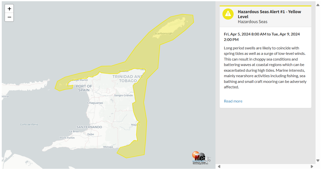
— What is happening: Long-period swells up to 16 seconds are forecast to continue affecting northern and eastern coastlines, moving in from the north, combined with spring tides and elevated winds at low levels from Friday.
— What can we expect: Open water waves are forecast to remain up to 2.0 meters, while swells, spring tides, and elevated winds are forecast to produce occasional large, battering waves in nearshore areas through Tuesday, according to the alert. However, forecast models show high-energy swells continuing through the end of next week. There is an increased risk of rip currents and potentially dangerous conditions for small craft operators.
Latest Alerts

Localized Flood Alert Discontinued For Trinidad
Trinidad and Tobago is NOT under any tropical storm or hurricane threat, watch, or warning at this time.
The Hazardous Seas Alert
The Trinidad and Tobago Meteorological Service issued a Hazardous Seas Alert (Yellow Level) on Thursday at 3:04 PM. The alert goes into effect for northern and eastern coastal areas of Trinidad and Tobago at 8:00 AM Friday, April 5th, 2024, and remains in effect through 2:00 PM Tuesday, April 8th, 2024.
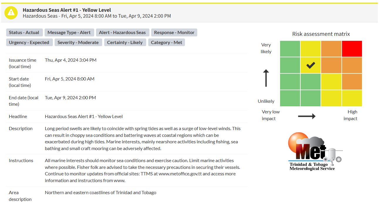
“Long-period swells are likely to coincide with spring tides as well as a surge of low-level winds. This can result in choppy sea conditions and battering waves in coastal regions, which can be exacerbated during high tides. Marine interests, mainly nearshore activities including fishing, sea bathing, and small craft mooring, can be adversely affected,” according to the Trinidad and Tobago Meteorological Service. This “alert” status considers the possibility of the event occurring. This hazardous sea event is likely.

The alert’s color indicates the event’s severity and probability of the event occurring. Currently, the alert level is Yellow. This means that the hazards are likely, and the severity of impacts is moderate for this particular alert.
There is an increased risk of strong rip currents, which pose a serious hazard to swimmers and beachgoers. Rip currents can be life-threatening even for experienced swimmers. Agitated seas are likely to be particularly perilous for offshore activities, including fishing and other small craft marine interests. Due to the presence of spring tides, conditions at seawalls along affected coastlines can be exacerbated, especially at high tide.
For a moderate Hazardous Seas Alert, there is the potential for possible injuries, where behavioral changes are required to ensure safety. There may be minor damage to property, with income-earning temporarily disrupted and a couple of communities affected.
The Met Office is advising all marine interests to monitor sea conditions and exercise caution along affected areas. Limit marine activities where possible. Fisherfolk are also advised to take the necessary precautions in securing their vessels.


