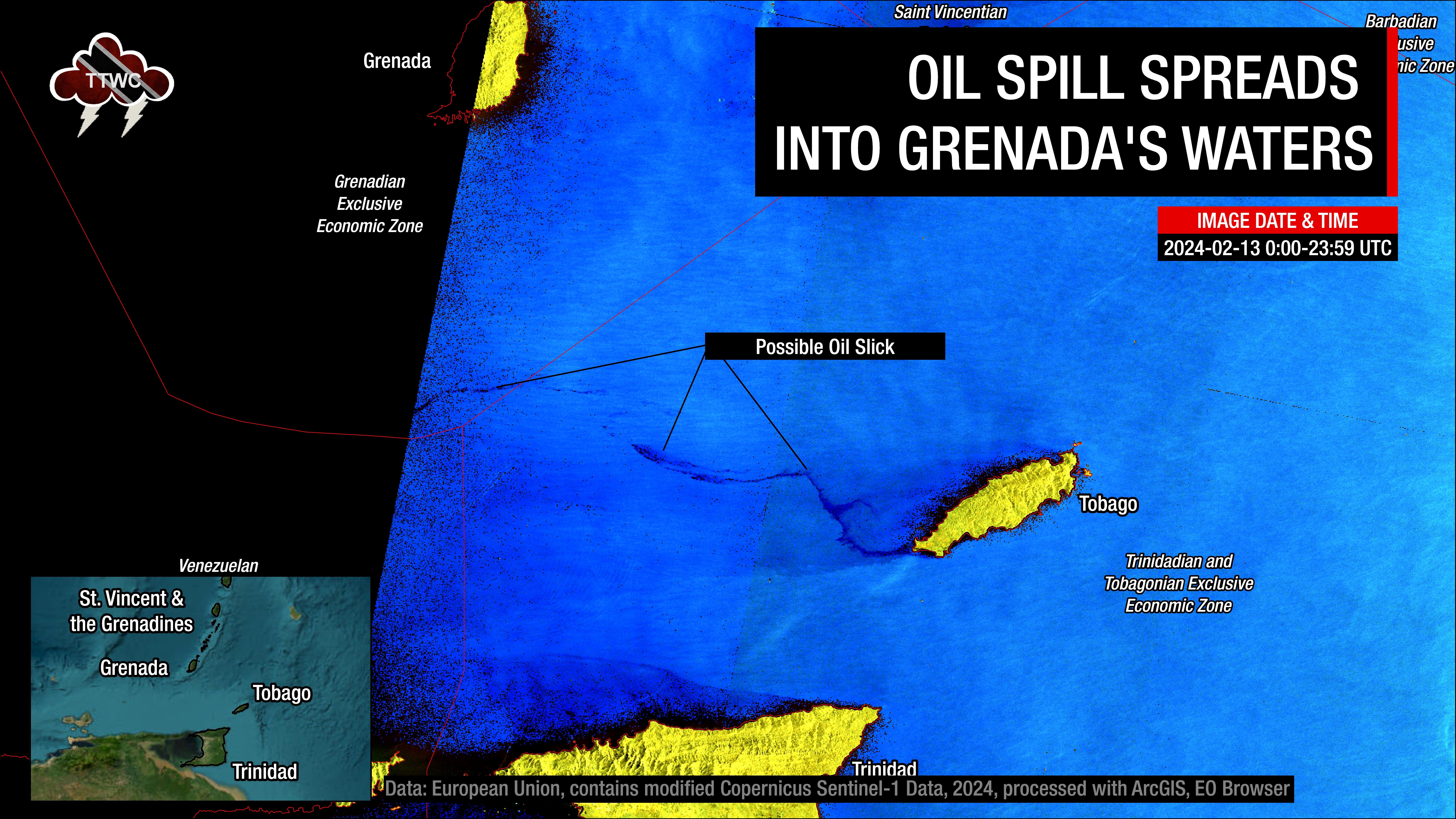
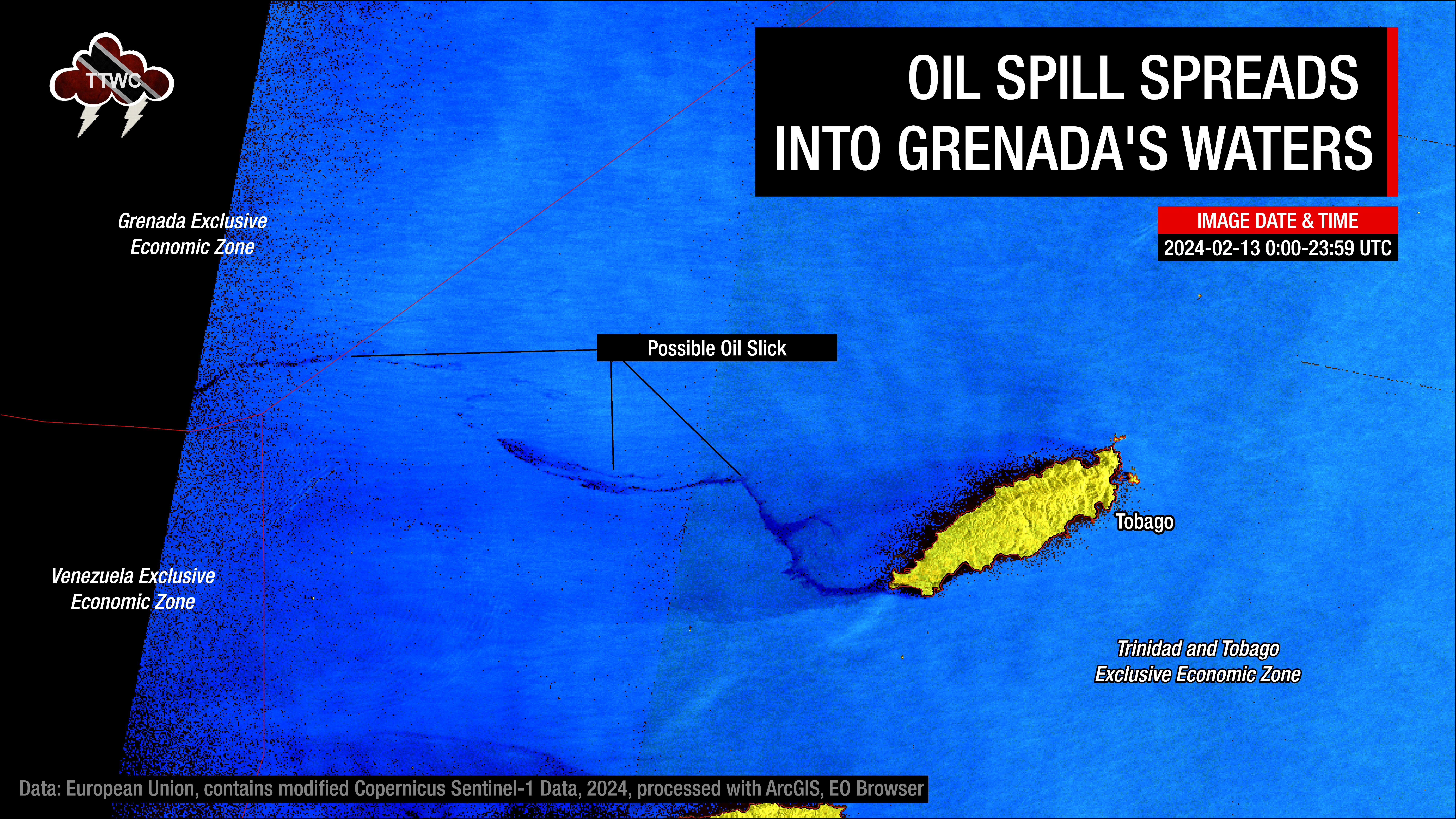
The latest satellite imagery by Copernicus Sentinel-1A has detected possible oil moving out of Trinidad and Tobago’s marine area into Grenada’s southernmost marine area of responsibility.
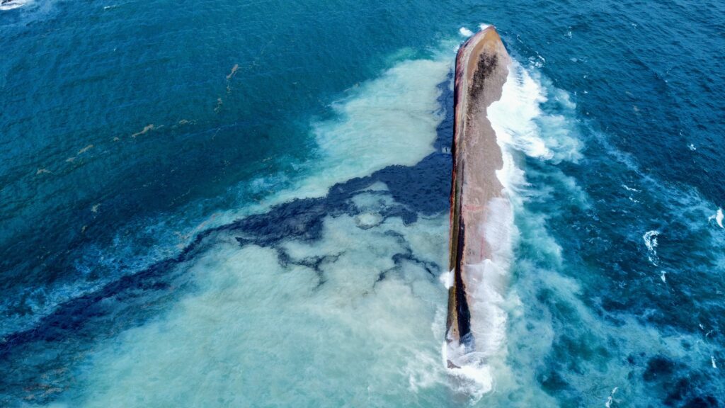
Based on data analyzed by TTWC and the Tobago Emergency Management Agency (TEMA), a silverlike slick emanating from the wrecked vessel, now identified as a barge called Gulfstream, with streaks of a thick black-like substance. The anomaly measured 78 nautical miles, approximately 144 kilometers in length and extended from the west to northwest of Tobago into the Caribbean Sea.
Samples have been sent to the Institute of Marine Affairs for fingerprinting. Once the samples are run, the type of substance can be identified. In the past, crude oil has been misidentified as bunker fuel or another type of hydrocarbon. To ensure accuracy in reporting, until the samples are confirmed to be crude oil (or otherwise), we will continue to use “oil-like substance” in our reporting. TEMA estimates the IMA report should come in sometime this upcoming week.
The oil-like substance has been spilling into the ocean since overnight February 6th into February 7th, initially covering the windward coastlines of Tobago, closest to where the barge was stuck on Cove Reef. On Sunday, February 11th, 2024, the oil-like substance travelled up to 88 kilometers west and northwest of Tobago.
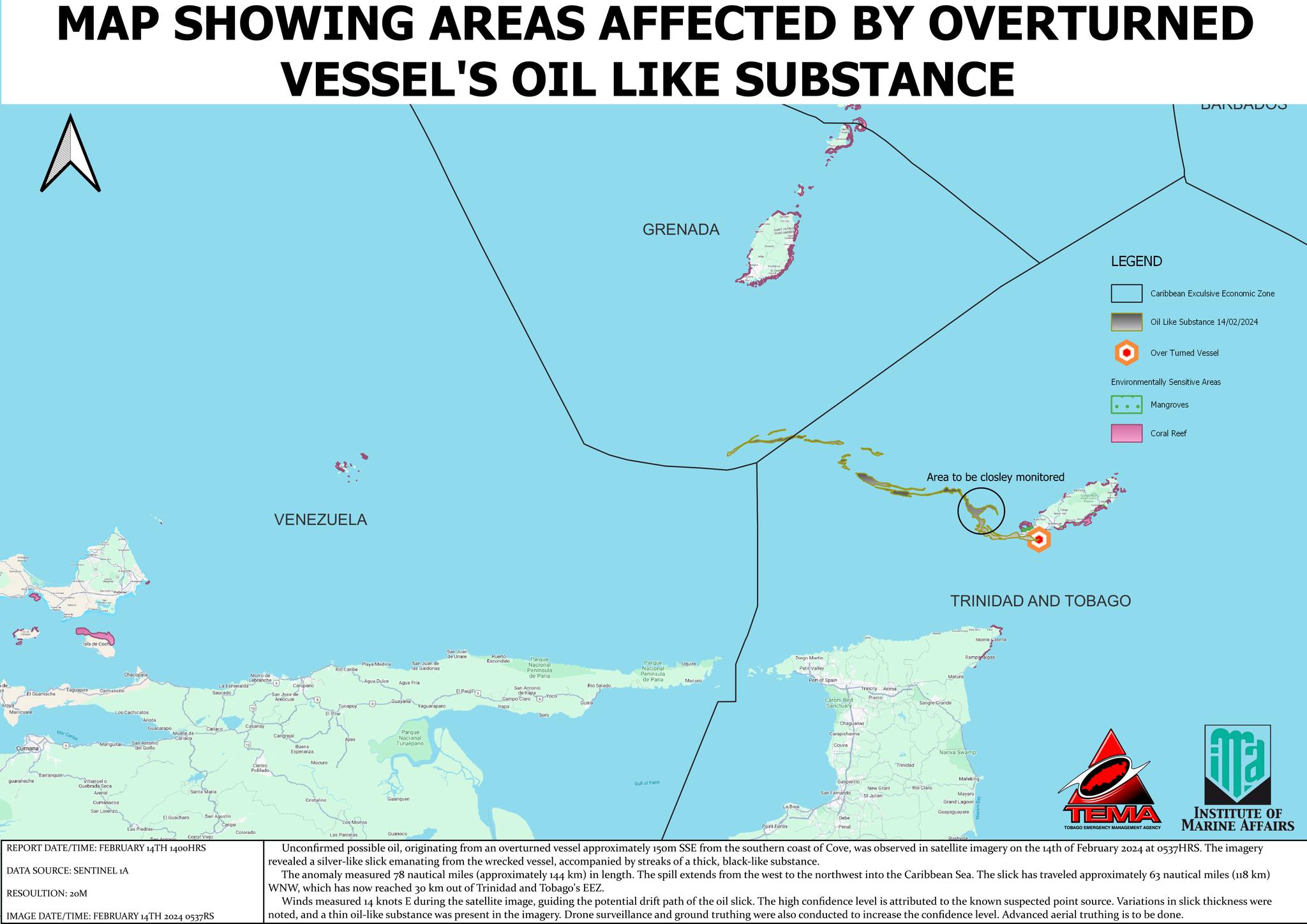
As of February 14th, high-resolution satellite imagery has detected the possible oil slick travelling approximately 63 nautical miles, or 118 kilometers, west-northwest, which has now reached 30 kilometers out of Trinidad and Tobago’s Economic Exclusive Zone (EEZ), which is the of the sea in which T&T has exclusive rights regarding the exploration and use of marine resources, including energy production from water and wind.
The possible oil slick has now moved into the southernmost area of Grenada’s Economic Exclusive Zone by approximately 30 kilometers. According to TEMA, winds measured 14 knots from the east during the satellite image, guiding the potential drift path of the possible oil slick. Based on the current trajectory of the possible oil slick due to prevailing winds and ocean currents, the coastline of Grenada is not under any threat. At this time, no oil/oil-like substance has made it on Tobago’s west or northern coastlines.
TEMA also added that the high confidence level is attributed to the known suspected point source variations in slick thickness were noted, and a thin oil-like substance was present in the imagery drone surveillance and ground truthing were also conducted to increase the confidence level advanced aerial truthing is to be done by the T&T Air Guard.
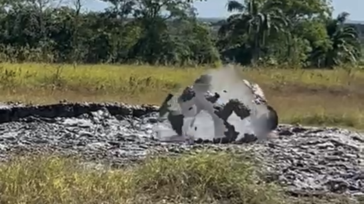
On Wednesday, February 14th, 2024, one week after the Tobago Oil Spill began, the Trinidad and Tobago Coast Guard made headway in learning new information about the vessel’s origins.