


Trinidad and Tobago is bracing for more rainfall over the next 24 hours as more rain, showers and thunderstorms are forecast through Wednesday afternoon. Though this updated alert is slated to expire at 10:00 AM, forecast models indicate more thunderstorms occurring between 10:00 AM and 5:00 PM on Wednesday across both islands.
What you need to know
— Rainfall: Through the next 24 hours, periods of rain with isolated moderate to heavy showers and thunderstorms are forecast, with higher totals favoring eastern Trinidad, interrupting cloudy skies. Additional rainfall totals between 15 and 25 millimeters are forecast across both islands over the next 24 hours, with locally higher amounts exceeding 25 millimeters.
— Hazards: Street and flash flooding have been observed across Trinidad, with riverine flooding possible across northeastern Trinidad. Wind gusts in excess of 45 KM/H accompanying heavy showers or thunderstorms are likely, with gusts in excess of 55 KM/H possible during and ahead of heavy showers or thunderstorms. Localized wind damage, such as fallen trees, is possible. Lightning will accompany thunderstorms. Landslides are also possible, mainly across northeastern Trinidad. Seas are forecast to become locally agitated during heavy showers or thunderstorms.
Latest Alerts

Adverse Weather Alert Discontinued For T&T
Trinidad and Tobago is NOT under any tropical storm or hurricane threat, watch, or warning at this time.
The Adverse Weather Alert
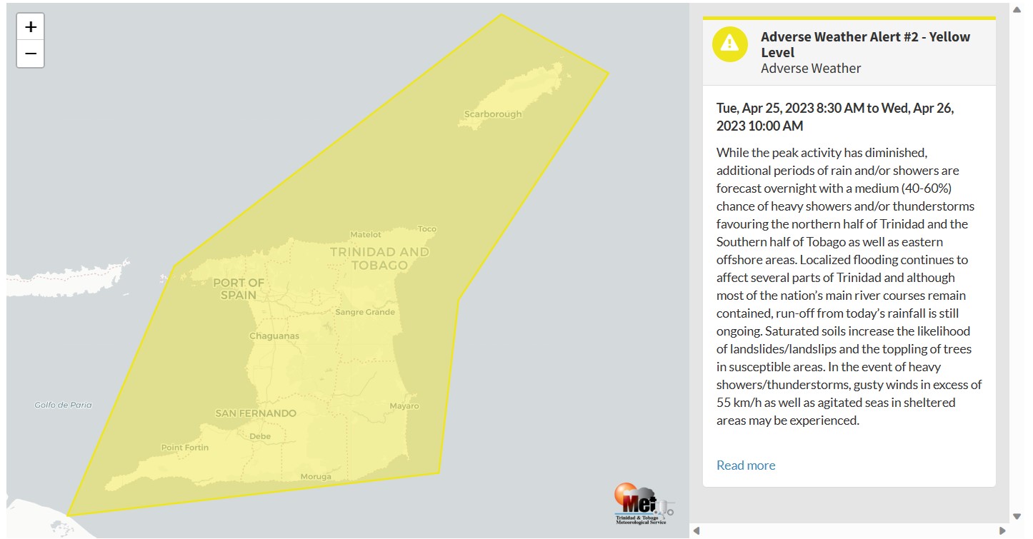
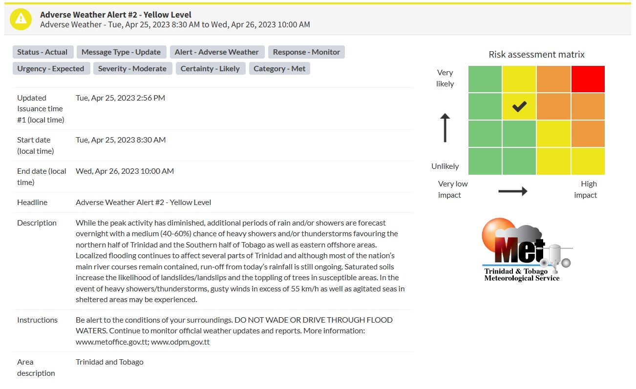
The Trinidad and Tobago Meteorological Service updated the Adverse Weather Alert (Yellow Level) on Tuesday at 2:56 PM. The alert went into effect for Trinidad, Tobago, and surrounding marine areas from 8:30 AM Tuesday, April 25th, 2023 and remains in effect through 10:00 AM Wednesday, April 26th, 2023. Severe weather on Tuesday has been ongoing since 3:00 AM, with additional inclement weather possible through the end of the alert period.
Trinidad and Tobago is not under any tropical storm watch or warning at this time.
According to the TTMS, the peak activity has diminished
This “alert” status takes into account the possibility of the event occurring. This adverse weather event is likely with the following impacts, according to the TTMS:
- Additional periods of rain and/or showers are forecast overnight with a medium (40-60%) chance of heavy showers and/or thunderstorms favoring the northern half of Trinidad and the Southern half of Tobago as well as eastern offshore areas.
- Localized flooding continues to affect several parts of Trinidad, and although most of the nation’s main river courses remain contained, run-off from today’s rainfall is still ongoing.
- Saturated soils increase the likelihood of landslides/landslips and the toppling of trees in susceptible areas.
- In the event of heavy showers/thunderstorms, gusty winds in excess of 55 km/h as well as agitated seas in sheltered areas, may be experienced.

The color of the alert indicates the severity of the event and the probability of the event occurring. Currently, the alert level is Yellow. This means that the hazards are likely, and the severity of the impacts is moderate for this particular alert. You should be aware of the hazards in your area associated mainly with gusty winds in excess of 55 KM/H, street, flash, and riverine flooding, landslides, as well as frequent lightning.
For a moderate Adverse Weather Alert, there is the potential for possible injuries, where behavioral changes are required to ensure safety. There may be minor damage to property, with income-earning temporarily disrupted and a couple of communities affected.
The Met Office is advising the public to monitor weather conditions and updates from official sources and not wade or drive through flood waters.


