


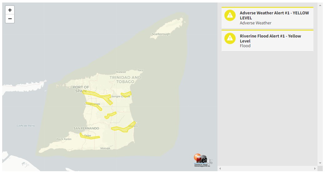
All major rivers across Trinidad are being closely monitored following prolonged heavy rainfall over the last 12 hours. Major river levels across Trinidad are above 80% capacity, with several smaller rivers and tributaries already overtopping since early Saturday morning.
What you need to know
— What has happened: Over the last 12 hours, between 25 and 100 millimeters of rain fell across parts of Trinidad, with isolated totals exceeding 100 millimeters. Compounding the flooding situation, over the next 24 hours, an additional 25-75 millimeters of rain fell across the country, with isolated totals exceeding 75 millimeters.
— What to expect: More rainfall over the next 24-36 hours. Riverine flooding is likely across all major river basins in Trinidad, particularly smaller tributaries to larger rivers.
The Riverine Flood Alert
The Trinidad and Tobago Meteorological Service issued a Riverine Flood Alert (Yellow Level) at 12:08 PM Saturday. The alert went into effect for Trinidad from 12:00 PM Saturday, November 26th, 2022, and remains in effect until 4:00 PM Monday, November 28th, 2022. The alert is in effect for the Caroni River, the North Oropouche River, the Caparo River, the Navet River, the Ortoire River and the South Oropouche River, as well as all surrounding tributaries.
Trinidad and Tobago is not under any tropical storm watch or warning at this time.
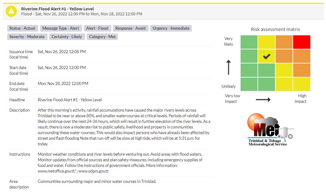
“After this morning’s activity, rainfall accumulations have caused the major river levels across Trinidad to be near or above 80%, and smaller watercourses at critical levels. Periods of rainfall will likely continue over the next 24-36 hours, which will result in further elevation of the river levels. As a result, there is now a moderate risk to public safety, livelihood and property in communities surrounding these water courses. This would also impact persons who have already been affected by street and flash flooding Note that run-off will be slow at high tide, which will be at 5:31 p.m. today.” according to the Trinidad and Tobago Meteorological Service. This “alert” status takes into account the possibility of the event occurring. This riverine flood event is likely.

The color of the alert indicates the severity of the event and the probability of the event occurring. Currently, the alert level is Yellow. This means that the hazards are likely, and the severity of the impacts is moderate for this particular alert. You should be aware of the hazards in your area, and you need to be aware of the impacts of street, flash, and riverine flooding in your area.
For a moderate Riverine Flood Alert, there is the potential for possible injuries, where behavioral changes are required to ensure safety. There may be minor damage to property, with income-earning temporarily disrupted and a couple of communities affected.
The Met Office is advising the public to monitor weather conditions and river levels before venturing out, avoid areas with flood waters, monitor updates from official sources and plan safety measures, including emergency supplies of food and water, and follow the instructions of government officials.

