


The Trinidad and Tobago Meteorological Service has discontinued the Adverse Weather Alert for the country as activity associated with the Intertropical Convergence Zone, and a low-level trough gradually dissipates. However, the ITCZ is forecast to remain present across the area on Thursday, with showers and thunderstorms still possible.
What you need to know
— Rainfall: Showers and thunderstorms remain in the forecast on Thursday due to the Intertropical Convergence Zone remaining near the country. Additional rainfall totals between 15 and 35 millimeters are forecast, trending higher across southern, eastern, and western coastal Trinidad with isolated totals up to 50 millimeters.
— Hazards: Chances for street/flash flooding are high on Thursday. Chances for riverine flooding remain low. Gusty winds in excess of 45 KM/H accompanying heavy showers or thunderstorms are likely. Lightning will accompany thunderstorms.
— Alerts/Watches/Warnings: The Adverse Weather Alert has been discontinued by the Trinidad and Tobago Meteorological Service. There are no tropical cyclone watches or warnings in effect for T&T at this time.
Adverse Weather Alert Discontinued
The Trinidad and Tobago Meteorological Service has discontinued the Adverse Weather Alert (Yellow Level) on Wednesday afternoon at 4:51 PM.
Trinidad and Tobago is not under any tropical storm watch or warning at this time.
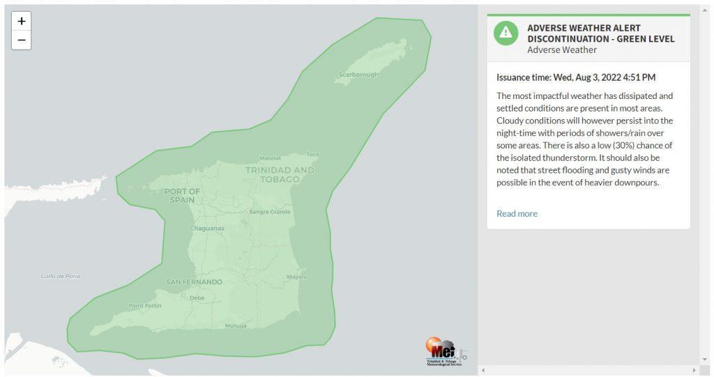
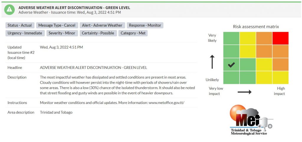
“The most impactful weather has dissipated, and settled conditions are present in most areas. Cloudy conditions will, however, persist into the nighttime with periods of showers/rain over some areas. There is also a low (30%) chance of an isolated thunderstorm. It should also be noted that street flooding and gusty winds are possible in the event of heavier downpours,” according to the Trinidad and Tobago Meteorological Service.

The color of the alert indicates the severity of the event and the probability of the event occurring. Currently, the alert level is at Green, as the discontinuation was issued, and the certainty is possible.
At this level, according to the TTMS, there is a low risk to public safety, livelihoods, and property.
The Met Office is advising the public to monitor weather conditions and official updates.


