


Trinidad and Tobago is forecast to experience slight to near-calm seas over the next seven days as the pressure gradient across the region slackens, allowing for light winds.
There are no sea-based alerts, watches, or warnings from the Trinidad and Tobago Meteorological Service for Trinidad and Tobago at this time.
Seas Forecast For Trinidad and Tobago
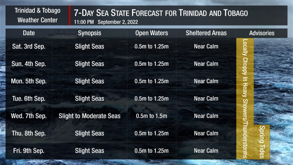
Seas are forecast to be slight into next week. Waves in open waters are forecast to be generally between 0.5 and 1.25 meters through the weekend into next week. In sheltered areas, waves are forecast to be near calm, becoming occasionally choppy in heavy showers or thunderstorms, particularly within the Gulf of Paria.
Swell periods are forecast to remain between 7 and 9 seconds coming from the northeast to east over the next seven days.
Winds are forecast to be gentle to light through next week with sustained winds between 0 to 15 knots from generally the south to the north. Gusts during this period are forecast to reach 20 knots, accompanying isolated heavy showers or thunderstorms.
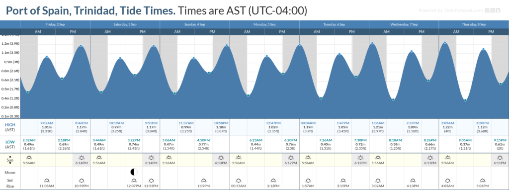
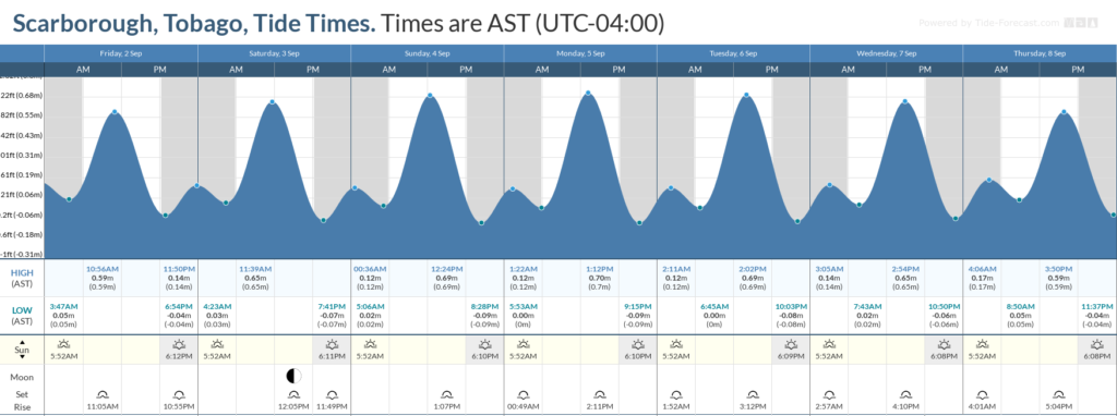
Spring tides are forecast to begin on September 8th, 2022. These are higher than usual high tides and lower than usual low tides which may increase the risk of rip currents. Spring tides may also lead to slower runoff of floodwaters and slower decrease of river levels.
How to spot a rip current

Rip Currents
Saharan Dust is also forecast to remain at minimal levels through the forecast period, with horizontal visibility and air quality minimally affected.


