Globally, tropical cyclones are classified differently based on their location, structure, and intensity. In the North Atlantic Basin, tropical cyclones are classified as tropical depressions, tropical storms, hurricanes, and major hurricanes.
The Saffir Simpson Hurricane Wind Scale
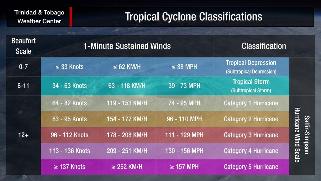
The Saffir-Simpson Hurricane Wind Scale (SSHWS), formerly the Saffir-Simpson Hurricane Scale (SSHS), classifies tropical cyclones in the Western Hemisphere into five categories based on the intensities of their sustained winds.
The SSHWS aims to make the risk associated with these powerful low-pressure systems straightforward and simple to understand. However, the category or classification of the system can falter when looking at the impacts – rainfall, storm surge, etc., as well as periphery impacts.
Tropical Disturbances
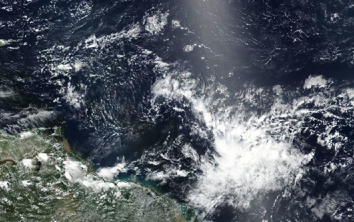
A tropical disturbance is a discrete tropical weather system with apparently organized convection (generally 100 to 300 miles or 160 to 480 kilometers in diameter) originating in the tropics or subtropics, having a nonfrontal migratory character and maintaining its identity for 24 hours or more.
A disturbance can be a perturbation within the Intertropical Convergence Zone, a tropical wave, an outflow boundary from an organized thunderstorm system, or any other low-level feature with sufficient spin (vorticity) and convergence to begin tropical cyclogenesis.
Without a low-level to surface focus, even with optimal upper-level conditions and atmospheric instability, no organized convection and surface low-pressure system will be able to form.
When the National Hurricane Center begins to monitor a tropical disturbance, it is sometimes called an INVEST.
What is an INVEST?
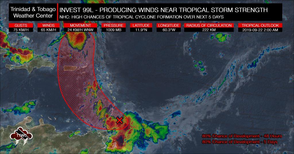
In Meteorology, an INVEST (short for an investigative area, also called area of interest) is a designated area of disturbed weather monitored for potential tropical cyclone formation.
In the Atlantic Basin, these INVESTs are designated by the United States National Hurricane Center, numbered from 90 to 99 followed by the suffix L. These suffixes change for each basin, with “E” and “C” in the Eastern and Central Pacific basins (respectively), or “W” in the Western Pacific basin. Numbers are rotated within the season and are re-used as necessary (the subsequent invest after 99 would be numbered 90).
According to the National Hurricane Center, by designating a tropical weather system as an INVEST, the collection of specialized data sets and computer model guidance on the area of interest can begin. This collection and processing of data are shown on several government and academic websites for analysis.
The designation of a system as an INVEST does not necessarily correspond to any particular likelihood of the development of the system into a tropical cyclone.
Potential Tropical Cyclones
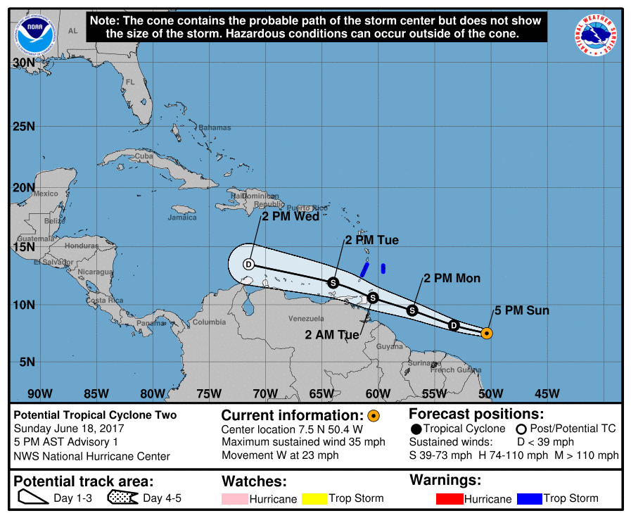
The National Hurricane Center began using this term in 2017, referring to a disturbance that has not yet become a tropical cyclone but poses the threat of bringing tropical storm or hurricane conditions to land areas within 48 hours.
This allows the National Hurricane Center, in conjunction with local governments and meteorological services to issue advisories, watches, and warnings in anticipation of tropical cyclone impacts.
It will be classified as a potential tropical cyclone (PTC) with a two-digit PTC number (for example, PTC-09 or PTC-15E) that otherwise looks identical to a Tropical Cyclone (TC) number.
For example, the first instance of a potential tropical cyclone was Potential Tropical Cyclone Two of 2017, which eventually formed into Tropical Storm Bret – making landfall across Southeastern Trinidad in late June.
Tropical Depressions
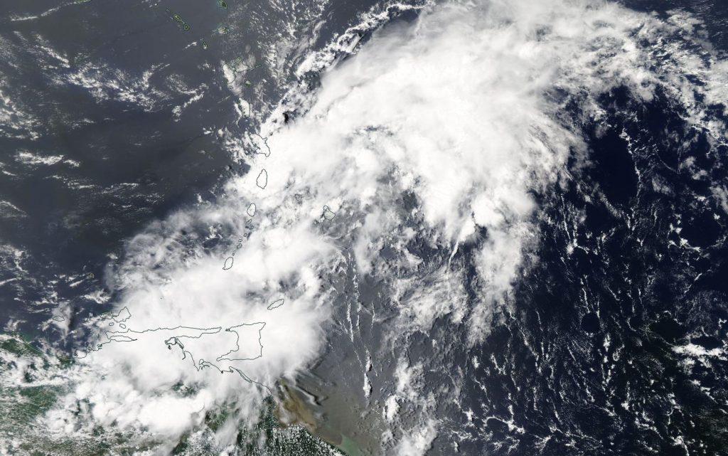
A tropical depression is a low-pressure system with a closed surface circulation with a maximum sustained surface wind speed (1-minute mean) of 62 KM/H or less. In addition to a closed and well-defined circulation meeting the wind threshold, a tropical depression needs to have organized, persisting, deep convection near the center.
This last criterion is usually determined using the Dvorak technique to estimate intensity, with a tropical depression usually classified when estimates reach T2.0. It is a widely used system to estimate tropical cyclone intensity (which includes tropical depression, tropical storm, and hurricane intensities) based solely on visible and infrared satellite images, as seen below.

However, these weaker tropical cyclones can still pack a punch. In Trinidad and Tobago, though gusty winds pose hazards for our trees, poorly constructed roofing, and overhead lines – our main hazards with these systems tend to be locally heavy rainfall.
Tropical Depression Seven (above), which degenerated into a tropical wave in 2012, triggered severe weather causing flooding and landslides throughout the country, particularly along the northwestern peninsula. Two deaths and heavy infrastructure damage occurred. The damaging effects of the severe weather considered a 1 in 50-year event were concentrated in the Diego Martin Corporation.
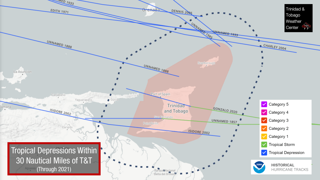
Ten tropical depressions have made landfall or passed within 30 nautical miles of Trinidad and Tobago’s coasts.
Tropical Storms
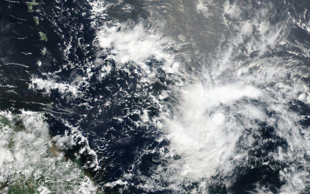
A tropical storm is another low-pressure system with a closed surface circulation with a maximum sustained surface wind speed (1-minute mean) ranging from 63 KM/H to 118 KM/H.
Like tropical depressions, tropical storms across Trinidad and Tobago’s main hazards tend to be locally heavy rainfall, even with the sustained and gusty winds posing a threat to power, roofs, and trees.
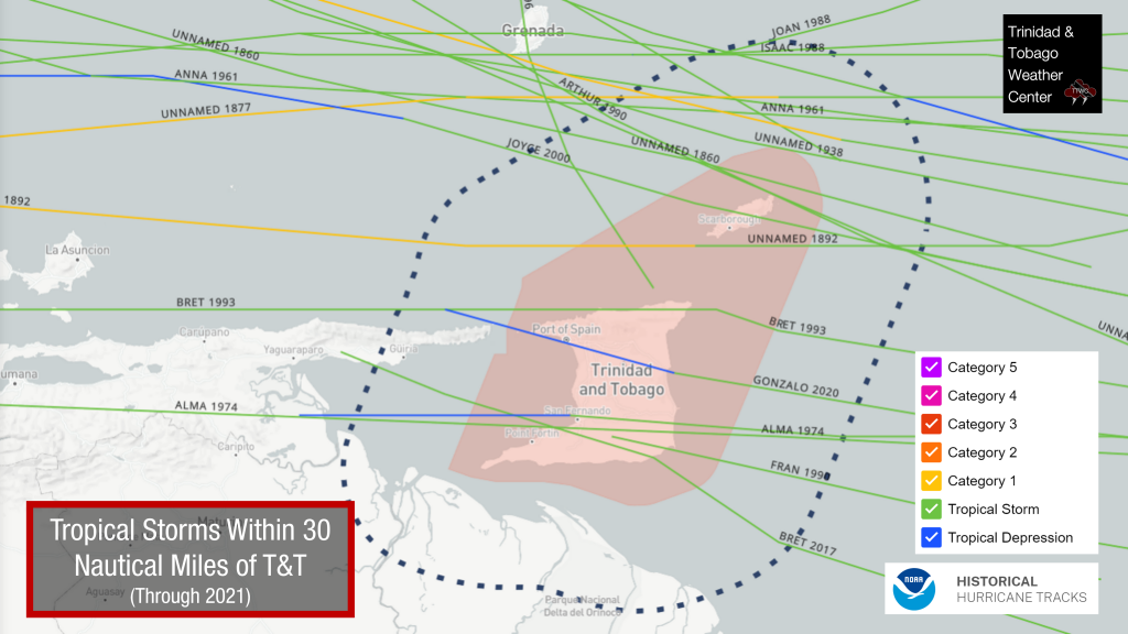
To date, 22 tropical storms made landfall or passed within 30 nautical miles of Trinidad and Tobago’s coasts.
Subtropical Depressions & Subtropical Storms
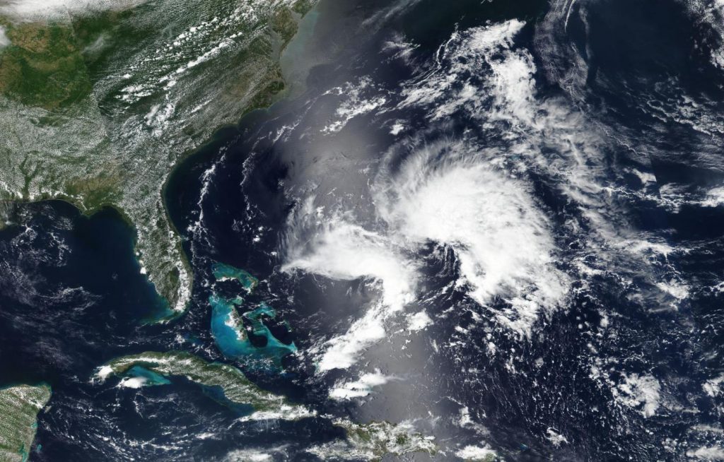
A subtropical cyclone is a non-frontal low-pressure system that has characteristics of both tropical and extratropical cyclones. Subtropical cyclones originate over tropical or subtropical waters and have a closed circulation about a well-defined center. Across the North Atlantic, they require central convection fairly near the center and a warming core in the mid-levels of the troposphere.
In comparison to tropical cyclones, the maximum winds occur relatively far from the center (greater than 60 nautical miles) and have a less symmetric wind field and distribution of convection.
Under certain conditions, subtropical cyclones can evolve into tropical cyclones.
Those with sustained winds below 62 KM/H (33 knots or 38 MPH) are called subtropical depressions, while those at or above this speed are referred to as subtropical storms.
Subtropical cyclones with hurricane-force winds of 119 KM/H (64 knots, or 74 MPH) or greater are not officially recognized by the National Hurricane Center. Once a subtropical storm intensifies enough to have hurricane-force winds, it is then automatically assumed to have become a fully tropical hurricane.
Generally, these systems form well north of our area. No subtropical cyclones have directly affected Trinidad and Tobago, or are considered near misses in recorded history.
Category 1 Hurricane
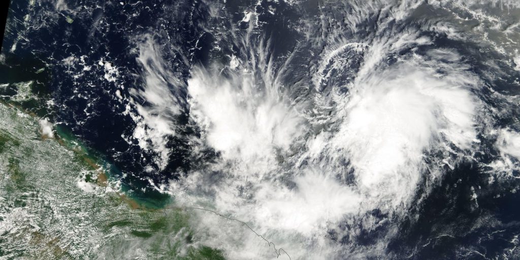
Category 1: Very dangerous winds will produce some damage.
Category 1 storms usually cause no significant structural damage to most well-constructed permanent structures. However, they can topple unanchored mobile homes and uproot or snap weak trees. Poorly attached roofs, galvanize or tiles can blow off.
Coastal flooding and pier damage are often associated with Category 1 storms. Even though it is the least intense type of hurricane, they can still produce widespread damage and can be life-threatening storms. Power outages are typically widespread to extensive, sometimes lasting several days.
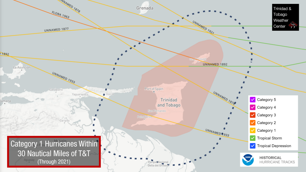
To date, seven Category 1 hurricanes have made landfall or passed within 30 nautical miles of Trinidad and Tobago’s coasts.
Category 2 Hurricane
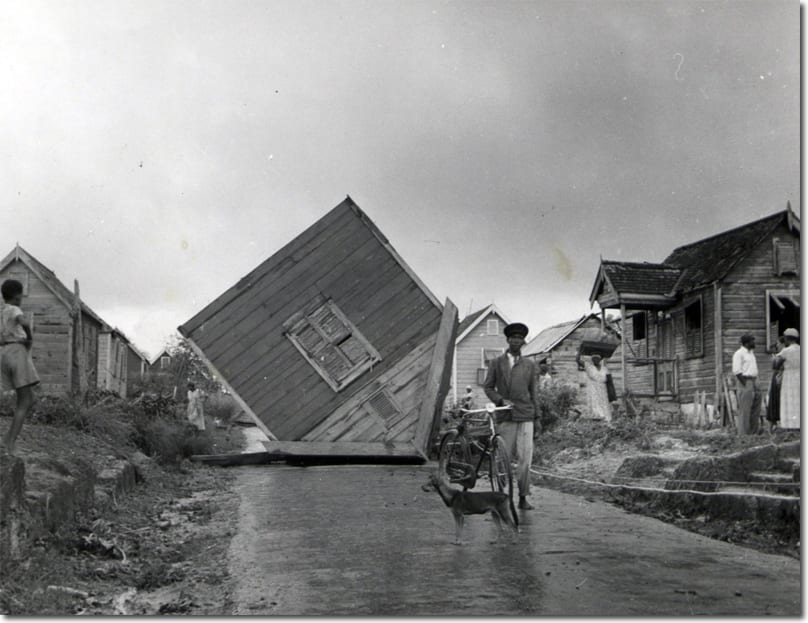
Category 2: Extremely dangerous winds will cause extensive damage
Storms of Category 2 intensity often damage roofing material (sometimes exposing the roof) and inflict damage upon poorly constructed doors and windows. Poorly constructed signs and piers can receive considerable damage and many trees are uprooted or snapped.
Whether anchored or not, poorly constructed homes are typically damaged and sometimes destroyed, and many manufactured homes also suffer structural damage.
Small craft in unprotected anchorages may break their moorings. Extensive to near-total power outages and scattered loss of potable water are likely, possibly lasting many days.
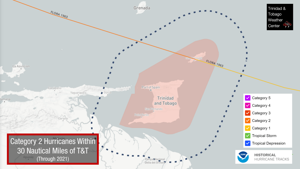
Only Hurricane Flora of 1963 affected T&T at Category 2 strength.
Major Category 3 Hurricane
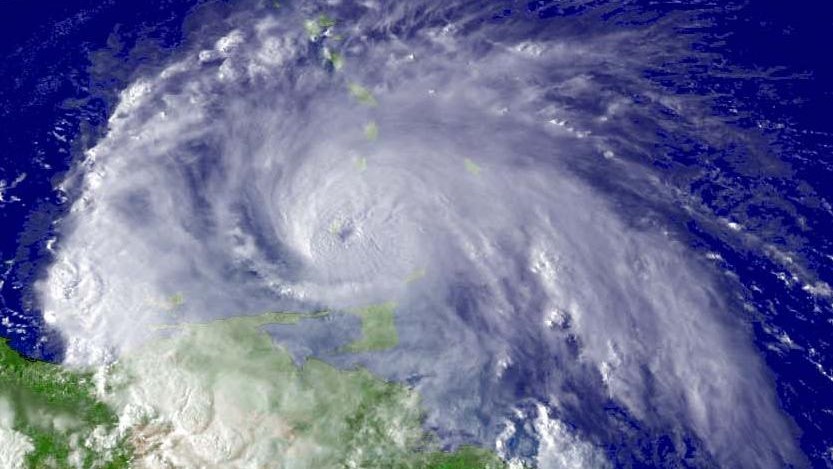
Category 3: Devastating damage will occur
Tropical cyclones of Category 3 and higher are described as major hurricanes in the Atlantic or Eastern Pacific basins.
These storms can cause some structural damage to small residences and utility buildings, particularly those of wood frame or manufactured materials with minor curtain wall failures.
Buildings that lack a solid foundation are usually destroyed, and gable-end roofs are peeled off. Manufactured homes typically sustain severe and irreparable damage.
Flooding near the coast destroys smaller structures, while larger structures are struck by floating debris. A large number of trees are uprooted or snapped, isolating many areas. Additionally, terrain may be flooded well inland.
Near-total to total power loss is likely for up to several weeks, and water will likely also be lost or contaminated.
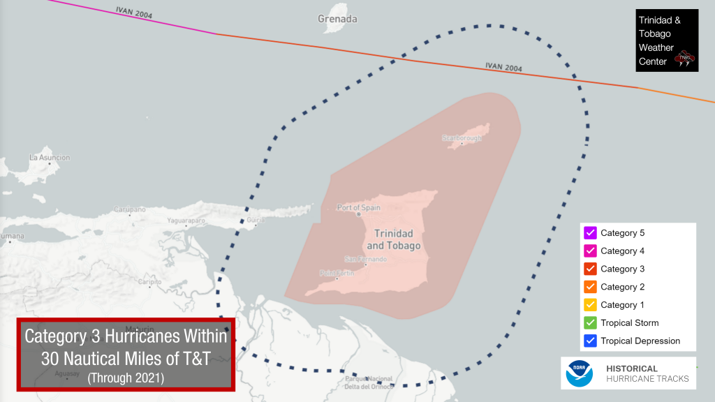
Only one Category 3 hurricane passed within 30 nautical miles of Trinidad and Tobago’s coasts – Hurricane Ivan of 2004.
Major Category 4 Hurricane
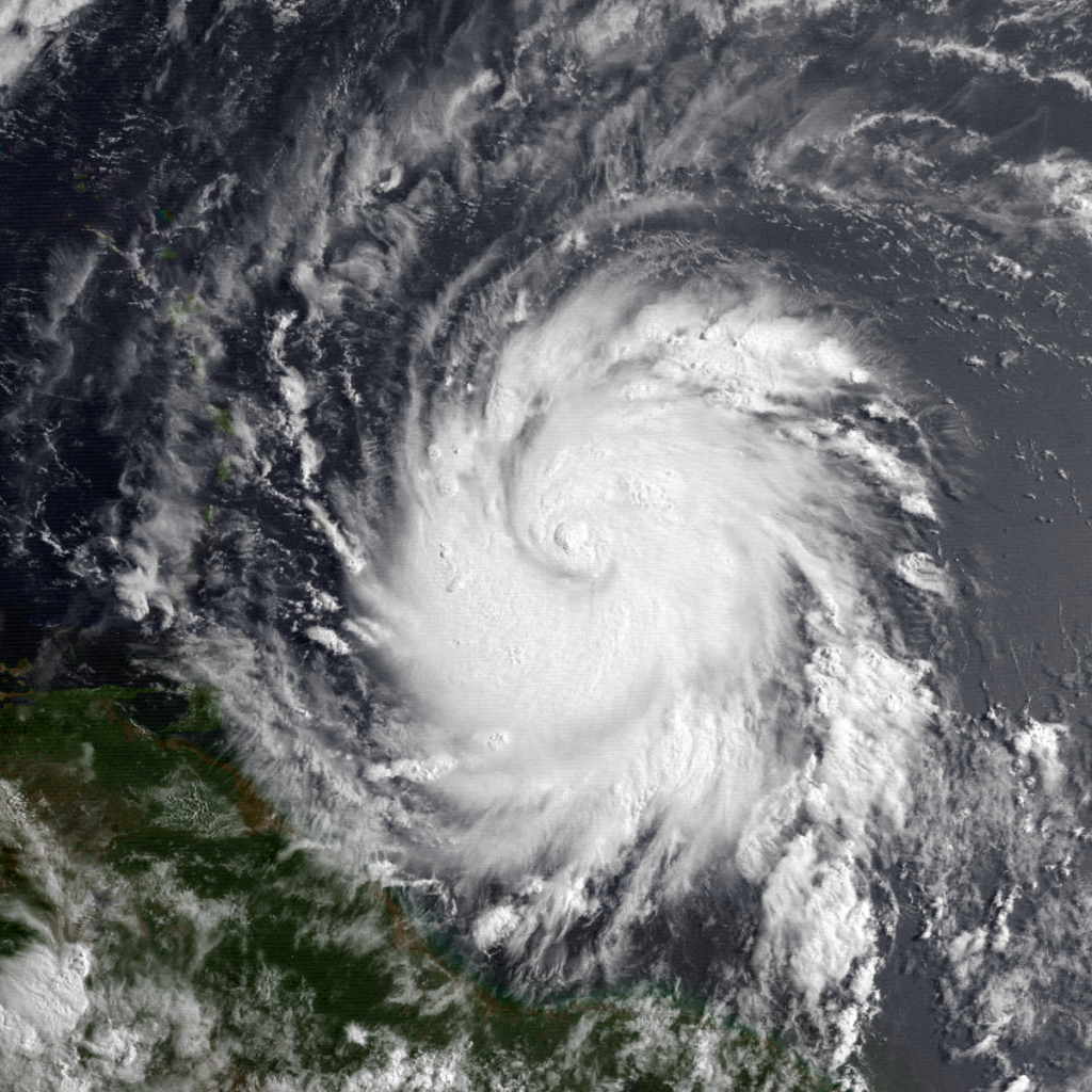
Category 4: Catastrophic damage will occur
Category 4 hurricanes tend to produce more extensive curtainwall failures, with some complete structural failure on small residences. Heavy, irreparable damage and the near-complete destruction of gas station canopies and other wide-span overhang-type structures are common.
Poorly constructed and manufactured homes are often flattened. Most trees, except for the heartiest, are uprooted or snapped, isolating many areas.
These storms cause extensive beach erosion, while terrain may be flooded far inland. Total and long-lived electrical and water losses are to be expected, possibly for many weeks.
No Category 4 hurricanes have directly affected Trinidad and Tobago or are considered near misses based on our definition (within 30 nautical miles) in recorded history.
Major Category 5 Hurricane
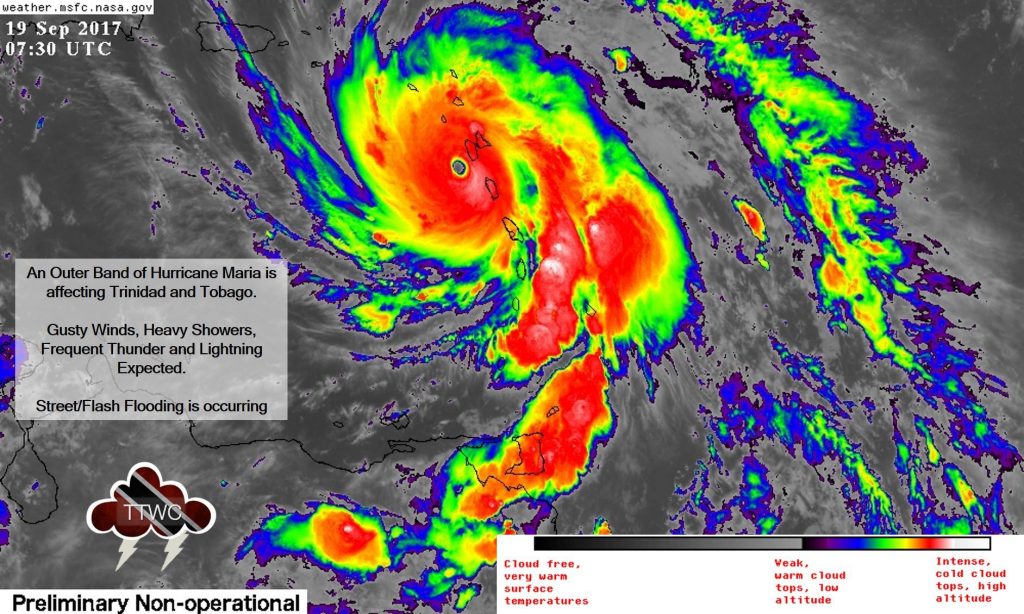
Category 5: Catastrophic damage will occur
Category 5 is the highest category of the Saffir–Simpson scale. These storms cause complete roof failure on many residences and industrial buildings and some complete building failures with small utility buildings blown over or away. The collapse of many wide-span roofs and walls, especially those with no interior supports, is common.
Very heavy and irreparable damage to many wood frame structures and total destruction to mobile/manufactured homes is prevalent. Only a few structures can survive intact, and only if located at least three to five miles (five to eight km) inland. They include office, condominium, and apartment buildings and hotels that are of solid concrete or steel frame construction, multi-story concrete parking garages, and residences that are made of either reinforced brick or concrete/cement block and have hipped roofs with slopes of no less than 35 degrees from horizontal and no overhangs of any kind, and if the windows are either made of hurricane-resistant safety glass or covered with shutters. Unless all of these requirements are met, the absolute destruction of a structure is inevitable.
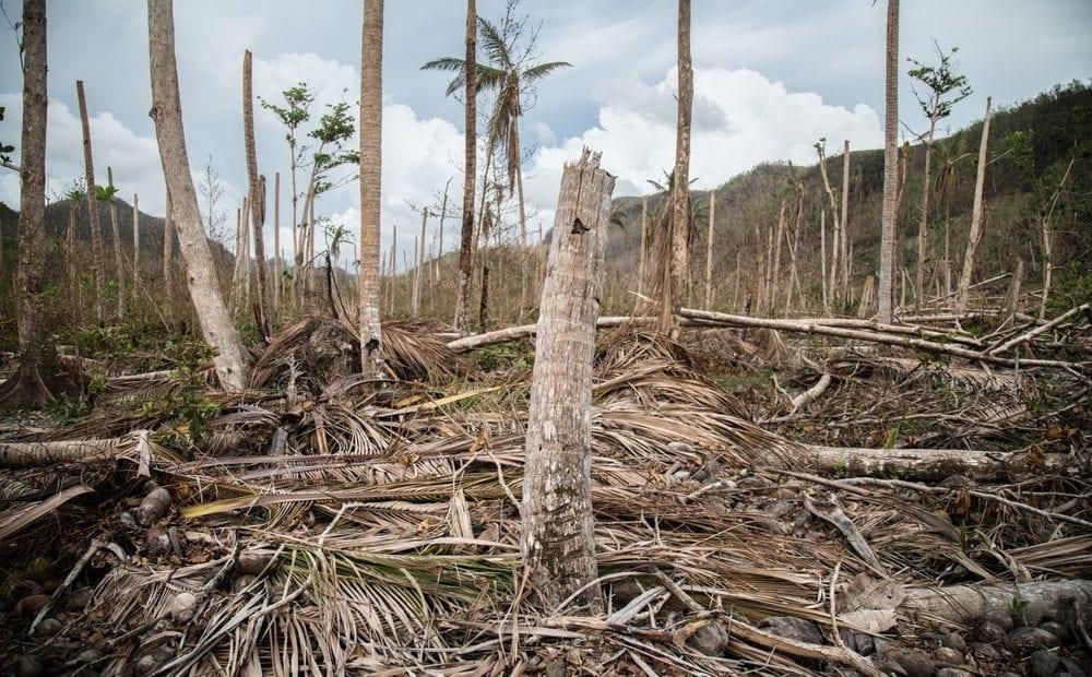
The storm’s flooding causes major damage to the lower floors of all structures near the shoreline, and many coastal structures can be completely flattened or washed away by the storm surge. Virtually all trees are uprooted or snapped, and some may be debarked, isolating most affected communities. Massive evacuation of residential areas may be required if the hurricane threatens populated areas. Total and extremely long-lived power outages and water losses are to be expected, possibly for up to several months.
No Category 5 hurricanes have directly affected Trinidad and Tobago, or are considered near misses in recorded history.
Post Tropical Cyclones
A post-tropical cyclone is simply a former tropical cyclone. This generic term describes a cyclone that no longer possesses sufficient tropical characteristics to be considered a tropical cyclone. Post-tropical cyclones can continue carrying heavy rains and high winds.
Depending on its location, one of three things may occur when a tropical cyclone reaches the end of its life cycle. If the tropical cyclone dissipates in the tropics, it may degenerate into a tropical wave. If a tropical cyclone degenerates – it can become a remnant low (more common overland) or an extratropical cyclone (in the northern latitudes).
Remnant Low
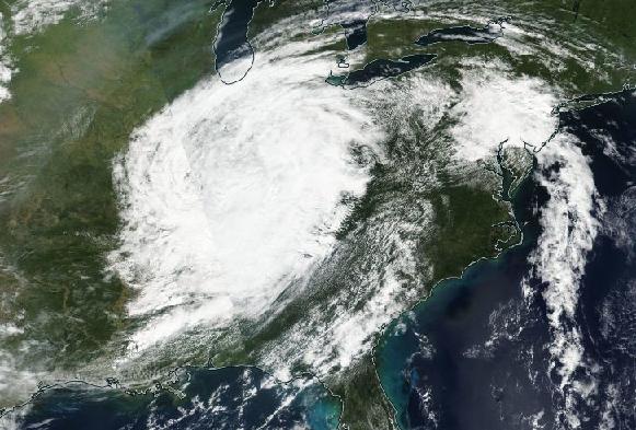
This is a post-tropical cyclone that no longer possesses the convective organization required of a tropical cyclone and has maximum sustained winds of less than 34 knots. These shallow systems may meander for some time before opening into a trough of low pressure or be absorbed into an extratropical cyclone.
Extratropical Cyclone
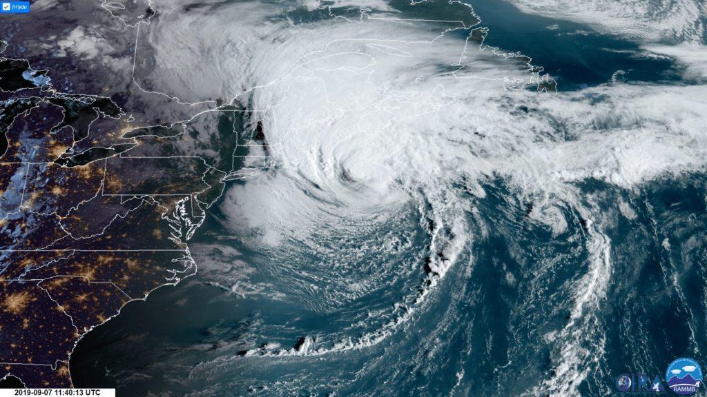
An extratropical cyclone is a term used in advisories and tropical summaries to indicate that a cyclone has lost its “tropical” characteristics. It is important to note that cyclones can become extratropical and still retain winds of hurricane or tropical storm force.
Tropical cyclones often transform into extratropical cyclones at the end of their tropical existence, usually between 30° and 40° latitude.


