


Tropical Wave 04 brought periods of showers and thunderstorms to Trinidad and Tobago over the last 36 hours, with isolated thunderstorms still ongoing across parts of Trinidad on Friday afternoon.
With an anticipated increase in Saharan Dust and some stabilization of the atmosphere from this evening, the Trinidad and Tobago Meteorological Service has discontinued the Adverse Weather Alert for the country.
What you need to know
— Rainfall: Showers and thunderstorms are forecast to gradually decrease into Friday night with increasingly hazy conditions. Higher rainfall chances will exist along eastern and southern coastlines into Saturday. Over the next 24 hours, with lingering showers, rainfall totals between 5-20 millimeters are forecast across the country, with higher rainfall totals up to 25 millimeters across southern and eastern Trinidad.
— Hazards: Street/flash flooding is likely to persist through Friday evening with lingering rainfall. Chances for riverine flooding remain fairly low. Gusty winds may accompany lingering heavy showers or thunderstorms. Lightning will accompany thunderstorms.
— Alerts/Watches/Warnings: The Adverse Weather Alert has been discontinued by the Trinidad and Tobago Meteorological Service.
Alert Discontinued
The Trinidad and Tobago Meteorological Service has discontinued the Adverse Weather Alert (Yellow Level) on Friday afternoon at 2:12 PM.
Trinidad and Tobago is not under any tropical storm watch or warning at this time.
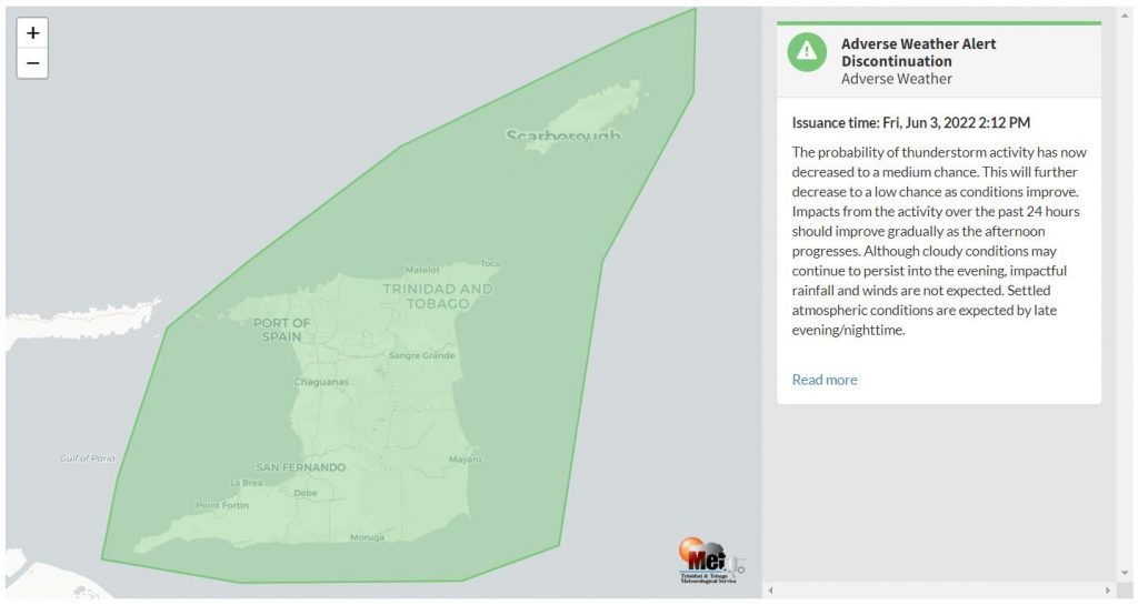
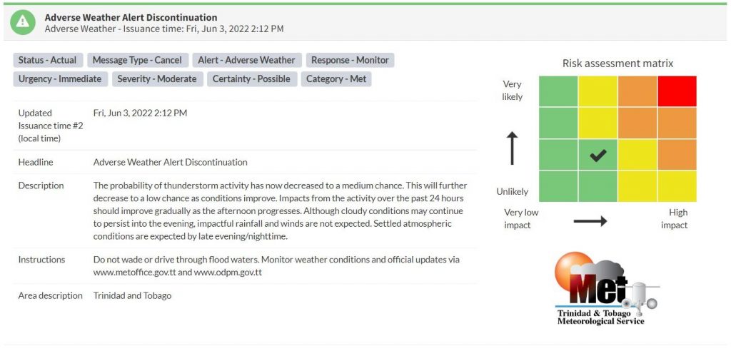
“The probability of thunderstorm activity has now decreased to a medium chance. This will further decrease to a low chance as conditions improve. Impacts from the activity over the past 24 hours should improve gradually as the afternoon progresses. Although cloudy conditions may continue to persist into the evening, impactful rainfall and winds are not expected. Settled atmospheric conditions are expected by late evening/nighttime.” according to the Trinidad and Tobago Meteorological Service.

The color of the alert indicates the severity of the event and the probability of the event occurring. Currently, the alert level is at Green, as the discontinuation was issued but the certainty is possible, meaning there is still a remote possibility of moderate impacts associated with heavy showers and thunderstorms like gusty winds and flooding.
For a moderate Adverse Weather Alert, there is the potential for possible injuries, where behavioral changes are required to ensure safety. There may be minor damage to property, with income-earning temporarily disrupted and a couple of communities affected.
The Met Office is advising the public to be alert for cloud-to-ground lightning activity and not venture into floodwaters, secure loose objects outdoors as well as monitor weather conditions and updates from official sources.
Small craft operators should be on the alert for above normal or choppy sea conditions in strong winds.


