Tropical Wave 01 is set to usher in a prolonged surge of Saharan Dust across the Lesser Antilles this upcoming week, reducing both visibility and air quality.
What you need to know:
– Saharan Dust Surges: Dust concentrations will gradually increase through Monday, May 16th, 2022. By late Monday, high to significant dust concentrations are set to fluctuate across the Lesser Antilles through the next five to seven days. Peak concentrations are expected between Wednesday on Friday.
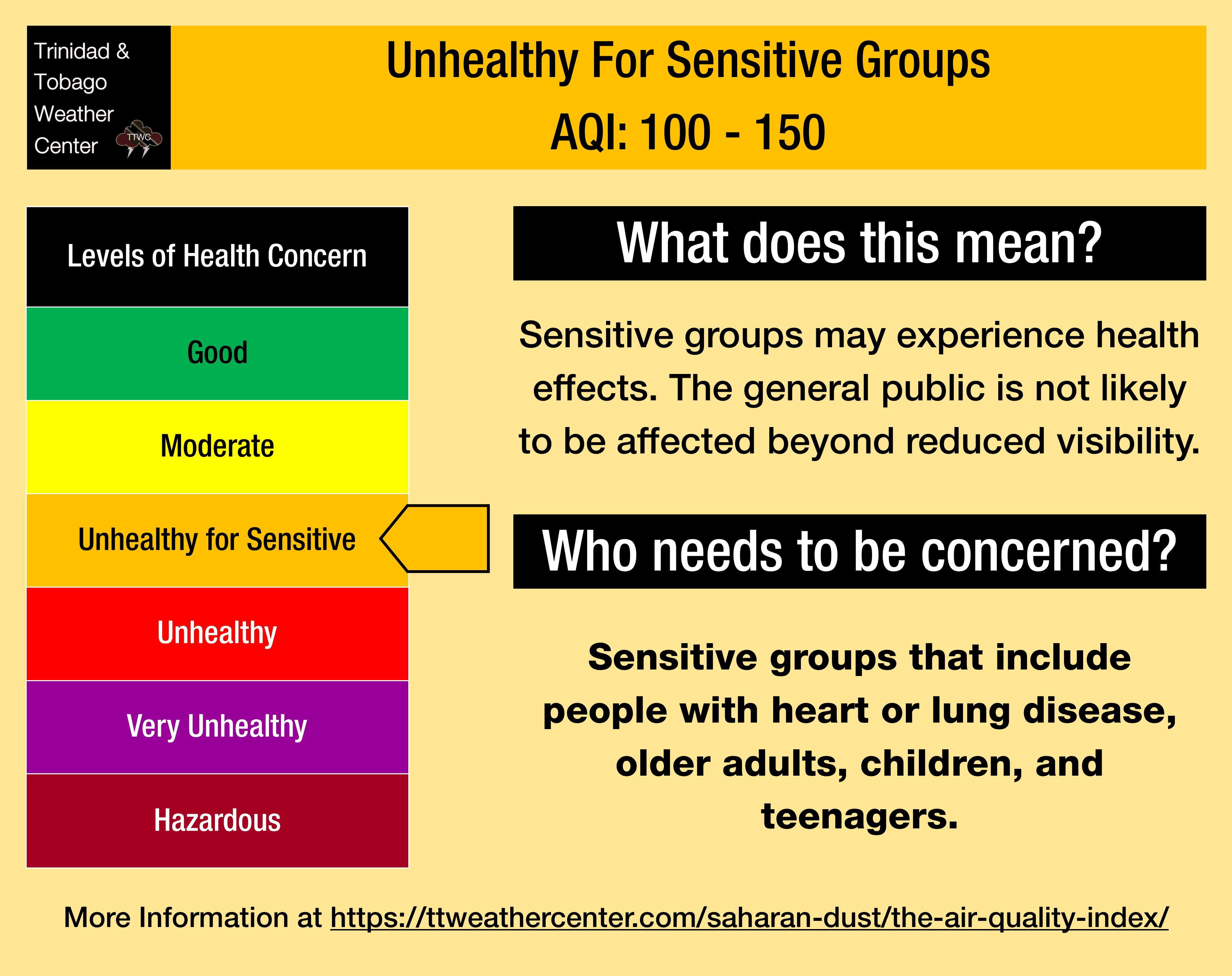
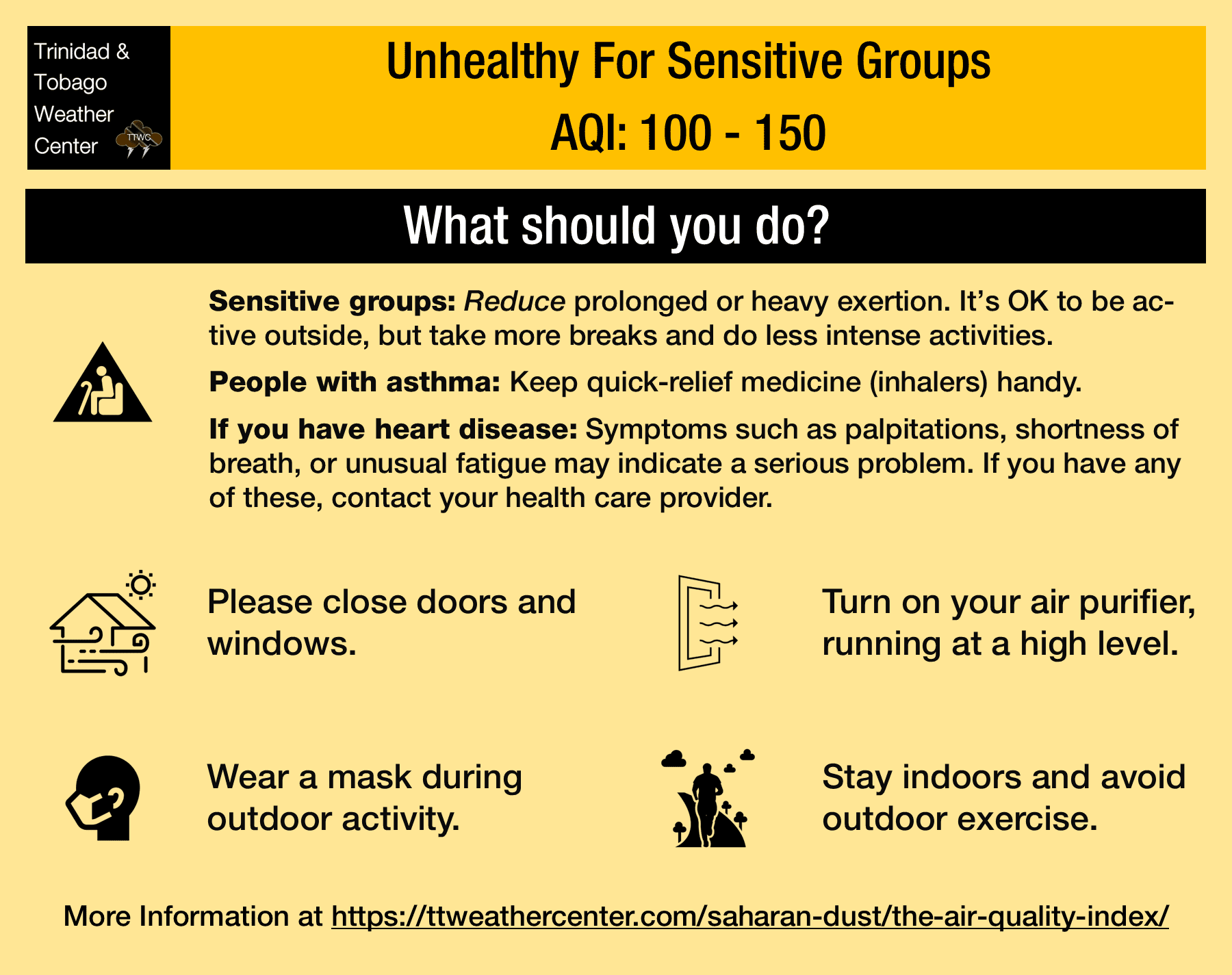
– Impacts: Through Monday, air quality is forecast to fluctuate between good and moderate levels. From late Monday night through the upcoming weekend, air quality may dip to levels that are moderate or unhealthy for sensitive groups.
– What Should You Do: Air quality impacts will mainly begin by late Monday. Mainly sensitive groups should take necessary precautions and keep necessary medications nearby.
Current AQI Levels Across T&T
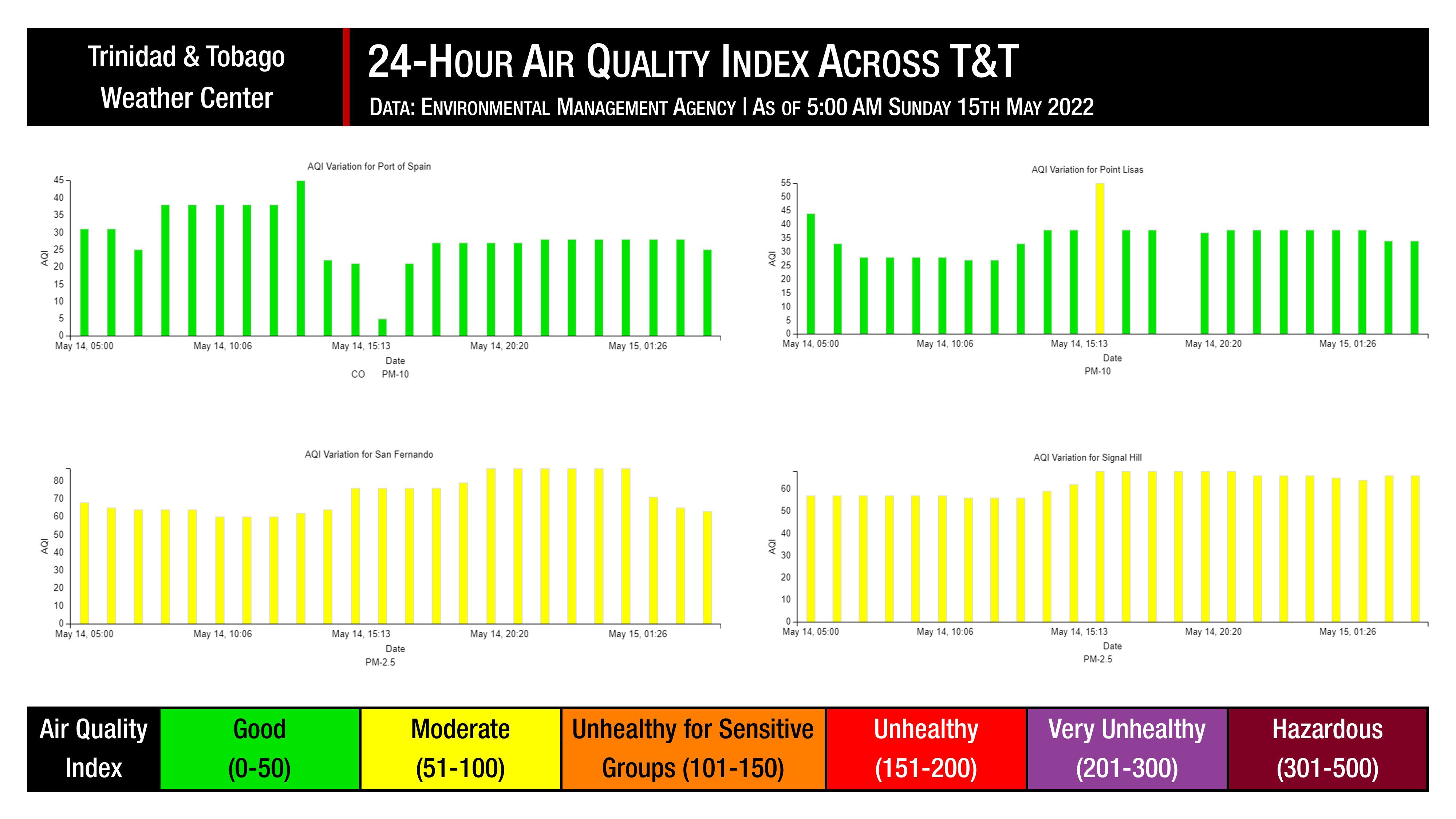
Air quality levels have been variable across Trinidad and Tobago over the last 24 hours. The Environmental Management Agency (EMA) air quality monitoring stations at Point Lisas and San Fernando have been recording good air quality levels, while the sites at Beetham, near Port of Spain, and Signal Hill, Tobago, are reporting good to moderate levels.
These measurements are based on PM2.5 (particulates the size of 2.5 micrometers and smaller, usually associated with increases in Saharan Dust, vehicle exhaust, and smoke) and PM10 particulates.
Visibility remained at or above 10 kilometers at the Piarco International Airport and the A.N.R. Robinson International Airport at Crown Point, Tobago, outside of shower activity over the last 24 hours.
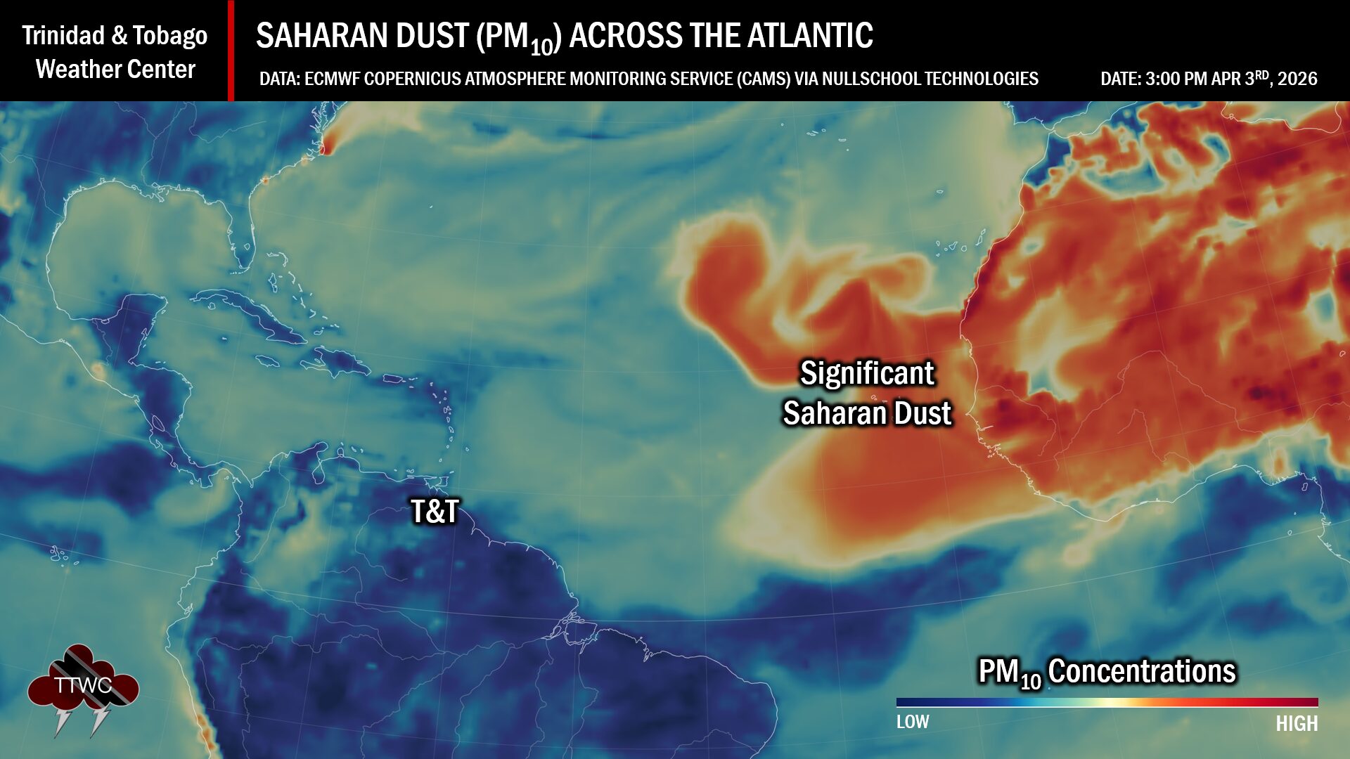
Saharan Dust Forecast
Forecast models indicate that mild to moderate Saharan Dust concentrations will persist across T&T through Monday, May 16th, 2022. Air quality and visibility outside of showers or thunderstorms will be good to moderate during this period. Periodic showers due to the passing of Tropical Wave 01 may aid in improving air quality in localized areas.
From Monday night, dust levels will increase and remain at high to significant levels into the upcoming weekend. Particulate matter, which reduces air quality and visibility, will peak between Wednesday, May 18th, 2022 through Friday, May 20th, 2022.
Generally, air quality may dip to moderate levels and, at times, be unhealthy for sensitive groups from Monday night. Outside of blowing smoke and rainfall, visibility may dip to five kilometers.
What does this mean for you?
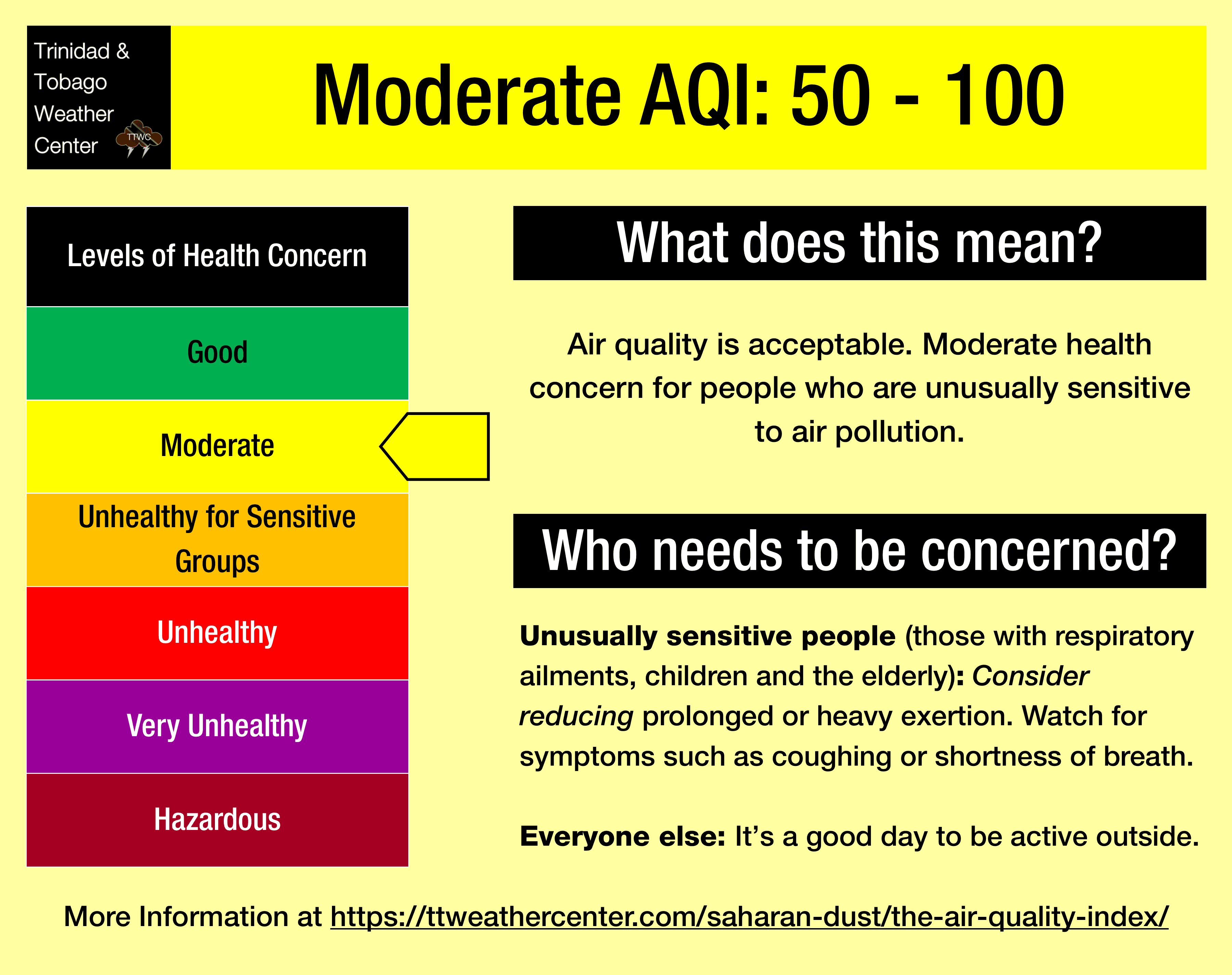
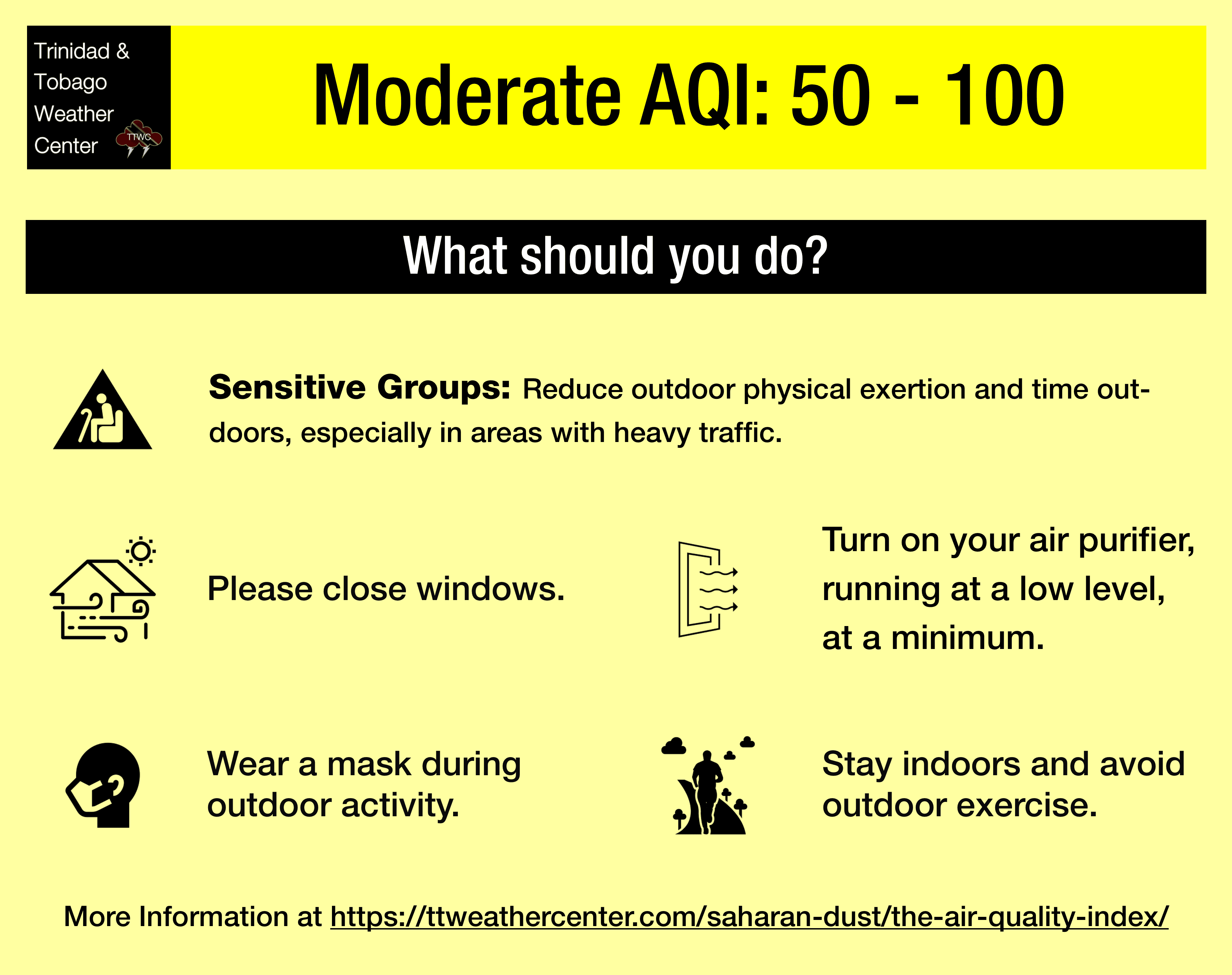
Over the next ten days, air quality is forecast to fluctuate between good to, at times, levels that are unhealthy for sensitive groups, mainly from Monday evening. High traffic periods, particularly between 6:00 AM and 9:00 AM, and again from 3:00 PM through 6:30 PM, air quality may be further reduced in localized areas.
For sensitive groups, such as children, the elderly, and persons who suffer from respiratory ailments and allergies, you may need to avoid prolonged exertion outdoors during these high traffic periods.
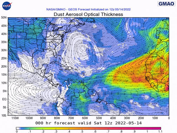
We’re in a period where the Intertropical Convergence Zone and tropical waves may shield Trinidad and Tobago from the Saharan Dust events. While tropical waves play a notable role in moving dust across the Atlantic and the Eastern Caribbean, these periodic tropical waves also improve air quality.
The concentration of the dust that follows the wave depends on the strength of the wave as it moves off the West African Coast. This is because of stronger thunderstorms across Central Africa. As strong winds move downward and outward from these thunderstorms, the wind kicks up dust as it moves across parts of the Saharan Desert and transports it into the upper atmosphere. This “plume” of dust follows the axis of the wave as it progresses westward into the Atlantic.
Dust that makes it into the upper levels of the atmosphere can then get transported across the Atlantic Ocean. The plumes of dust eventually affect the Eastern Caribbean.
Larger, more concentrated plumes of Saharan dust begin to occur in April and continue through November.