In Trinidad and Tobago, we generally experience a confirmed tornado touchdown once every 10-20 years. Our last two were the 2009 Caroni Plains tornado and, just as recently as last month, the 2019 Cunupia Tornado.
After an initially hot and sunny morning across Trinidad, daytime heating and sea breeze convergence triggered the rapid development of violent showers and severe thunderstorms across the Western half of the island, mainly in the Northwest.
These heavy showers and thunderstorms dumped 20-50 millimeters of rainfall across much of Northwestern and West-Central Trinidad, producing street flooding across parts of Port of Spain, Maraval, Cocorite, and surrounding areas.
It was initially reported as gusty winds, as it was assumed that this was a straight-line wind event, usually associated with downbursts from thunderstorms. As more videos came to light, as well as speaking with witnesses who work and live in the area, it was concluded by Trinidad and Tobago Weather Center that this was indeed a tornado event.
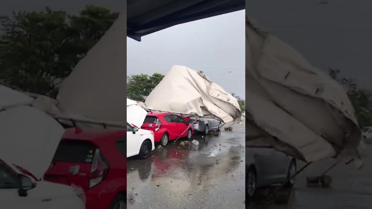
This event produced major to minor roof damage, downed a large tree, damaged a few cars, and destroyed a tent. Based on our site visits on Tuesday evening, this damage is characteristic of winds in the upper end of the EF-0 (Enhanced Fujita Scale) with maximum wind gusts near 137 KM/H or 85 MPH.
How Did the Tornado Form?
On Tuesday afternoon, a tropical wave was nearing the Lesser Antilles but had no noticeable effect on our overall wind regime. A surface-to-low-level trough was present across Trinidad and Tobago, with weak winds generally from the southeast to the east at low levels.

These light winds and increased atmospheric moisture across the islands allowed daytime heating and sea breeze convergence to trigger convective activity, even though the mid-levels of the atmosphere were dry and there was very strong wind shear across the region.
Several atmospheric conditions needed to come together across northwestern Trinidad for this rare phenomenon to form.
Tornado formation is not completely understood, and there are two main ways a tornado may form. In the case of the 2019 Port of Spain tornado, the below mechanism is the likely explanation for how this tornado formed.
Firstly, a horizontal spinning effect must form on the Earth’s surface. This usually originates in sudden changes in wind direction or speed, known as wind shear. This was definitely present in the atmosphere, with winds at low levels from the southwest (from sea breezes) and winds at higher levels from the east to southeast.
Secondly, a thundercloud, or occasionally a cumulus cloud, must be present. With daytime heating and sea breeze convergence, showers began developing just after midday on Tuesday.

During a thunderstorm, updrafts are occasionally powerful enough to lift the horizontal spinning row of air upwards, turning it into a vertical air column. This vertical air column then becomes the basic structure for the tornado. Tornadoes that form in this way are often weak and generally last less than 10 minutes.
In the case of the 2019 Port of Spain Tornado, it lasted generally 7-15 minutes, and moderate to minimal damage occurred between 12:35 PM and 12:50 PM on Tuesday, October 22nd, 2019.
Who was impacted?

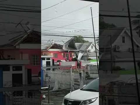
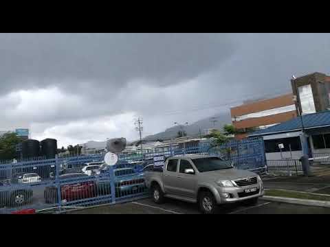
Gusty winds associated with this thunderstorm moved across parts of Wrightson Road, Westmoorings, and Invaders Bay, Port of Spain. However, the tornado began its rampage on the corner of Rosalinos Street and Wrightson Road, Port of Spain.
As strong winds ripped galvanized sheets off the business place, a fire safety equipment producer, metal became entangled in the nearby power lines at approximately 12:35 PM – 12:40 PM. This knocked out power to the Westmoornings area, as well as other parts of Western Trinidad.
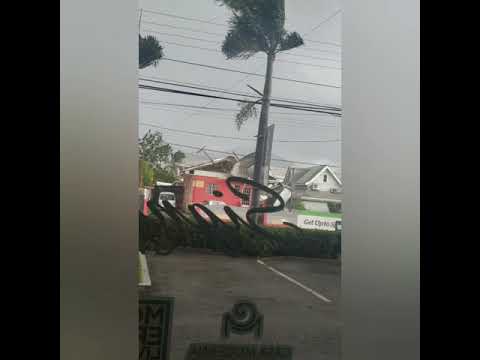
The tornado lifted off the ground as it moved across Wrightson Road during the lunchtime rush and touched back down near the Children’s Authority of Trinidad and Tobago’s Building and Massy Stores causing roof damage to both buildings.


A damaged Children’s Authority Building was damaged when gusty winds stripped off parts of the roof, sending sheets of galvanized metal flying into the air as the tornado moved through the area.
This tornado continued its west-southwesterly path into Invaders Bay, downing a tree in the open field just south of the Audrey Jeffers Highway off Wrightson Road.

The Port of Spain Tornado also moved through the open car lot in Invaders Bay, downing a tent on a few cars.
The Tornado
Based on the significant video evidence, this funnel cloud and tornado lasted between 10-20 minutes and produced minor to moderate wind damage.

In the United States and Canada, tornadoes are generally rated on a damage-based scale called the Enhanced Fujita Scale, though other regions have different tornado scales. This scale uses the damage (or lack thereof) to rate the wind speeds of the tornado after the event.
Based on the details of this tornado, we would rank it as an EF-0 tornado. With an EF-0 tornado, winds between 105 KM/H and 137 KM/H occur. Damage typical for this scale of a tornado is a peeled-off surface from some roofs, some damage to gutters or siding, branches broken off trees, and shallow-rooted trees pushed over.
Note that confirmed tornadoes with no reported damage (i.e., those that remain in open fields) are always rated EF0.
Street & Flash Flooding Across Other Areas
Tuesday’s showers were part of the usual afternoon showers and thunderstorms typical of the wet season. Peak rainfall accumulations ranged between 20 and 50 millimeters, mainly across extreme Western Coastal areas of West-Central and Northwestern Trinidad.
These heavy showers and thunderstorms triggered street and flash flooding across parts of Western Trinidad. Flooding was reported across Port of Spain, Maraval, Cocorite, and surrounding areas.
Power outages and dips were also reported across the East-West Corridor.
Was this a tornado?
All too frequently, we in Trinidad and Tobago attribute straight-line winds, or downbursts, to a tornado. A downburst is an area of strong, downward-moving air associated with a downdraft of a thunderstorm. As the downdraft impacts the ground, the air is forced outwards in all directions while it also curls backward. This results in incredible wind damage close to the surface of the ground, as well as horizontal rotation midway up between the ground and the base of the thundercloud.

There are some similarities between a microburst/downburst and a tornado, such as both are parented by severe thunderstorms, they can form rapidly, and they both have the potential to produce very high wind speeds and, therefore, significant wind damage.
However, tornado damage tends to be localized, and radial versus downburst/microburst winds cause damage along a straight line in one direction. (See below) Winds can reach up to 240 KM/H.

Technical talk aside, let’s also review the video evidence of the 2019 Port of Spain Tornado. In the event of a downburst, it is common for several structures in the same vicinity to suffer similar damages, such as the downburst event last week in the Bonne Aventure/Caratal area.
However, in this instance, where the alleged tornado initially touched down, only one structure was affected. You even see in the video debris is being blown in a (chaotic) spiral manner.
According to the American Meteorological Society’s Glossary of Meteorology, a tornado is defined as “A rotating column of air, in contact with the surface, pendant from a cumuliform cloud, and often visible as a funnel cloud and/or circulating debris/dust at the ground.”
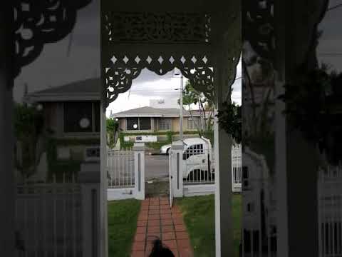
The above video clearly shows the circulating debris/dust near the ground as the roof of a business is ripped off, and the below video shows a funnel.
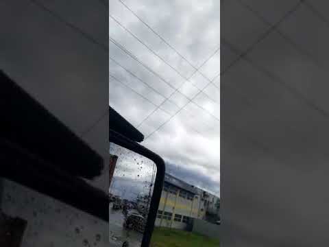
In fact, in some videos, the funnel (well above ground) is spotted. Note that in weaker tornadoes, the winds may reach the ground, but you won’t see it beyond the debris it kicks up—such as in this case.
Further evidence, beyond the localized nature of the observed damage and the spiral lift of debris into the air, is the rapid change of winds as the tornado moves through some areas.
This was seen in Invaders Bay, where winds were gusting predominantly from the south in the above video. Then, there was a rapid change in wind direction as the collapsed tent began moving in the opposite direction. In a downburst event, winds will continue to gust, particularly in open areas, in one direction as winds spread out radially from the source. In tornadoes, these rapid changes in wind direction are normal.
We’re aware of the video circulating on social media stating that this event, what we’re calling the 2019 Port of Spain Tornado, was a downburst and even going as far as to state that the Trinidad and Tobago Meteorological Service (TTMS) has confirmed it was a downburst and not a tornado.
The TTMS Weighs In
This post has been updated to reflect the comments from the Trinidad and Tobago Meteorological Service, but we stand by our assessment that it was, in fact, a tornado. That’s the great thing about the scientific community – scientists can have different interpretations of the same data.
While the TTMS used the video below for their explanation, we used in situ observations of the damage pattern, several videos, eyewitness accounts, and satellite and radar observations.
Their position is that it was not a fully formed tornado. However, when winds from a funnel cloud touch down on land, it is designated as a tornado, and if it does so over water, it is a waterspout.
A tornado is a rapidly rotating column of air that is in contact with both the surface of the Earth and a cumulonimbus cloud. Either a tornado existed, or it didn’t. A “not fully formed tornado” is either a funnel cloud or that column of air that would have touched down without a funnel cloud visibly touching down.
Sometimes that rapidly rotating column of air gets in contact with the ground *without* a funnel cloud touching down, for various reasons, which is known as a tornado without a funnel.
See the explanation from the Trinidad and Tobago Meteorological Service on the October 22nd event here:
The Trinidad and Tobago Meteorological Service is clarifying media reports on the presence of a cloud vortex in Woodbrook yesterday, mistakenly being called a Tornado.
A tornado is defined as a rapidly rotating column of air that blows around a small area of intense low pressure with a circulation “that reaches the ground”. A tornado’s circulation is present on the ground either as a funnel-shaped cloud or a swirling cloud of dust and debris.
The evidence from reports received, indicate that while the dynamics were in place for such a phenomenon to form, it was not able to fully do so. Cloud rotation in incipient stages was caught on camera and updrafts carried debris and surface material toward the cloud base, while horizontal vortices moved material away from the low-pressure column.
The intense low-pressure column, in association with the updrafts and downdrafts at the base edge of a thundercloud produced gusty winds which caused some damage yesterday. The Trinidad and Tobago Meteorological Service confirms that this was NOT a fully formed Tornado.
How Frequently Does T&T Experience Tornadoes?
This is a difficult question to answer, as there has been little good (or at least public) record-keeping of tornado events in Trinidad and Tobago.
It’s even more difficult to ascertain what exactly was a tornado versus the more common straight-line winds across Trinidad. Media reports and the general public usually attribute major wind damage to “twister-like” or “tornado-like” events.
Wind damage across Trinidad and Tobago can be attributed to gusty winds from thunderstorms or straight-line winds nine times out of ten.
However, we’re trying to build a database of these events by scouring media reports dating back to the early 1900s to come up with how frequently these events occur and where they have occurred in the past.
Tornadoes across Trinidad and Tobago remain a very rare feature, but due to a lack of technology to issue and disseminate timely warnings to the public, it is imperative you know what to do in the event one occurs.


