


As we’ve mentioned over the last few days, Tropical Storm Gonzalo is forecast to track near T&T, bringing agitated seas.
The Trinidad and Tobago Meteorological Service has now issued a Hazardous Seas Alert (Yellow Level) for our coastal waters beginning at 8:00 AM Saturday 25th July 2020 through 2:00 AM Sunday 26th July 2020
As of 10:00 PM Friday, Trinidad is under an Adverse Weather Alert, while a Tropical Storm Warning is in effect for Tobago.
Based on the latest model guidance and analysis, waves up to 4.0 meters are likely in open waters across Tobago’s waters, occasionally up to 4.5 meters. Across Trinidad, waves up to 3.5 meters are likely in open waters and near 1.5 meters in sheltered areas, but choppy.
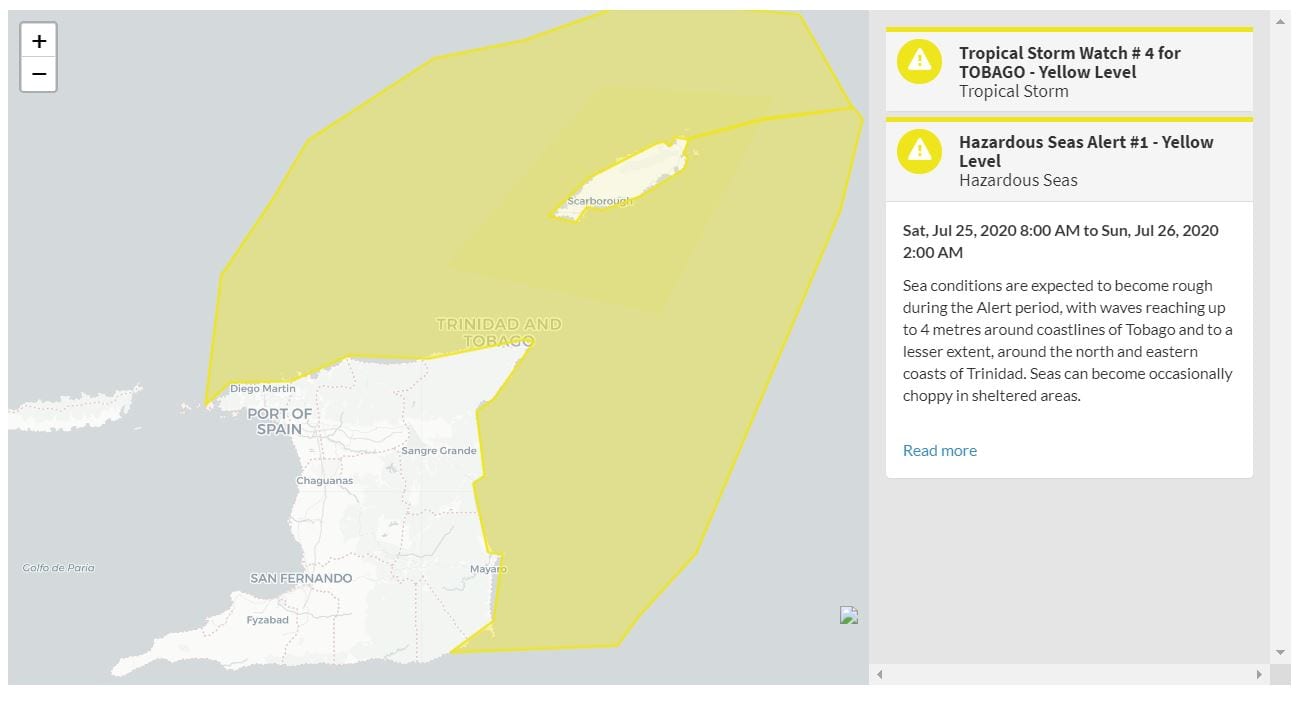
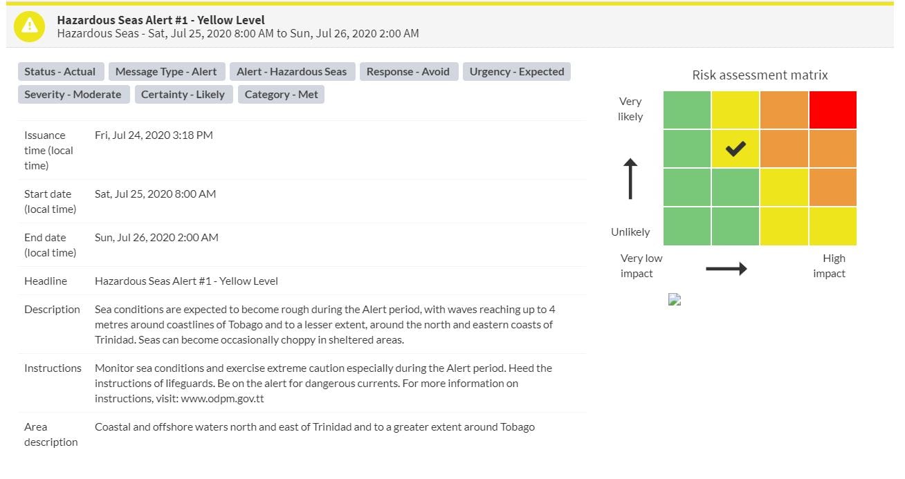
“Sea conditions are expected to become rough during the Alert period, with waves reaching up to 4 meters around coastlines of Tobago and, to a lesser extent, around the north and eastern coasts of Trinidad. Seas can become occasionally choppy in sheltered areas.” according to the Trinidad and Tobago Meteorological Service. This “alert” status takes into account the possibility of the event occurring. This event is likely.

The color of the alert indicates the severity of the event and the probability of the event occurring. Currently, the alert level is at Yellow. This means that the hazard is likely, and you need to be aware of the impacts of hazardous seas in your area. Moderate impacts are expected, so there is a chance of possible injuries, and persons would need to take action to ensure safety. There may be minor damage to the property.


Impacts on T&T’s Shorelines (Mainly on Saturday)
Impacts possible from rough seas include the following:
- Loss of life;
- Injuries;
- Sea search and rescue disruptions;
- Disruptions to sea transportation;
- Scarcity of seafood;
- Damage or loss of boats and fishing equipment;
- Disruptions to marine recreation and businesses
- Economic losses.
Other impacts from the high winds, apart from hazardous seas, include:
- Injuries;
- Coastal erosion;
- Localized disruptions of businesses;
- Disruption to outdoor and sporting activities;
- Disruption of transportation (air and especially sea) and
There is also the potential for loss of life. There is a high risk of rip currents, strong currents that can carry even the strongest swimmers out to sea.
Rip currents are powerful channels of water flowing quickly away from the shore, which occur most often at low spots or breaks in the sandbar and near structures such as groins, jetties, and piers. If caught in a rip current, relax and float. Don’t swim against the current. If able, swim in a direction following the shoreline. If unable to escape, face the shore and call or wave for help.
There is also the potential for injuries to beachgoers, beach closures, localized disruptions to marine recreation and businesses, and financial losses.
High tides combined with onshore wind and swell actions could result in localized coastal flooding and beach erosion.
High surfs can knock spectators off exposed rocks and jetties. Breaking waves may occasionally impact harbors making navigating the harbor channel dangerous.
Saltwater will likely splash onto low-lying coastal roads such as the South Trunk Road at Mosquito Creek, the Guayaguayare Mayaro Road at the Guayaguayare Sea Wall, and the Manzanilla-Mayaro Road. Bays and beaches may become inundated.
Coral reefs may experience increased stress and damage, in addition to localized beach erosion, particularly in areas where battering waves focus.
