


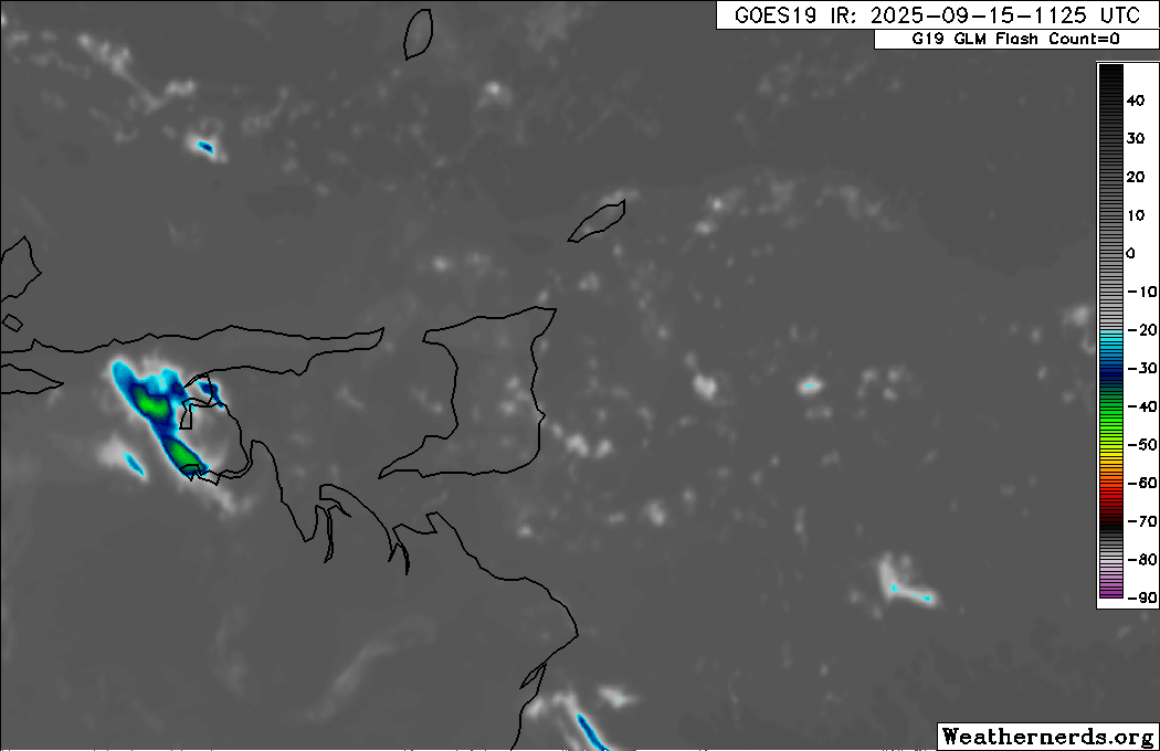
For the fourth straight day, locally heavy showers and thunderstorms are possible once more this afternoon, favoring western Trinidad. As a result, Trinidad and Tobago has been placed under a fourth Adverse Weather Alert for the fourth day in a row.
This activity is due to the Intertropical Convergence Zone across the area, combined with light winds, strong daytime heating, sea-breeze convergence on the west coast, and orographic effects in hilly areas, all typical features of the Wet Season.
What you need to know
— Rainfall: On Monday, while some areas may receive little accumulating rainfall, across both islands, up to 25 millimeters of rainfall is forecast, with overall lower accumulations across the western half of Trinidad. However, in isolated areas of western and northern Trinidad, localized totals between 25 and 50 millimeters are possible.
— Hazards: Localized heavy showers or thunderstorms are likely to lead to street or flash flooding, accompanied by gusty winds up to 45 km/h. These winds, combined with already saturated soils, may lead to fallen trees in elevated areas with possible landslides. In isolated strong thunderstorms, frequent lightning is likely, favoring the western areas of Trinidad. Seas may also become agitated in the Gulf of Paria.
Latest Alerts

Another Adverse Weather Alert In Effect For T&T Today
Trinidad and Tobago is NOT under any tropical storm or hurricane threat, watch, or warning at this time.
The Adverse Weather Alert
The Trinidad and Tobago Meteorological Service issued an Adverse Weather Alert (Yellow Level) on Monday, September 15th, 2025, at 11:15 AM. The alert was immediately effective at 11:15 AM and remains in effect for mainly Trinidad, and to a lesser extent Tobago and surrounding waters, through 5:00 PM today.
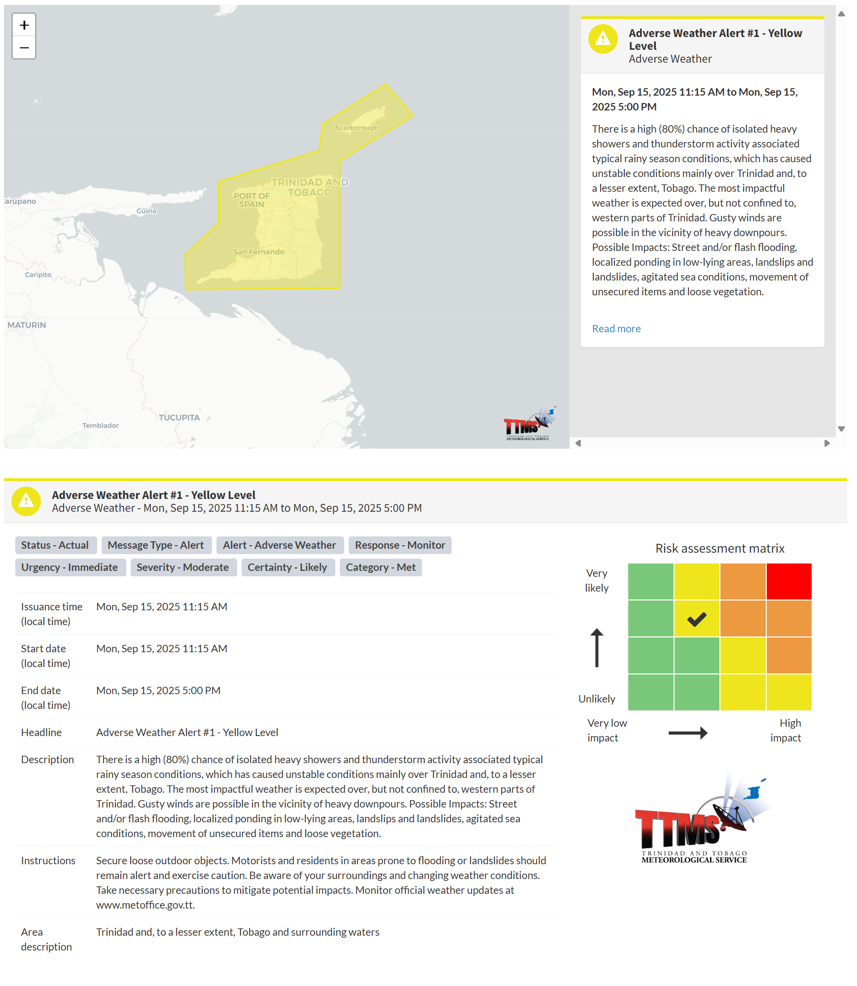
According to the TTMS, this “alert” status considers the possibility of the event occurring. This adverse weather event is likely, and the following are likely, according to the TTMS:
- There is a high (80%) chance of isolated heavy showers and thunderstorm activity associated with typical rainy season conditions, which have caused unstable conditions mainly over Trinidad and, to a lesser extent, Tobago.
- The most impactful weather is expected over, but not confined to, the western parts of Trinidad.
- Gusty winds are possible in the vicinity of heavy downpours.
- Possible impacts: Street and/or flash flooding, localized ponding in low-lying areas, landslips and landslides, agitated sea conditions, movement of unsecured items, and loose vegetation.

The alert’s color indicates the severity of the event and the probability of its occurrence. Currently, the alert level is Yellow. This means that the hazards are likely, and the severity of the impacts is moderate for this particular alert. You should be aware of the hazards in your area, which are primarily associated with street or flash flooding, gusty winds exceeding 45km/h, possibly falling trees, landslides, and agitated seas.
A moderate Adverse Weather Alert can result in possible injuries and behavioral changes, which are necessary to ensure safety. Minor property damage may also occur, temporarily disrupting income-earning activities and affecting several communities.
The Met Office advises motorists and residents in areas prone to flooding or landslides to remain alert and exercise caution. Be aware of your surroundings and changing weather conditions as you go about your daily activities. Take necessary precautions to mitigate potential impacts.


