


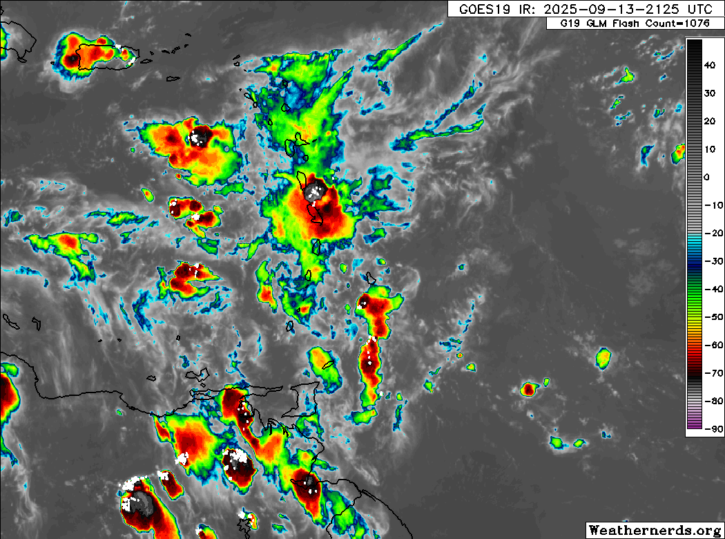
Locally strong thunderstorms are possible once more overnight through Sunday afternoon, mainly between the early morning and late morning hours. As a result, Trinidad and Tobago has been placed under a third Adverse Weather Alert for the third day in a row.
This activity is due to a low-level trough and low-level convergence trailing the passage of Tropical Wave 32 on Saturday, all typical features of the Wet Season.
What you need to know
— Rainfall: Through Sunday night, isolated moderate to heavy showers and thunderstorms are likely, interrupting variably cloudy conditions. Forecast models show rainfall totals across both islands ranging between 5 and 25 millimeters in most areas, favoring Tobago and isolated areas of eastern, northern, and western Trinidad receiving totals between 25 and 75 millimeters.
— Hazards: Street/flash flooding is likely. Gusty winds in excess of 45 KM/H accompanying heavy showers or thunderstorms are possible. Lightning will accompany thunderstorms. Landslides are possible in elevated areas of northwestern Trinidad. Seas are forecast to become agitated in the Gulf of Paria with intense activity.
Latest Alerts

Adverse Weather Alert Discontinued For Western Trinidad
Trinidad and Tobago is NOT under any tropical storm or hurricane threat, watch, or warning at this time.
The Adverse Weather Alert
The Trinidad and Tobago Meteorological Service issued an Adverse Weather Alert (Yellow Level) on Saturday at 10:25 PM. The alert goes into effect for Trinidad, Tobago, and the surrounding waters at 4:00 AM Sunday.
It remains in effect through 12:00 PM (noon) Sunday. Severe impacts are possible, but the certainty is low, 2/4 on the TTMS likelihood scale, which means the alert could be upgraded to Orange Level.
Trinidad and Tobago is not under any tropical storm watch or warning at this time.
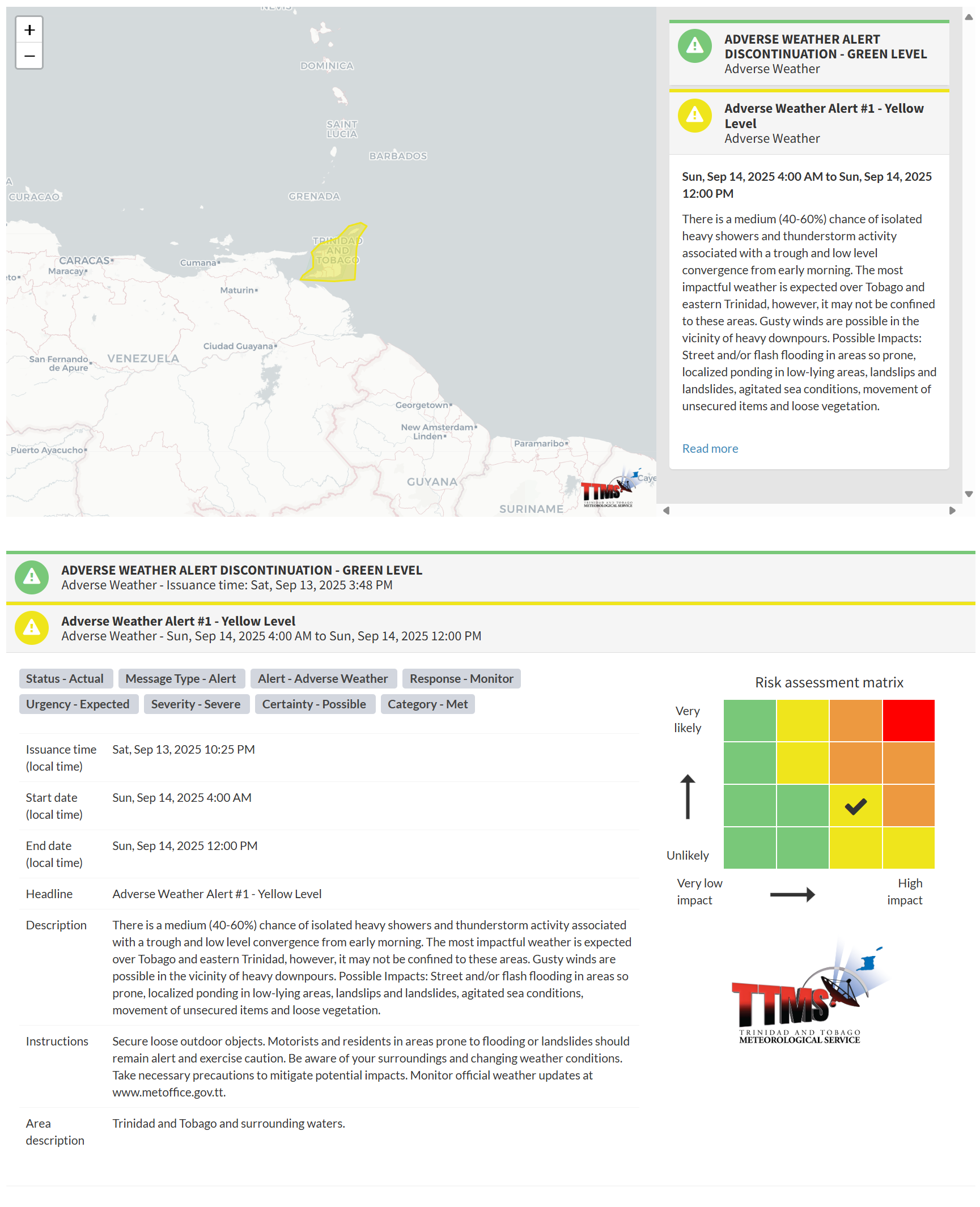
“There is a medium (40-60%) chance of isolated heavy showers and thunderstorm activity associated with a trough and low-level convergence from early morning. The most impactful weather is expected over Tobago and eastern Trinidad; however, it may not be confined to these areas. Gusty winds are possible in the vicinity of heavy downpours. Possible Impacts: Street and/or flash flooding in areas so prone, localized ponding in low-lying areas, landslips and landslides, agitated sea conditions, movement of unsecured items and loose vegetation,” according to the Trinidad and Tobago Meteorological Service. This “alert” status takes into account the possibility of the event occurring. This adverse weather event is possible, with a certainty of two out of four.

The color of the alert indicates the severity of the event and the probability of the event occurring. Currently, the alert level is Yellow. This means that the hazards are possible, but the severity of the impacts is severe for this particular alert. You should be aware of the hazards in your area, including gusty winds exceeding 45 KM/H, street and flash flooding, and frequent lightning.
For a severe Adverse Weather Alert, there is the potential for the loss of a single life or serious injuries where physical defenses are needed, and major losses are possible in confined areas. Income earning may be possible in these severely affected areas for several days, and with several communities affected, external help may be needed for recovery.
The Met Office is advising the public to secure loose outdoor objects. Motorists and residents in areas prone to flooding or landslides should remain alert and exercise caution. Be aware of your surroundings and changing weather conditions, and take necessary precautions to mitigate potential impacts.


