


There is a medium chance of showers and thunderstorms developing across the western half of Trinidad, leading to intense rainfall, frequent lightning, and gusty winds. This pattern of late morning through afternoon activity across the western half of Trinidad is typical during the Wet Season, where light winds, sea breeze convergence, and daytime heating lead to intense rainfall and impactful street/flash flooding.
Though forecast models have backed off intense activity today, due to the potential for impactful weather, the Trinidad and Tobago Meteorological Service has issued a late-notice Adverse Weather Alert for the western half of Trinidad.
What you need to know
— Rainfall: Through this afternoon, isolated moderate to heavy showers, and isolated to scattered thunderstorms are forecast, interrupting variably cloudy skies. While rainfall is forecast across both islands, including the eastern half of Trinidad and Tobago, the most intense activity is forecast across the western half of Trinidad. Across the western half of Trinidad, rainfall totals between 15 and 25 millimeters are forecast, with isolated higher totals favoring southwestern and northwestern areas. Elsewhere, rainfall totals less than 20 millimeters are likely.
— Hazards: Street/flash flooding is possible, mainly across western Trinidad. Gusty winds in excess of 45 KM/H accompanying heavy showers or thunderstorms are possible. Lightning will accompany thunderstorms. Landslides are possible in elevated areas of northwestern Trinidad. Seas are forecast to become agitated in the Gulf of Paria with intense activity.
Latest Alerts

Adverse Weather Alert Discontinued For Western Trinidad
Trinidad and Tobago is NOT under any tropical storm or hurricane threat, watch, or warning at this time.
The Adverse Weather Alert
The Trinidad and Tobago Meteorological Service issued an Adverse Weather Alert (Yellow Level) on Tuesday at 10:55 AM. The late-notice alert went into effect for the western half of Trinidad, including Port-of-Spain, Diego Martin, Chaguanas, Couva, San Fernando, and Point Fortin at 11:00 AM.
It remains in effect through 5:00 PM Tuesday. Severe impacts are possible, but the certainty is low, 2/4 on the TTMS likelihood scale, which means the alert could be upgraded to Orange Level.
Trinidad and Tobago is not under any tropical storm watch or warning at this time.
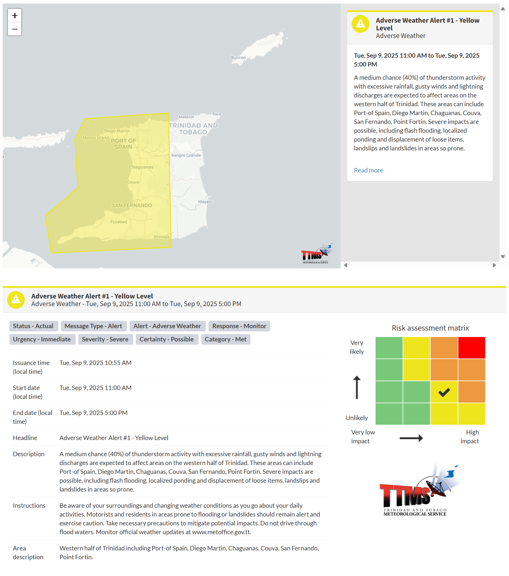
“A medium chance (40%) of thunderstorm activity with excessive rainfall, gusty winds, and lightning discharges is expected to affect areas on the western half of Trinidad. These areas can include Port-of-Spain, Diego Martin, Chaguanas, Couva, San Fernando, and Point Fortin. Severe impacts are possible, including flash flooding, localized ponding and displacement of loose items, landslips and landslides in areas so prone,” according to the Trinidad and Tobago Meteorological Service. This “alert” status takes into account the possibility of the event occurring. This adverse weather event is possible, with a certainty of two out of four.

The color of the alert indicates the severity of the event and the probability of the event occurring. Currently, the alert level is Yellow. This means that the hazards are possible, but the severity of the impacts is severe for this particular alert. You should be aware of the hazards in your area, including gusty winds exceeding 45 KM/H, street and flash flooding, and frequent lightning.
For a severe Adverse Weather Alert, there is the potential for the loss of a single life or serious injuries where physical defenses are needed, and major losses are possible in confined areas. Income earning may be possible in these severely affected areas for several days, and with several communities affected, external help may be needed for recovery.
The Met Office is advising the public to be aware of their surroundings and changing weather conditions as they go about their daily activities. Motorists and residents in areas prone to flooding or landslides should remain alert and exercise caution. Take necessary precautions to mitigate potential impacts. Do not drive through flood waters.


