


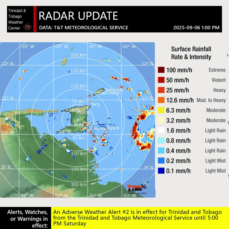
An active Intertropical Convergence Zone continues to produce scattered showers and thunderstorms primarily east of Trinidad and Tobago on Saturday. According to the Trinidad and Tobago Meteorological Service, although thunderstorm activity primarily exists east of Trinidad and Tobago, “there remains a high (70%) chance of thunderstorm activity eventually moving inland as the day progresses due to the proximity of the Inter-Tropical Convergence Zone and a favorable upper-level environment.”
What you need to know
— Rainfall: On Saturday, while some areas may receive little accumulating rainfall, across both islands, up to 25 millimeters of rainfall is forecast, with overall lower accumulations across the western half of Trinidad. However, in isolated areas of western and northern Trinidad, as well as eastern halves of both islands, localized totals between 25 and 50 millimeters are possible, with even higher totals favoring southeastern Trinidad.
— Hazards: Localized heavy showers or thunderstorms are likely to lead to street or flash flooding, with gusty winds possible up to 45 km/h. These winds, combined with already saturated soils, may lead to fallen trees in elevated areas with possible landslides. In isolated strong thunderstorms, frequent lightning is likely, favoring the southern and eastern areas of Trinidad.
Latest Alerts

Adverse Weather Alert Discontinued For Western Trinidad
Trinidad and Tobago is NOT under any tropical storm or hurricane threat, watch, or warning at this time.
The Adverse Weather Alert
The Trinidad and Tobago Meteorological Service updated the Adverse Weather Alert (Yellow Level) on Saturday, September 6th, 2025, at 10:53 AM. The alert went into effect from 5:00 AM Saturday through 5:00 PM. This timing is in line with most high-resolution regional models, as well as global weather prediction models.
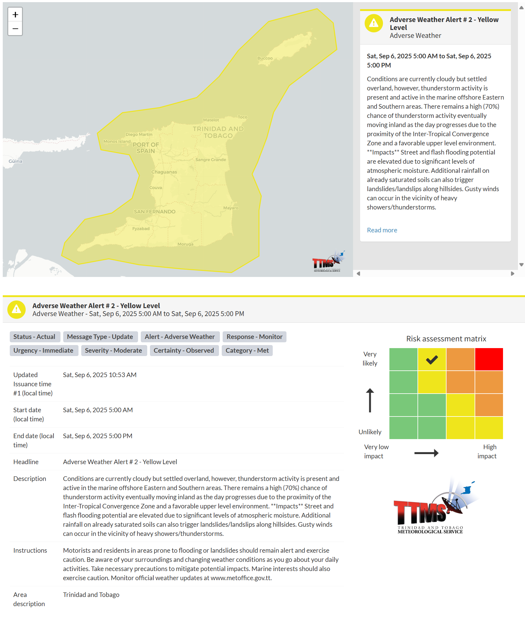
According to the TTMS, this “alert” status considers the possibility of the event occurring. This adverse weather event has been observed, and the following are very likely, according to the TTMS:
- Conditions are currently cloudy but settled overland; however, thunderstorm activity is present and active in the marine offshore Eastern and Southern areas.
- There remains a high (70%) chance of thunderstorm activity eventually moving inland as the day progresses due to the proximity of the Inter-Tropical Convergence Zone and a favorable upper-level environment.
- Street and flash flooding potential are elevated due to significant levels of atmospheric moisture.
- Additional rainfall on already saturated soils can also trigger landslides/landslips along hillsides.
- Gusty winds can occur in the vicinity of heavy showers/thunderstorms.

The alert’s color indicates the severity of the event and the probability of its occurrence. Currently, the alert level is Yellow. This means that the hazards have been observed, and the severity of the impacts is moderate for this particular alert. You should be aware of the hazards in your area, which are primarily associated with street or flash flooding, gusty winds exceeding 45km/h, possibly falling trees, landslides, and agitated seas.
A moderate Adverse Weather Alert can result in possible injuries and behavioral changes, which are necessary to ensure safety. Minor property damage may also occur, temporarily disrupting income-earning activities and affecting several communities.
The Met Office advises motorists and residents in areas prone to flooding or landslides to remain alert and exercise caution. Be aware of your surroundings and changing weather conditions as you go about your daily activities. Take necessary precautions to mitigate potential impacts.


