


What’s happening: A cluster of thunderstorms producing frequent lightning and heavy rainfall is hours away from affecting Trinidad and Tobago as of 10:30 PM, Thursday, August 28th, 2025. By midnight through early Friday morning, these thunderstorms are forecast to affect both islands, with periods of locally heavy rainfall, gusty winds, and frequent lightning as they gradually weaken. At this time, there are no alerts, watches, or warnings from the Trinidad and Tobago Meteorological Service.
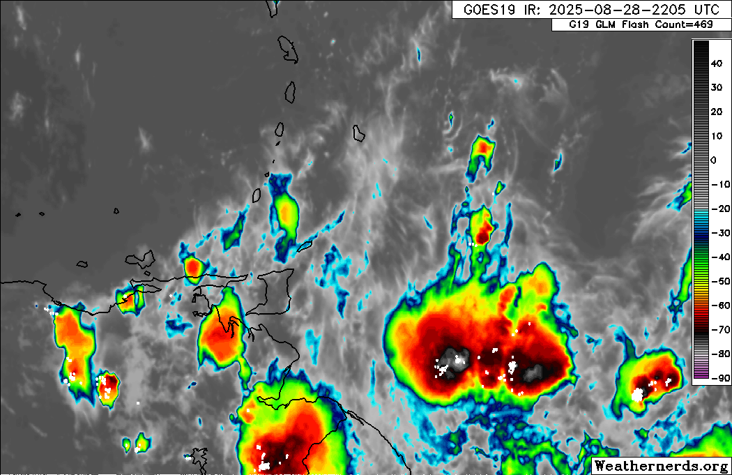
What is it: Over the last six hours, we’ve been tracking a long-lived cluster of thunderstorms embedded within the Intertropical Convergence Zone, moving westward. Given the persistence of this thunderstorm cluster, it can be classified as a mesoscale convective system, using the ITCZ as a focus for convergence. This activity is ahead of an approaching Tropical Wave, forecast to move across the area on Friday into Saturday.
What to expect: Before midnight on Thursday, scattered showers, some of which may be locally heavy, are expected to affect parts of Tobago and eastern Trinidad, accompanied by increased cloudiness across both islands. After midnight, scattered to widespread rainfall is forecast across both islands, accompanied by scattered heavy showers and thunderstorms, which gradually diminished in intensity into the early morning hours through Friday. Additionally, but more localized, showers and thunderstorms are forecast through Friday and Saturday due to a tropical wave.
Hazards: Street/flash flooding, gusty winds to 55 km/h, and frequent lightning are all possible associated with heavy showers and thunderstorms. In isolated areas, rainfall totals may exceed 25 millimeters, leading to short-lived flooding, favoring Trinidad. Landslides and fallen trees are possible in elevated and forested areas.
What should you do: Remain indoors during thunderstorm activity. Be aware of your surroundings, particularly those who live in flood-prone areas, as street/flash flooding is likely during downpours. However, at this time, riverine flooding is unlikely. Mariners should exercise extreme caution, as locally rough/choppy seas are likely in heavy showers/thunderstorms. If traversing mountainous and forested areas, be aware of fallen trees and landslides, particularly overnight tonight, as a result of gusty winds.
Latest Alert
There are no alerts, watches, or warnings in effect for Trinidad and Tobago from the Trinidad and Tobago Meteorological Service at this time.
Trinidad and Tobago is NOT under any tropical storm or hurricane threat, watch, or warning at this time.


