


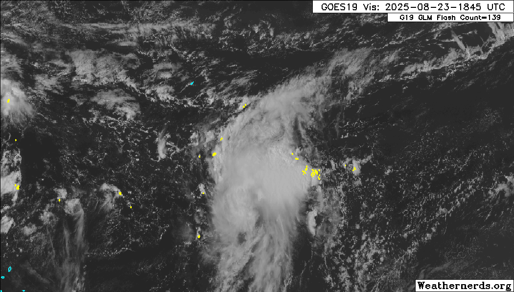
The 2025 Atlantic Hurricane Season’s sixth storm formed north of the Leeward Islands on Saturday afternoon. Tropical Storm Fernand is now moving into the northern Atlantic Ocean, posing little threat to land. It poses no direct or indirect threat to Trinidad and Tobago and the Lesser Antilles.
Fernand formed from a trough of low pressure that developed off the northern portion of Tropical Wave 27, which moved across the Lesser Antilles on Friday and is now located approximately 655 kilometers south-southeast of Bermuda.
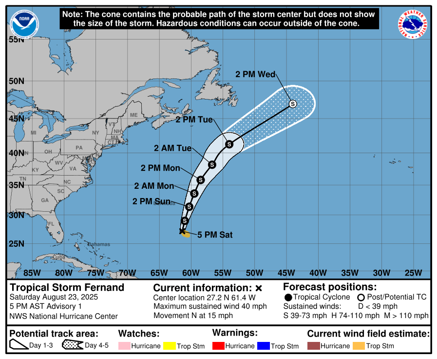
The National Hurricane Center states that Fernand, with current maximum sustained winds near 65 km/h and higher gusts, is forecast to intensify over the next 48 hours as it moves east of Bermuda, approaching hurricane strength by Monday. All major models show Fernand reaching category one strength.
The NHC said dangerous surf and gale conditions are expected around Bermuda during the early workweek as the system makes its closest approach to the island.
Residents and visitors in Bermuda are being advised to monitor the weather for updates, as a slight westward deviation in the track could lead to more significant impacts. At this time, only a Small Craft Warning is in effect for Bermuda.
By Tuesday, as Fernand moves into the subtropical North Atlantic, the storm is expected to weaken due to the influence of cooler waters and increasing shear, and it will likely become post-tropical within three to four days.
Tropical-storm force winds extend 165 kilometers outward from this center, with a minimum central pressure of 1010 millibars, measured by an Air Force Reserve Hurricane Hunter aircraft investigating the system.


