


The National Hurricane Center (NHC) is monitoring a tropical wave, the 18th analyzed east of T&T for the season and approximately 1,775 kilometers east of Trinidad and Tobago, for development.
In their 8:00 PM Tropical Weather Outlook, the NHC says, “a tropical wave interacting with a broad area of low pressure is producing disorganized showers and thunderstorms more than 800 miles southwest of the Cabo Verde Islands. Environmental conditions could become marginally conducive for gradual development late this weekend through early next week as the system moves westward to west-northwestward around 10 mph. By the middle of next week, environmental conditions are forecast to become unfavorable for further development.”
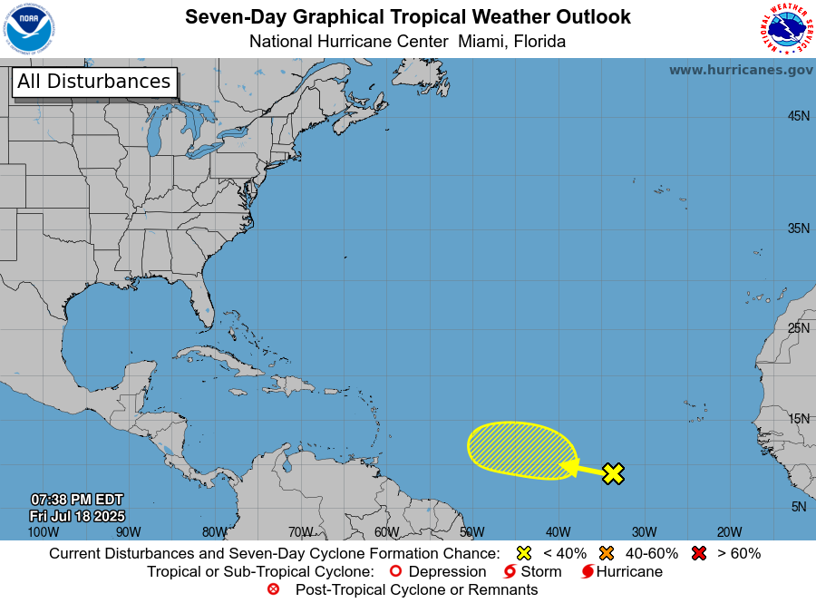
As of 8:00 PM Friday, formation chances over the next 48 hours remain at near zero percent, while over the next seven days, development chances are low at 20%.

Meanwhile, according to the Trinidad and Tobago Meteorological Service, “This wave is showing a small core of moderate vorticity. Present model projections indicate that it is likely to reach the Lesser Antilles by Wednesday (23rd) into Thursday (24th), with most of the associated weather passing over the Windward to southern Leeward Islands. However, it can still create enough instability to produce isolated thunderstorm activity over Trinidad and Tobago.”
Based on current model guidance, as of Friday evening, top global models show some brief organization is possible in the central Tropical Atlantic, but as environmental conditions become increasingly unfavorable as the disturbance nears the Lesser Antilles, it becomes disoragnized.
Additionally, model guidance indicates that the strongest winds and heaviest rainfall associated with this wave’s passage during the middle to latter half of next week stay across the northern half of the island chain. For T&T, while isolated showers and thunderstorms are possible, primarily through daytime heating, sea breeze convergence, and light to southerly/ southeasterly winds, mostly hot and sunny conditions are likely as this well-defined wave moves across the region by next Wednesday into Thursday.
This wave is still six days away, so as we approach the middle of next week, we’ll have a better understanding of what may unfold. At this time, there are no islands, including those in T&T, under any tropical storm threat, watch, or warning.


