


The axis of Tropical Wave 08 has moved west, and the Intertropical Convergence Zone ITCZ) lingers across southern Trinidad, producing showers and isolated thunderstorms. In the wake of Tropical Wave 08, a surge of Saharan Dust has moved in, bringing hazy and settled weather to Tobago and the northern half of Trinidad. Another tropical wave (Tropical Wave 09) is forecast to move across the country overnight, interacting with the ITCZ, and bringing another round of showers and thunderstorms, primarily, but not limited to, Trinidad.
What you need to know
— What has happened: Over the past 12 hours, periods of showers and isolated thunderstorms have produced between 10 and 50 millimeters of rainfall, leading to sporadic reports of flooding, with gusty winds bringing down trees and utility poles.
— What to expect: Isolated to scattered showers and thunderstorms are forecast through today, favoring the southern half of Trinidad. Additional rainfall is forecast overnight through tomorrow morning due to another tropical wave.
— Hazards: While the likelihood of these hazards materializing has decreased, the hazard profile remains unchanged. The main hazards will be street and flash flooding, as well as gusty winds exceeding 50 km/h, accompanied by heavy rainfall. Seas may become locally rough or agitated during heavy showers or thunderstorm activity.
Latest Alerts

TTMS Issues Adverse Weather Alert For T&T
Trinidad and Tobago is NOT under any tropical storm or hurricane threat, watch, or warning at this time.
The Adverse Weather Alert Discontinuation
The Trinidad and Tobago Meteorological Service discontinued the Adverse Weather Alert (Yellow Level) on Monday at 11:07 AM.
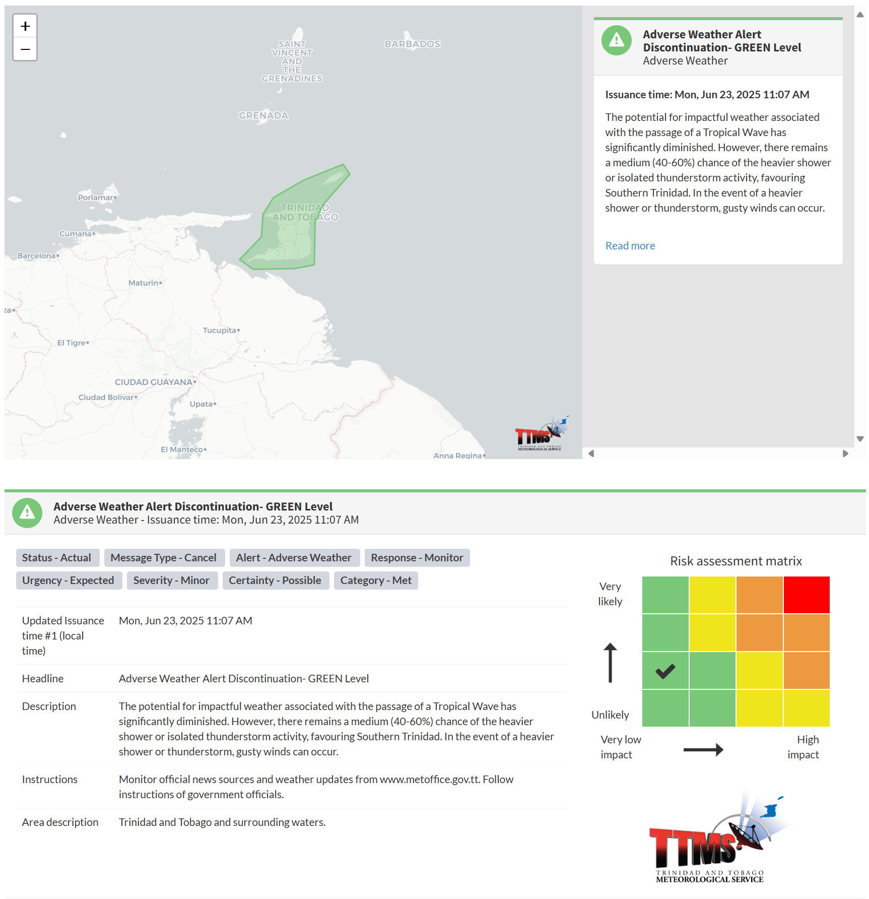
The TTMS states, “The potential for impactful weather associated with the passage of a Tropical Wave has significantly diminished. However, there remains a medium (40-60%) chance of the heavier shower or isolated thunderstorm activity, favouring Southern Trinidad. In the event of a heavier shower or thunderstorm, gusty winds can occur.”
This “alert” status considers the possibility of the event ending, with certainty at its second-lowest level, at “possible”. Discontinuations and green-level alerts have historically been issued with a likelihood of ‘very likely/observed’ or ‘likely’.

The alert’s color indicates the severity of the event and the probability of its occurrence. Currently, the alert level is green. This means that the hazards are still possible, and the severity of the impacts is moderate for this particular alert. You should remain aware of the hazards in your area, which are primarily associated with street or flash flooding, gusty winds exceeding 50 km/h, possibly falling trees, landslides, and agitated seas.
A moderate Adverse Weather Alert can result in possible injuries and behavioral changes, which are necessary to ensure safety. Minor property damage may also occur, temporarily disrupting income-earning activities and affecting several communities.
The Met Office advises the population to monitor official news sources and weather updates and follow the instructions of government officials.


