


An active tropical wave is forecast to move across T&T from this afternoon through tomorrow, interacting with the Intertropical Convergence Zone, bringing a high chance of heavy showers and thunderstorms.
What you need to know
— Rainfall: Through Monday night (beyond the alert period), between 25 and 50 millimeters of rainfall is forecast across the country, with totals up to 75 millimeters, favoring eastern areas of Trinidad.
— Hazards: With heavy showers and thunderstorms, as well as periods of rain, many of the typical hazards of the Wet Season are likely. Street and flash flooding is likely in heavy rain, showers, and thunderstorms, accompanied by wind gusts exceeding 50 km/h, and lightning during thunderstorm activity. With additional heavy rainfall, smaller watercourses may rise rapidly. As soils remain fairly saturated, landslides are possible in elevated areas. Seas may become locally rough or agitated during heavy showers or thunderstorm activity.
Latest Alerts

TTMS Issues Adverse Weather Alert For T&T
Trinidad and Tobago is NOT under any tropical storm or hurricane threat, watch, or warning at this time.
The Adverse Weather Alert
The Trinidad and Tobago Meteorological Service issued an Adverse Weather Alert (Yellow Level) on Sunday, June 22nd, 2025, for Trinidad and Tobago and surrounding waters. The alert goes into effect from 2:00 PM Sunday (today) through 2:00 PM Monday, June 23rd, 2025. Impactful weather is likely to occur beyond this alert period due to additional moisture and instability flowing across T&T associated with the ITCZ through early Tuesday morning.
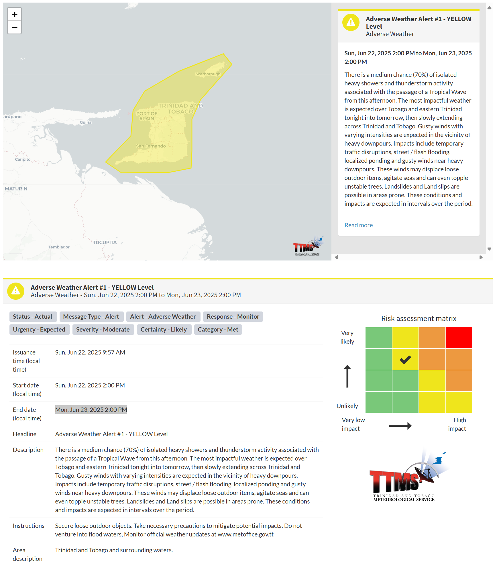
According to the TTMS, this “alert” status considers the possibility of the event occurring. This adverse weather event is likely, and the following are likely, according to the TTMS:
- There is a medium chance (70%) of isolated heavy showers and thunderstorm activity associated with the passage of a Tropical Wave from this afternoon.
- The most impactful weather is expected over Tobago and eastern Trinidad tonight into tomorrow, then slowly extending across Trinidad and Tobago.
- Gusty winds with varying intensities are expected in the vicinity of heavy downpours. Impacts include temporary traffic disruptions, street/flash flooding, localized ponding, and gusty winds near heavy downpours.
- These winds may displace loose outdoor items, agitate seas, and can even topple unstable trees.
- Landslides and Land slips are possible in areas prone.

The alert’s color indicates the severity of the event and the probability of its occurrence. Currently, the alert level is Yellow. This means that the hazards are likely, and the severity of the impacts is moderate for this particular alert. You should be aware of the hazards in your area, which are primarily associated with street or flash flooding, gusty winds exceeding 50 km/h, possibly falling trees, landslides, and agitated seas.
A moderate Adverse Weather Alert can result in possible injuries and behavioral changes, which are necessary to ensure safety. Minor property damage may also occur, temporarily disrupting income-earning activities and affecting several communities.
The Met Office advises securing loose outdoor objects. Take necessary precautions to mitigate potential impacts. Do not venture into flood waters. Monitor official weather updates.


