


The axis of Tropical Wave 05 has moved west, with the potential for impactful rainfall decreasing. While isolated showers and the occasional thunderstorm remain possible, significant rainfall totals are not expected for the remainder of Friday.
What you need to know
— What has happened: Over the past three days, periods of heavy rain/showers and thunderstorms have produced between 100 and 150 millimeters of rainfall, with several areas recording as high as 200 to 300 millimeters of rain, leading to flooding and landslides.
— What to expect: Isolated showers and the odd thunderstorm or two remain possible this afternoon following the passage of this wave, predominantly affecting Trinidad.
— Hazards: While the likelihood of these hazards materializing has decreased, the hazard profile remains unchanged. The main hazards will be street and flash flooding, as well as gusty winds exceeding 55 km/h, accompanied by heavy rainfall. Seas may become locally rough or agitated during heavy showers or thunderstorm activity.
Latest Alerts

TTMS Issues Adverse Weather Alert For T&T
Trinidad and Tobago is NOT under any tropical storm or hurricane threat, watch, or warning at this time.
The Adverse Weather Alert Discontinuation
The Trinidad and Tobago Meteorological Service discontinued the Adverse Weather Alert (Yellow Level) on Friday at 10:19 AM.
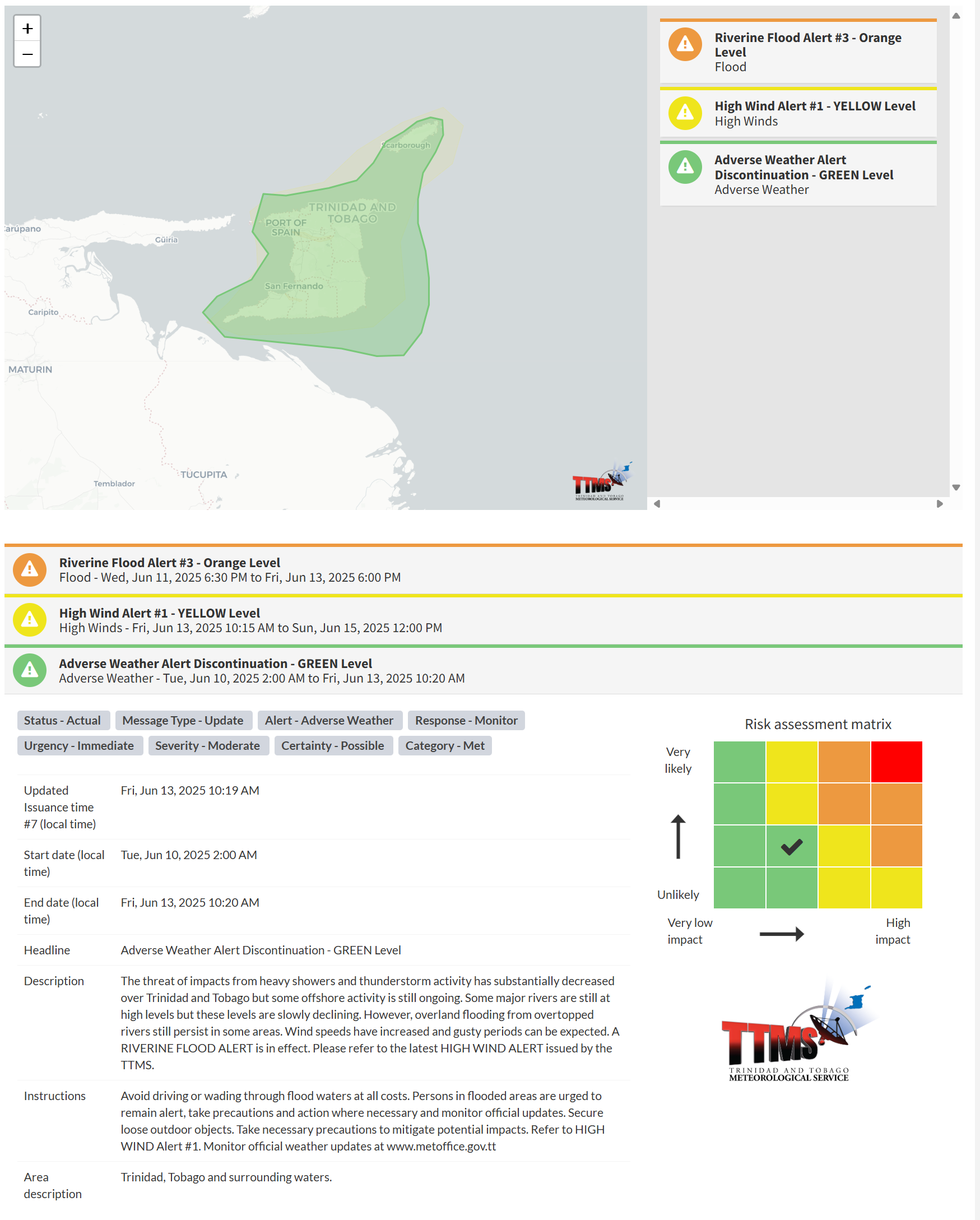
The TTMS states, “The threat of impacts from heavy showers and thunderstorm activity has substantially decreased over Trinidad and Tobago, but some offshore activity is still ongoing. Some major rivers are still at high levels, but these levels are slowly declining. However, overland flooding from overtopped rivers still persists in some areas. Wind speeds have increased, and gusty periods can be expected.”
This “alert” status considers the possibility of the event ending, with certainty at its second-lowest level, at “possible”. Discontinuations and green-level alerts have historically been issued with a likelihood of ‘very likely/observed’ or ‘likely’.

The alert’s color indicates the severity of the event and the probability of its occurrence. Currently, the alert level is green. This means that the hazards still possible, and the severity of the impacts is moderate for this particular alert. You should be remain aware of the hazards in your area, which are primarily associated with street or flash flooding, gusty winds exceeding 55 km/h, possibly falling trees, landslides, and agitated seas.
A moderate Adverse Weather Alert can result in possible injuries and behavioral changes, which are necessary to ensure safety. Minor property damage may also occur, temporarily disrupting income-earning activities and affecting several communities.
The Met Office advises the population to avoid driving or walking through floodwaters at all costs. Individuals in flooded areas are advised to remain vigilant, take necessary precautions, and act accordingly while monitoring official updates. Secure loose outdoor objects. Take necessary precautions to mitigate potential impacts.


