Over the last 48 hours, rainfall accumulations of between 75 and 200 millimeters have fallen across Northern Trinidad, primarily in the Caroni River Basin. As a result, major rivers across Trinidad have risen at a significant rate, with multiple rivers now approaching or crossing threshold levels. Given that additional rainfall is forecasted, a Riverine Flood Alert has been issued for the Caroni River, now at Orange Level, with severe impacts likely.
What you need to know
— What has happened: Over the last 60 hours, between 100 and 225 millimeters of rain fell across parts of Trinidad, with totals ranging from 25 to 100 millimeters elsewhere across both islands.
— What to expect: Additional rainfall is forecast on Thursday night and Friday, mainly on saturated soils. Riverine flooding, according to the TTMS, is likely over the next 24 hours, primarily along the Caroni River, the South Oropouche River and their tributaries. Other major rivers, including the North Oropouche, are rising at relatively low rates, but are also being closely monitored and well contained.
Latest Alerts

TTMS Issues Adverse Weather Alert For T&T

Adverse Weather Alert Extended Until 9 PM For T&T
Trinidad and Tobago is NOT under any tropical storm or hurricane threat, watch, or warning at this time.
The Riverine Flood Alert
The Trinidad and Tobago Meteorological Service updated the Riverine Flood Alert on Thursday, June 12th, 2025, at 4:19 PM. The alert went into effect for the Caroni River Basin and has been expanded to the South Oropouche River Basin west of Wilson Road through 6:00 PM Friday, June 13th, 2025.
Trinidad and Tobago is not under any tropical storm watch or warning at this time.

“The Caroni River continues to exceed capacity near the Tumpuna and El Carmen areas, and overspilling is ongoing. Water levels remain dangerously high and forecast rainfall is expected to exacerbate current conditions. The Manuel Congo River, after an earlier decline, is now gradually rising again due to today’s rainfall and is nearing critical levels once more. The South Oropouche River is also at threatening levels and continues a slow but steady rise. Some areas along this river have already experienced localized overflows, posing increased risk to surrounding communities. Further rainfall is expected over the next 12-24 hours, which will likely worsen riverine flooding conditions. As a result, a severe risk remains to public safety, livelihoods, and property, particularly for residents in flood-prone communities along the Caroni, Manuel Congo and South Oropuche Rivers. Other rivers, including the North Oropouche, are rising at lower rates but are still under close observation,” according to the Trinidad and Tobago Meteorological Service. This “alert” status takes into account the possibility of the event occurring. This riverine flood event has been observed.

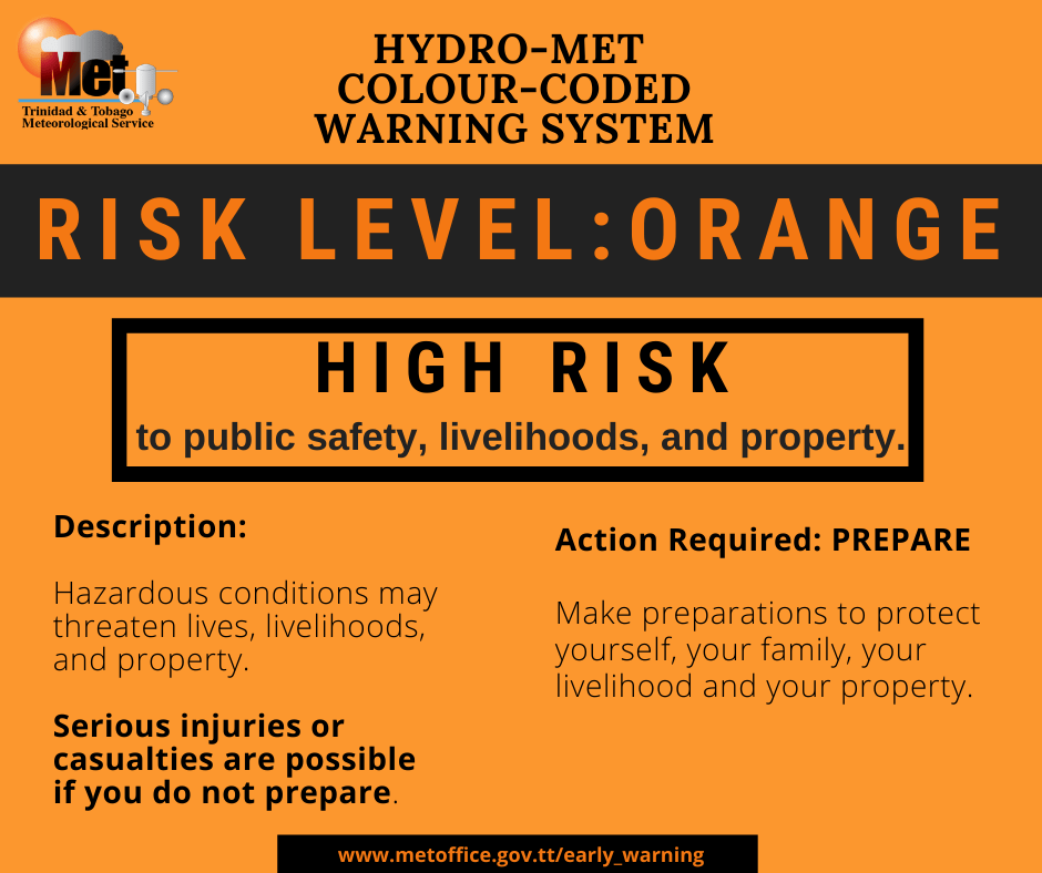
The color of the alert indicates the severity of the event and the probability of the event occurring. Currently, the alert level is Orange. This means that the hazard has been observed, and you need to be aware of the impacts of street, flash, and riverine flooding in your area. Severe impacts are very likely.
For a severe Riverine Flood Alert, there is a potential for loss of life or serious injuries; physical defenses are necessary, significant losses are possible in confined areas, income-earning activities are impossible for several days, and several communities are affected, requiring external help for recovery.
The public should finalize preparations to protect lives, livelihoods, and property. Activate your safety plan. Protect important assets and documents. Do not take unnecessary risks. Follow the instructions of government officials. Monitor official sources for information.