


Tropical Wave 04 on Tuesday and a low-level trough on Wednesday have moved across Trinidad and Tobago, bringing periods of rain, showers, and thunderstorms to the country as forecast. This has led to rising river levels and sporadic street and flash flooding, wind damage to homes, and fallen trees across both islands. Lingering moisture and instability will lead to more showers and thunderstorms on Thursday, ahead of Tropical Wave 05 that is forecast to move across the country on Friday, bringing additional rounds of rainfall.
What you need to know
— Rainfall: Through Friday night (beyond the alert period), between 25 and 50 millimeters of rainfall is forecast across the country, with totals up to 100 millimeters, favoring much of Trinidad.
— Hazards: With heavy showers and thunderstorms, as well as periods of rain, many of the typical Wet Season hazards are on the table for the next three days. Street and flash flooding is likely in heavy rain, showers, and thunderstorms, accompanied by wind gusts exceeding 50 km/h, and lightning during thunderstorm activity. With additional heavy rainfall, smaller watercourses may rise rapidly and overflow in some areas. As soils become increasingly saturated, landslides are possible in elevated areas. Seas may become locally rough or agitated during heavy showers or thunderstorm activity.
Latest Alerts

TTMS Issues Adverse Weather Alert For T&T
Trinidad and Tobago is NOT under any tropical storm or hurricane threat, watch, or warning at this time.
The Adverse Weather Alert
The Trinidad and Tobago Meteorological Service updated the Adverse Weather Alert (Yellow Level) on Wednesday, June 11th, 2025, at 3:40 PM for Trinidad and Tobago and surrounding waters. The alert went into effect from 2:00 AM Tuesday, June 10th, 2025, and has been extended through 4:00 PM Thursday, June 12th, 2025. Impactful weather is likely to occur beyond this alert period due to additional moisture and instability flowing across T&T, particularly with favorable low- and upper-level conditions.
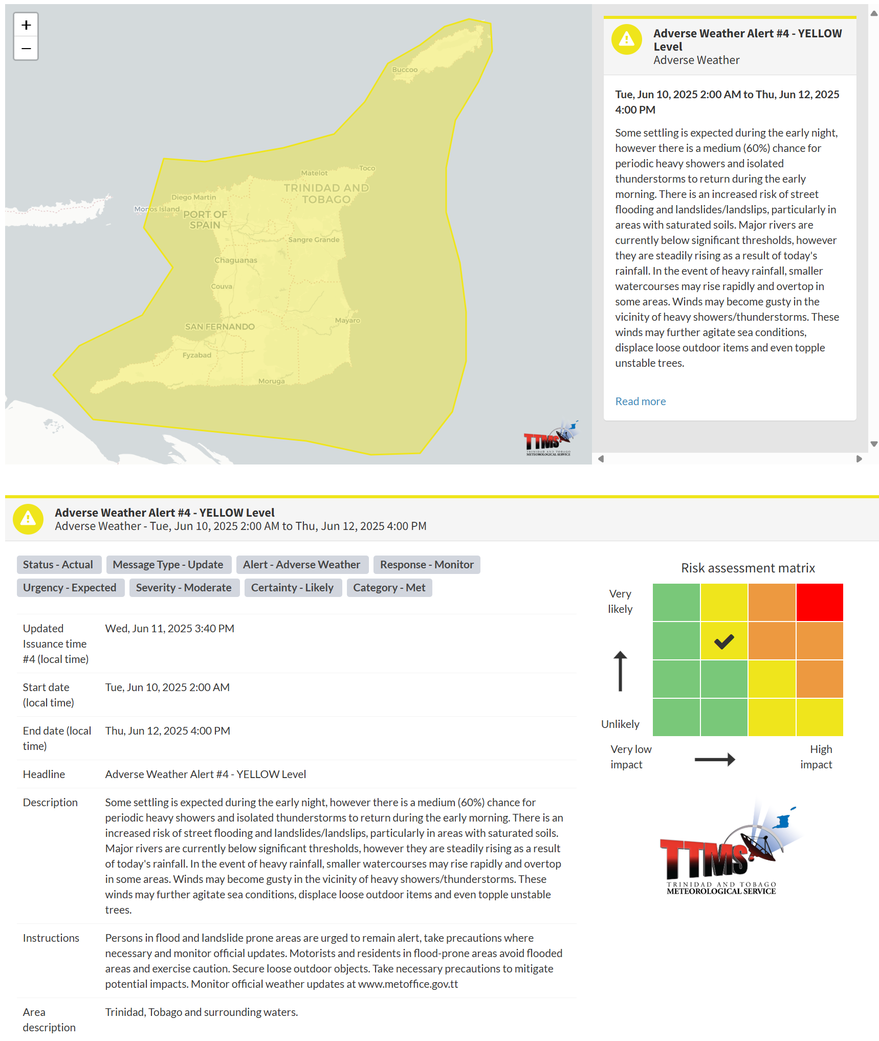
According to the TTMS, this “alert” status considers the possibility of the event occurring. This adverse weather event is likely, and the following are likely, according to the TTMS:
- Some settling is expected during the early night, however there is a medium (60%) chance for periodic heavy showers and isolated thunderstorms to return during the early morning.
- There is an increased risk of street flooding and landslides/landslips, particularly in areas with saturated soils.
- Major rivers are currently below significant thresholds, however they are steadily rising as a result of today’s rainfall. In the event of heavy rainfall, smaller watercourses may rise rapidly and overtop in some areas.
- Winds may become gusty in the vicinity of heavy showers/thunderstorms. These winds may further agitate sea conditions, displace loose outdoor items and even topple unstable trees.

The alert’s color indicates the severity of the event and the probability of its occurrence. Currently, the alert level is Yellow. This means that the hazards are likely, and the severity of the impacts is moderate for this particular alert. You should be aware of the hazards in your area, which are primarily associated with street or flash flooding, gusty winds exceeding 50 km/h, possibly falling trees, landslides, and agitated seas.
A moderate Adverse Weather Alert can result in possible injuries and behavioral changes, which are necessary to ensure safety. Minor property damage may also occur, temporarily disrupting income-earning activities and affecting several communities.
The Met Office advises people in flood- and landslide-prone areas to remain alert, take necessary precautions, and monitor official updates throughout the day. Motorists and residents in flood-prone areas should avoid flooded areas and exercise caution. Secure loose outdoor objects. Take necessary precautions to mitigate potential impacts. Monitor official weather updates.


