


As anticipated, the Trinidad and Tobago Meteorological Service (TTMS) has discontinued the Adverse Weather Alert for Trinidad and Tobago. However, with the Intertropical Convergence Zone still to T&T’s south, the axis of Tropical Wave 02 still to T&T’s east, sufficient moisture and instability remain in place, isolated to scattered showers, and some heavy or developing into short-lived thunderstorms remain possible mainly overnight tonight through Friday.
What you need to know
— What has happened: Activity associated with Tropical Wave 02, particularly near and ahead of the wave axis where calmer weather typically prevails, has diminished.
— What to expect: Isolated to scattered showers and isolated thunderstorms remain possible overnight tonight through Friday following the passage of this wave, predominantly affecting Trinidad.
— Hazards: While the likelihood of these hazards materializing has decreased, the hazard profile remains unchanged. The main hazards will be street and flash flooding, primarily on Thursday night into Friday, as well as gusty winds exceeding 50 km/h, accompanied by heavy showers and thunderstorm activity on Thursday through Friday night. Seas may become locally rough or agitated during heavy showers or thunderstorm activity.
Latest Alerts

TTMS Issues Adverse Weather Alert For T&T
Trinidad and Tobago is NOT under any tropical storm or hurricane threat, watch, or warning at this time.
The Adverse Weather Alert Discontinuation
The Trinidad and Tobago Meteorological Service discontinued the Adverse Weather Alert (Yellow Level) on Thursday at 10:12 AM.
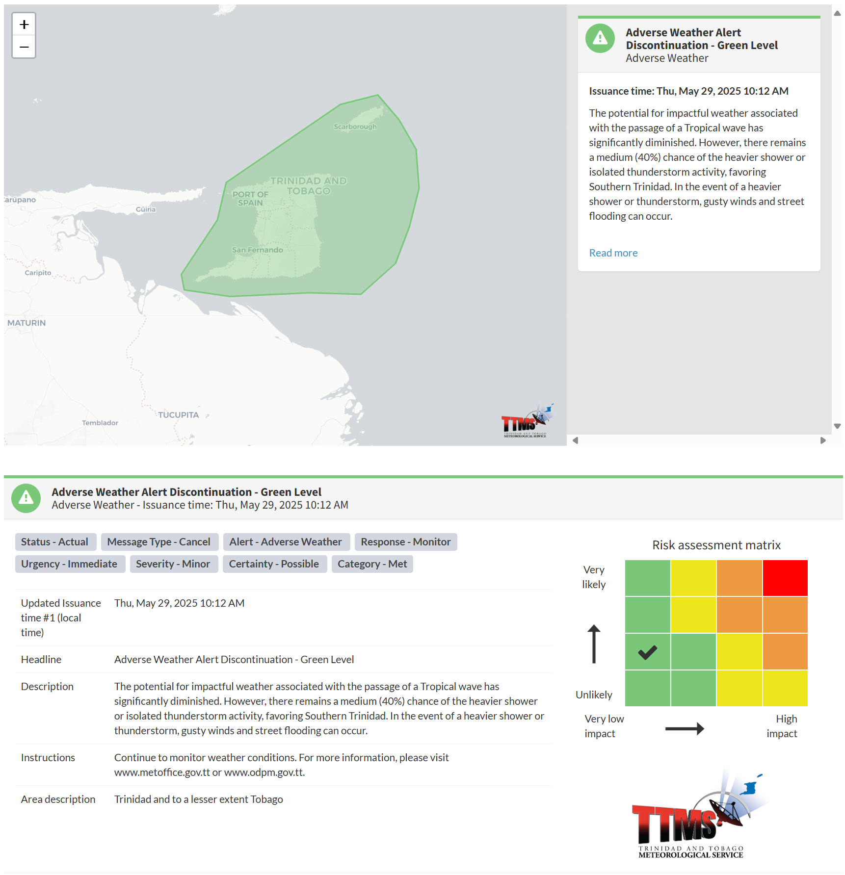
The TTMS states, “The potential for impactful weather associated with the passage of a Tropical wave has significantly diminished. However, there remains a medium (40%) chance of the heavier shower or isolated thunderstorm activity, favoring Southern Trinidad. In the event of a heavier shower or thunderstorm, gusty winds and street flooding can occur.”
This “alert” status considers the possibility of the event ending, with certainty at its second-lowest level, at “possible”. Discontinuations and green-level alerts have historically been issued with a likelihood of ‘very likely/observed’ or ‘likely’.

The Met Office advises the population to remain vigilant and monitor weather conditions. At this risk level, there is a low risk to public safety, lives, livelihoods, and property.


