


An active tropical wave embedded within the Intertropical Convergence Zone is approaching Trinidad and Tobago. Much of the shower and thunderstorm activity remains south of Tobago, gradually moving westward.
On Thursday, this tropical wave is forecast to move across the country, with periodic showers and occasional thunderstorms. However, overall rainfall accumulations are forecast to be relatively low, leading to short-lived street or flash flooding.
What you need to know
— Rainfall: Through Thursday night, forecast models indicate between 5 and 15 millimeters of rainfall across most of Trinidad and Tobago, with isolated totals of 25 to 35 millimeters favoring the southern and eastern halves of Trinidad.
— Hazards: The main hazards will be street and flash flooding, as well as gusty winds exceeding 45 km/h, accompanying heavy showers and thunderstorm activity. Seas may become locally rough or agitated during heavy showers or thunderstorm activity.
Latest Alerts

TTMS Issues Adverse Weather Alert For T&T
Trinidad and Tobago is NOT under any tropical storm or hurricane threat, watch, or warning at this time.
The Adverse Weather Alert
The Trinidad and Tobago Meteorological Service issued an Adverse Weather Alert (Yellow Level) on Wednesday, May 28th, 2025, at 4:17 PM for Trinidad and Tobago. The alert goes into effect from 5:00 AM Thursday, May 29th, 2025, through 4:00 PM Thursday, May 29th, 2025.
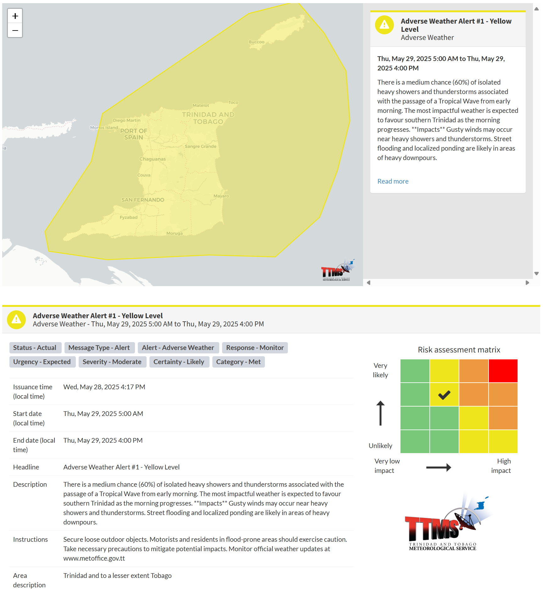
According to the TTMS, this period of inclement weather is due to an approaching tropical wave, set to bring impacts primarily to Trinidad from early Thursday morning.
This “alert” status considers the possibility of the event occurring. This adverse weather event is likely, and the following impacts are likely, according to the TTMS:
- Gusty winds may occur near heavy showers and thunderstorms.
- Street flooding and localized ponding are likely in areas of heavy downpours.

The alert’s color indicates the severity of the event and the probability of its occurrence. Currently, the alert level is Yellow. This means that the hazards are likely, and the severity of the impacts is moderate for this particular alert. You should be aware of the hazards in your area, which are primarily associated with street or flash flooding, gusty winds exceeding 45 km/h, possibly falling trees, landslides, and agitated seas.
A moderate Adverse Weather Alert can result in possible injuries and behavioral changes, which are required to ensure safety. Minor damage to property may also occur, temporarily disrupting income-earning activities and affecting a couple of communities.
The Met Office advises the public to continue to remain vigilant and monitor weather conditions, assess their surroundings before venturing out, avoid driving or wading through flood waters, take necessary precautions to mitigate potential impacts, follow the instructions of government officials, and monitor weather updates.


