


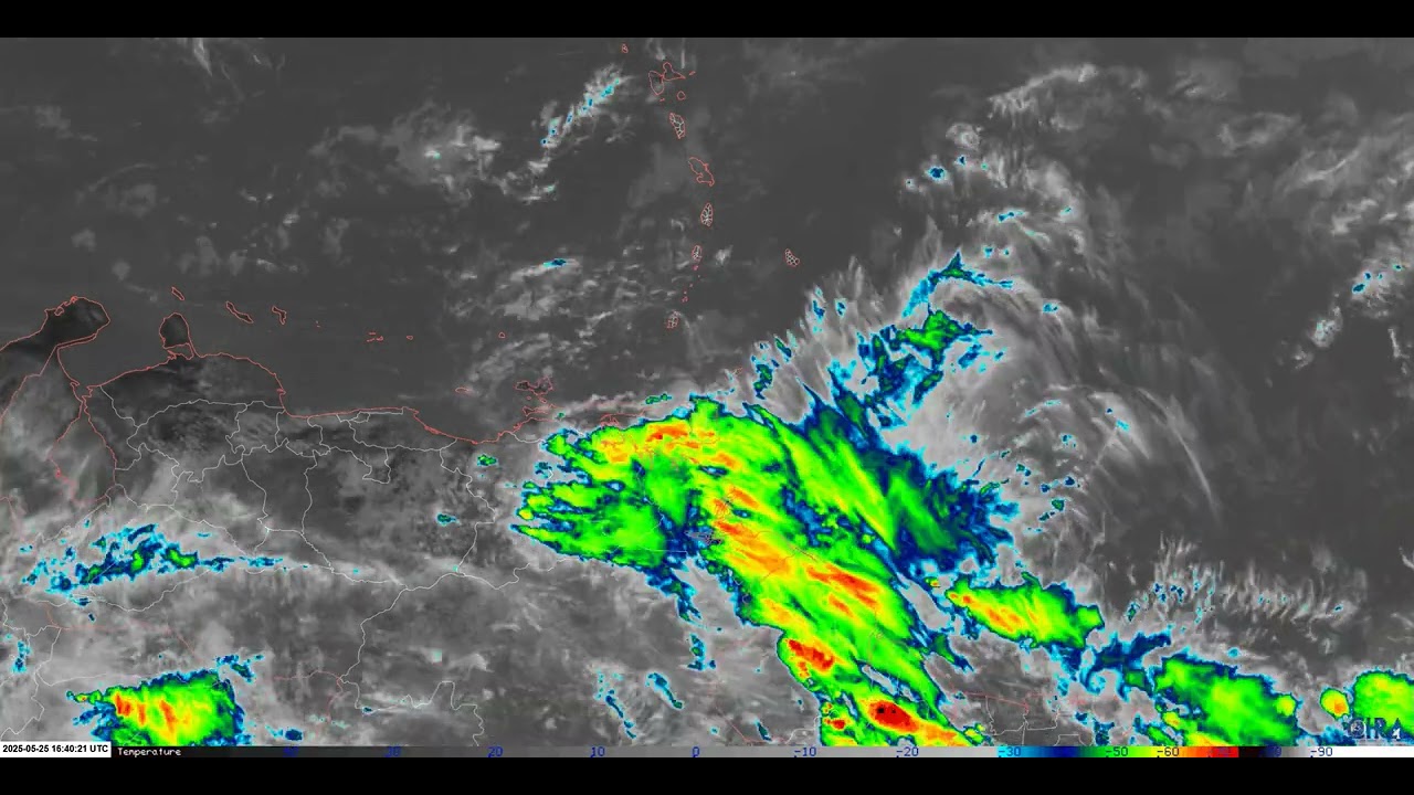
The first tropical wave of 2025 moved across Trinidad and Tobago on May 25th, approximately six days after the Intertropical Convergence Zone triggered the official start of the 2025 Wet Season. However, unlike the rainfall event that caused notable flooding across Trinidad, this tropical wave‘s activity primarily stayed to the south of the country, bringing sporadic street and flash flooding predominantly to southern Trinidad. However, one house collapse in South Oropouche has left three homeless.
The Tropical Wave
Early-season tropical waves tend to be relatively weak and low-latitude, with the first for 2025 being no exception. This tropical wave departed from the West African coast on May 18th and gradually moved across the Atlantic Ocean, generally moving between 10 and 15 knots.
Increased cloudiness and persistent light to moderate rainfall began to affect mainly southern Trinidad from late May 24th, with most of the heavier rainfall occurring during the first half of May 25th. Given that this tropical wave was embedded within the Intertropical Convergence Zone, which generally has peaks in activity during the pre-dawn hours, most of the heavier rainfall occurred on early May 25th across southern Trinidad.
Limited Impacts
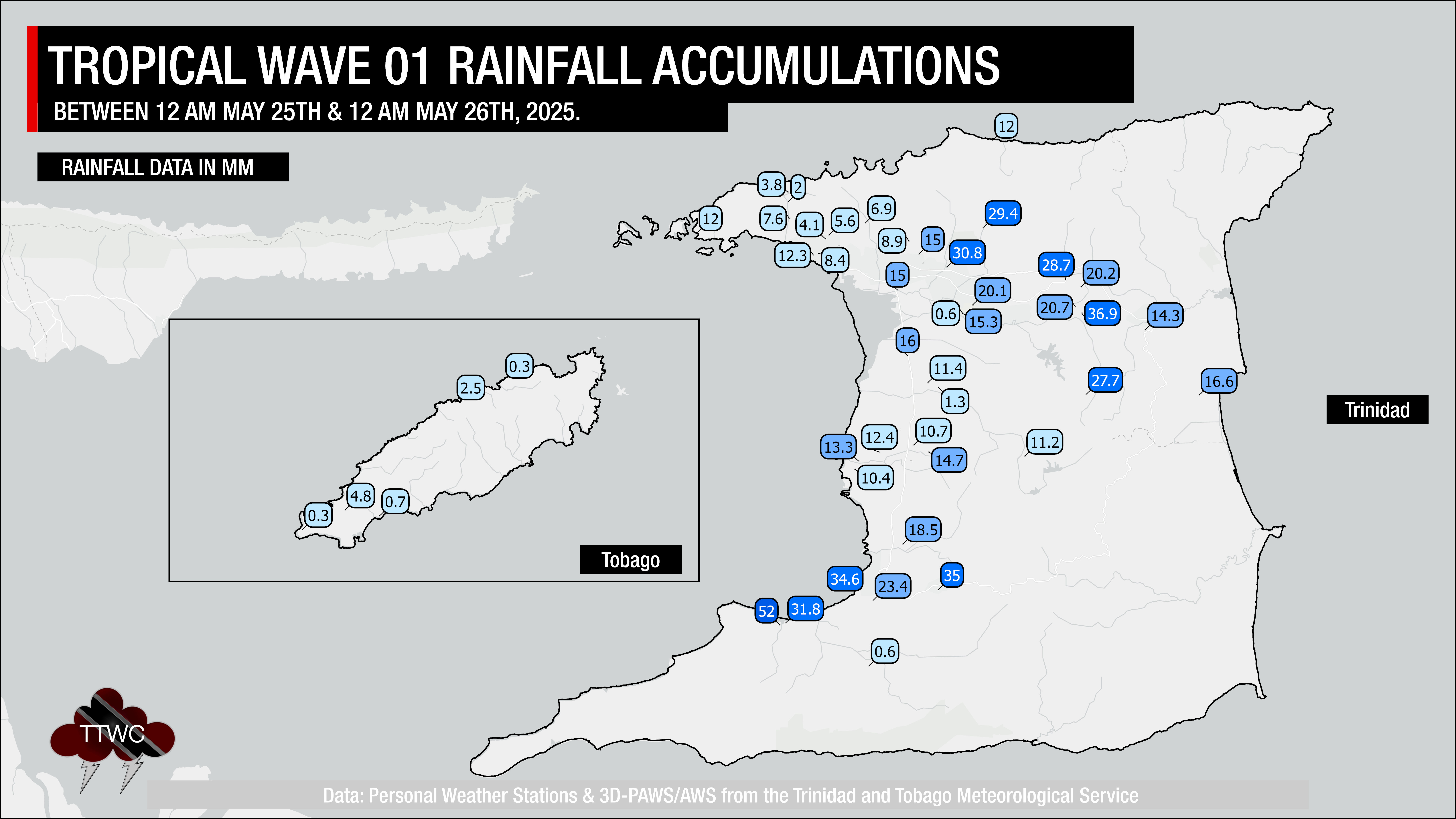
Generally, most areas across Trinidad and Tobago recorded up to 15 millimeters of rainfall, with lower accumulations across northwestern Trinidad and across much of Tobago. Higher rainfall accumulations occurred across the eastern and southern halves of Trinidad, where, unfortunately, reliable rainfall gauge data is sparse or non-existent.
Street flooding was reported along Scott’s Road and Penal Rock Road, and along Goodman Trace in Penal.
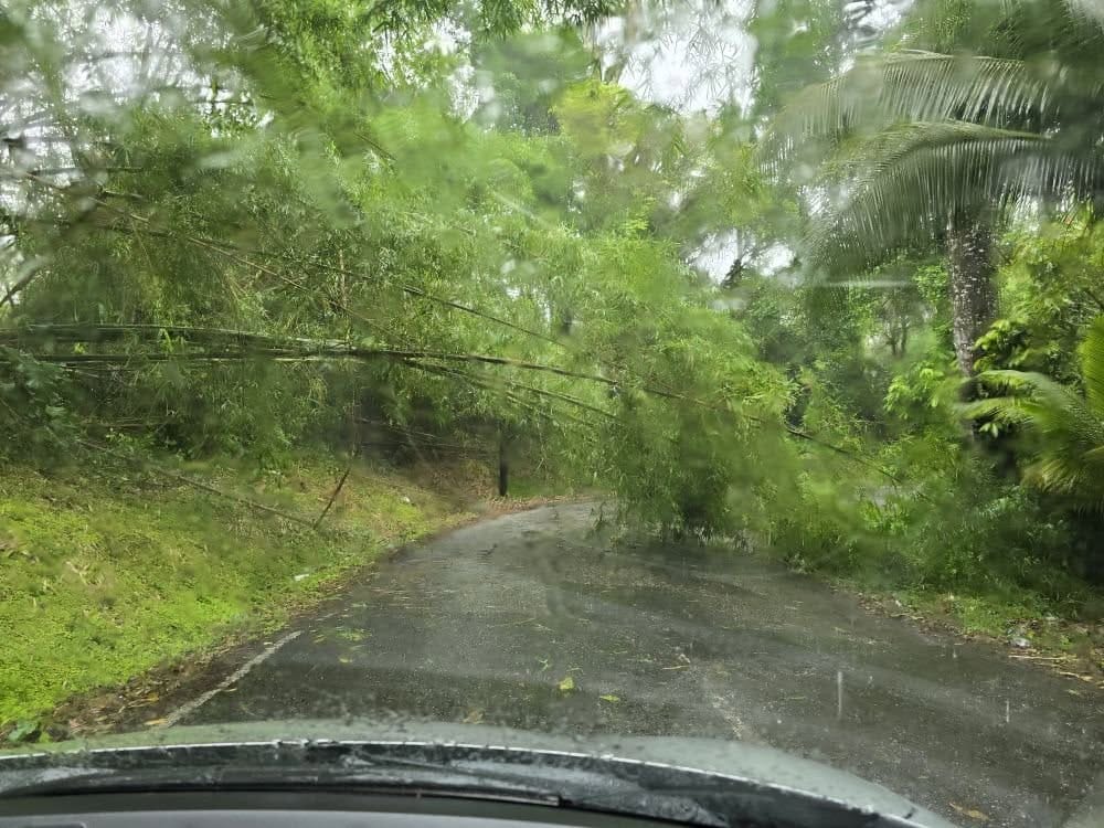
Fallen bamboo trees also temporarily blocked the Cunapo Southern Main Road, after the Biche High School, heading to Rio Claro. Generally, wind gusts across the country remained between 40 and 50 km/h, except for a 59.4 km/h gust recorded at Piarco during a shower at 10:00 AM. Generally, there were no reports of wind damage across the country.
At Paltoo Trace, South Oropouche, a family of three was left homeless after heavy rains led to the house collapsing, injuring the 45-year-old matriarch of the family.
What’s Next?
The next tropical wave is forecast to move across Trinidad and Tobago on Thursday, May 29th, 2025, and like the first, is forecast to be a fairly low-latitude wave embedded within the Intertropical Convergence Zone.
As a result, rainfall is forecast to favor the southern and eastern halves of Trinidad, but with significant Saharan Dust forecast across the region during the time of this wave’s passage, rainfall may be limited. Nonetheless, isolated showers and isolated thunderstorms are likely across Trinidad and, to a lesser extent, Tobago from early May 29th. Until then, a dense plume of Saharan Dust is forecast to move across T&T and the Lesser Antilles, bringing generally dry conditions to the country, potentially reducing air quality to levels that are unhealthy for sensitive groups.


