


The Trinidad and Tobago Meteorological Service (TTMS) has discontinued the Adverse Weather Alert for Trinidad. However, with the Intertropical Convergence Zone still to T&T’s south, sufficient moisture and instability remain in place, isolated to scattered showers, and some heavy or developing into short-lived thunderstorms remain possible this afternoon and overnight.
What you need to know
— What has happened: Prolonged periods of rain have fallen across Trinidad and Tobago, with river levels elevated but major rivers now contained.
— What to expect: Less impactful rainfall remains in the forecast, but occasional showers and rain are possible through the overnight hours.
— Hazards: Landslides remain possible in elevated areas, with street/flash flooding in heavy rainfall, and exacerbated minor flooding is possible near swollen watercourses.
Latest Alerts

TTMS Maintains Adverse Weather Alert For T&T
Trinidad and Tobago is NOT under any tropical storm or hurricane threat, watch, or warning at this time.
The Adverse Weather Alert Discontinuation
The Trinidad and Tobago Meteorological Service discontinued the Adverse Weather Alert (Yellow Level) on Monday at 3:58 PM.
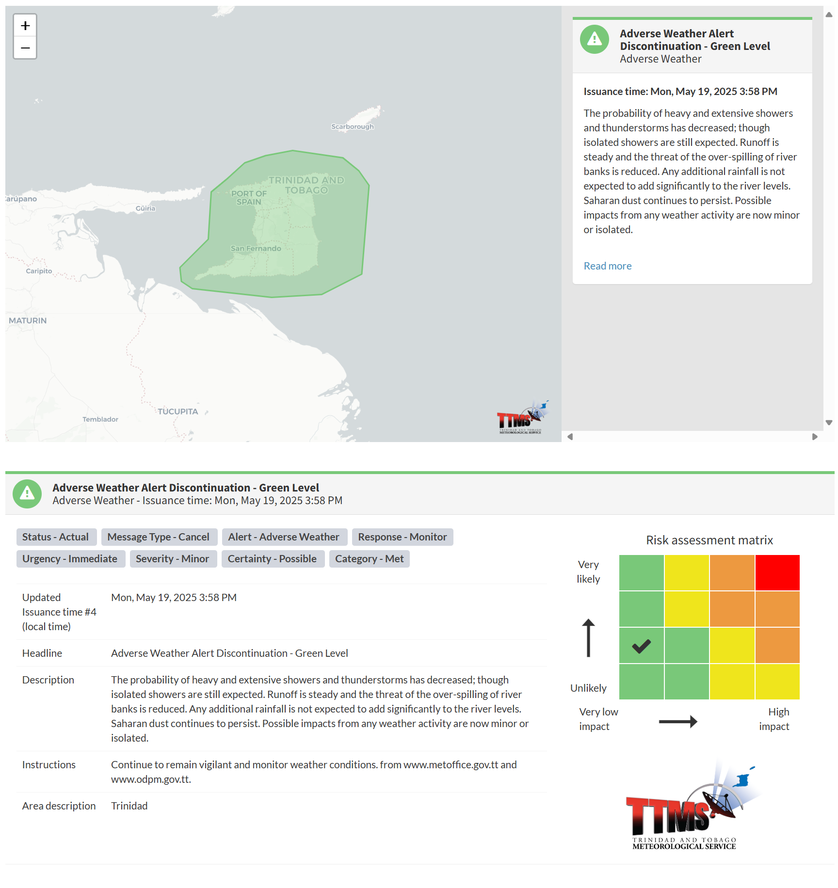
The TTMS states, “The probability of heavy and extensive showers and thunderstorms has decreased; though isolated showers are still expected. Runoff is steady and the threat of the over-spilling of river banks is reduced. Any additional rainfall is not expected to add significantly to the river levels. Saharan dust continues to persist. Possible impacts from any weather activity are now minor or isolated.”
This “alert” status considers the possibility of the event ending, with the certainty at its second-lowest, at possible. Discontinuations and green-level alerts have historically been issued with a likelihood of very likely/observed or likely.

The Met Office advises the population to remain vigilant and monitor weather conditions. At this risk level, there is a low risk to public safety, lives, livelihoods, and property.


