Residents in low-lying areas of the Caroni, North Oropuche, Cunupia, South Oropouche, Guaracara, and Caparo Rivers are on alert this evening as river levels continue to rise, in some cases dramatically, following copious rainfall over the last 36 hours, compounded with additional forecast rainfall as the Intertropical Convergence Zone drifts over T&T tonight through tomorrow. As a result, the Adverse Weather Alert remains in effect for T&T through 6:00 PM tomorrow.

Over the past three hours, the Caroni River, in particular, has increased beyond 90% capacity in the middle and upper basin (El Carmen and Tumpuna), respectively, while smaller tributaries have exceeded their capacity.
Over the last 36 hours, rainfall accumulations across Trinidad have largely exceeded forecast model guidance, with totals ranging between 50 and 100 millimeters (2-4 inches) and isolated totals up to 150 millimeters (6 inches). This water is making its way through the island’s watercourses, primarily threatening smaller watercourses at this time.

What you need to know
— Rainfall: Through Tuesday night, forecast models indicate an additional 25 to 50 millimeters of rainfall across most of Trinidad and Tobago, with rainfall totals between 50 and 125 millimeters possible favoring southern Trinidad.
— Hazards: The main hazards are now all modalities of flooding—street/flash floods in heavy showers and thunderstorms, and riverine flooding, particularly near smaller watercourses that are already at threshold and low-lying areas near major watercourses that are rising or near thresholds. Due to soil saturation, landslides in elevated areas, primarily across Trinidad, and falling trees are possible. Gusty winds remain a risk in heavy showers and thunderstorms, which can also agitate seas.
Latest Alerts
TTMS Issues Adverse Weather Alert For T&T
Trinidad and Tobago is NOT under any tropical storm or hurricane threat, watch, or warning at this time.
The Adverse Weather Alert
The Trinidad and Tobago Meteorological Service updated the Adverse Weather Alert (Yellow Level) on Sunday, May 18th, 2025, at 4:56 PM for Trinidad and Tobago. The alert went into effect from 6:00 PM Saturday, May 17th, 2025, and now remains in effect through 6:00 PM Monday, May 19th, 2025.

According to the TTMS, this period of inclement weather is due to several factors: “Low and mid-level south-easterly winds are expected to draw equatorial moisture over our area, thus increasing atmospheric moisture and instability this weekend.” The TTMS says through tomorrow, “The Inter-Tropical Convergence Zone (ITCZ) is gradually migrating northward and is expected to trigger rainfall and thunderstorm activity later tonight into tomorrow.”
This “alert” status considers the possibility of the event occurring. This adverse weather event is likely.
The TTMS says, “Although elevated due to runoff, the main Caroni River is not expected to exceed its banks at this time. Conditions are being closely monitored.”
They continued, “Despite current settled conditions, smaller watercourses, such as the Manuel Congo and Caroni (Tumpuna) rivers, may still respond to earlier rainfall runoff. With additional rainfall forecast, there is the risk of localized overtopping, especially in low-lying or flood-prone areas. There is a heightened risk of landslides/landslips in vulnerable areas. Additional impacts include street or flash flooding, localized ponding, gusty winds in the vicinity of heavy downpours, which can also lead to agitated seas. Residents are advised to remain alert and exercise caution, especially in areas with a history of flooding or landslides.”

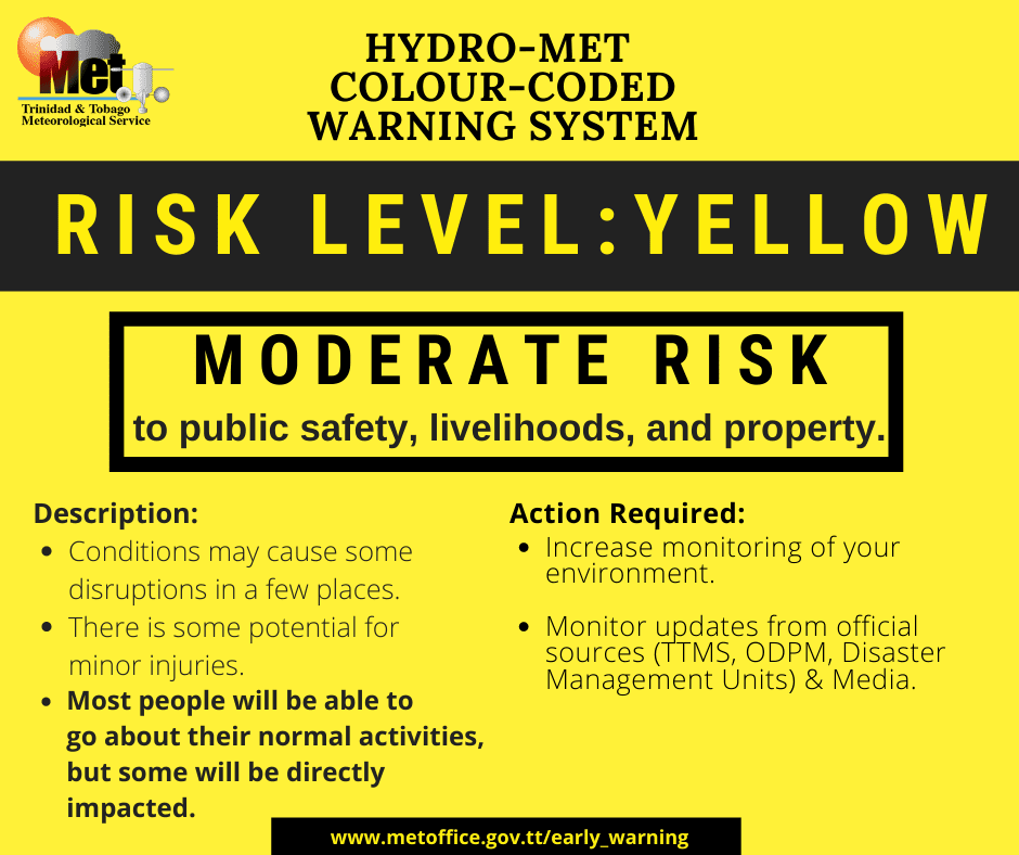
The alert’s color indicates the severity of the event and the probability of its occurrence. Currently, the alert level is Yellow. This means that the hazards are likely, and the severity of the impacts is moderate for this particular alert. You should be aware of the hazards in your area, which are associated mainly with street/flash flooding as well as riverine flooding, gusty winds, falling trees, landslides, and agitated seas.
A moderate Adverse Weather Alert can result in possible injuries and behavioral changes, which are required to ensure safety. Minor damage to property may also occur, temporarily disrupting income-earning activities and affecting a couple of communities.
The Met Office advises the public to continue to remain vigilant and monitor weather conditions, assess their surroundings before venturing out, avoid driving or wading through flood waters, take necessary precautions to mitigate potential impacts, follow the instructions of government officials, and monitor weather updates.


