


As heavy rainfall mainly affects Trinidad, flooding has begun in various areas of the country. With additional rain forecast through tomorrow, the Adverse Weather Alert has been extended through 6:00 PM tomorrow (Monday).
What you need to know
— Rainfall: Over the past 24-36 hours, between 25 and 75 millimeters of rainfall have accumulated across Trinidad. Through Tuesday night, forecast models indicate an additional 25 to 75 millimeters of rainfall across most of Trinidad and Tobago, with lower accumulations across northern Trinidad and Tobago, while across the southern half of Trinidad, rainfall totals between 75 and 150 millimeters are forecast. Particularly across southern Trinidad, even higher rainfall totals are likely.
— Hazards: The main hazards will be street/flash flooding and gusty winds accompanying heavy shower and thunderstorm activity. As soils become increasingly saturated, landslides are also possible in elevated southern and eastern areas, with river levels needing close monitoring, particularly in central and southern areas. Seas may become locally rough or agitated in heavy shower/thunderstorm activity.
Latest Alerts

TTMS Issues Adverse Weather Alert For T&T
Trinidad and Tobago is NOT under any tropical storm or hurricane threat, watch, or warning at this time.
The Adverse Weather Alert
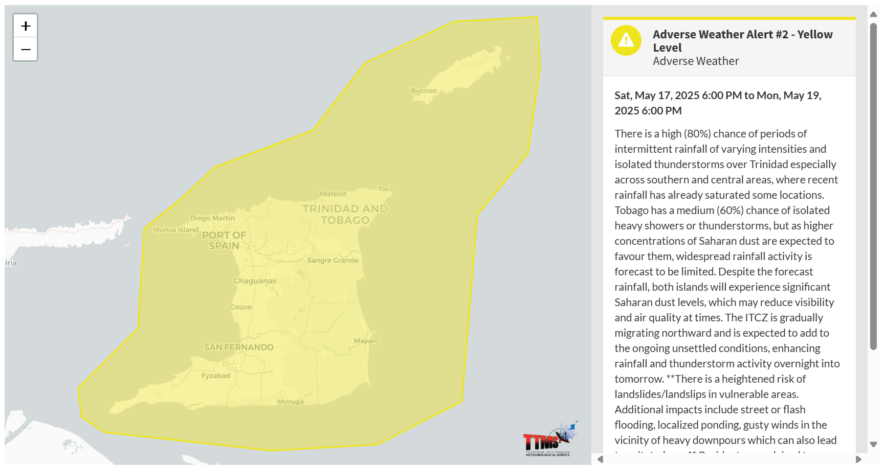
The Trinidad and Tobago Meteorological Service updated the Adverse Weather Alert (Yellow Level) on Sunday, May 18th, 2025, at 9:26 AM for Trinidad and Tobago. The alert went into effect from 6:00 PM Saturday, May 17th, 2025, and now remains in effect through 6:00 PM Monday, May 19th, 2025.

According to the TTMS, this period of inclement weather is due to several factors: “Low and mid-level south-easterly winds are expected to draw equatorial moisture over our area, thus increasing atmospheric moisture and instability this weekend.”
This “alert” status considers the possibility of the event occurring. This adverse weather event is likely, and the following impacts are likely, according to the TTMS:
- There is a high (80%) chance of periods of intermittent rainfall of varying intensities and isolated thunderstorms over Trinidad, especially across southern and central areas, where recent rainfall has already saturated some locations.
- Tobago has a medium (60%) chance of isolated heavy showers or thunderstorms, but as higher concentrations of Saharan dust are expected to favour them, widespread rainfall activity is forecast to be limited.
- Despite the forecast rainfall, both islands will experience significant Saharan dust levels, which may reduce visibility and air quality at times.
- The ITCZ is gradually migrating northward and is expected to add to the ongoing unsettled conditions, enhancing rainfall and thunderstorm activity overnight into tomorrow.
- There is a heightened risk of landslides/landslips in vulnerable areas. Additional impacts include street or flash flooding, localized ponding, gusty winds in the vicinity of heavy downpours, which can also lead to agitated seas. Residents are advised to remain alert and exercise caution, especially in areas with a history of flooding or landslides.

The alert’s color indicates the severity of the event and the probability of its occurrence. Currently, the alert level is Yellow. This means that the hazards are likely, and the severity of the impacts is moderate for this particular alert. You should be aware of the hazards in your area, which are associated mainly with street/flash flooding, gusty winds, falling trees, landslides, and agitated seas.
A moderate Adverse Weather Alert can result in possible injuries and behavioral changes, which are required to ensure safety. Minor damage to property may also occur, temporarily disrupting income-earning activities and affecting a couple of communities.
The Met Office advises the public to continue to remain vigilant and monitor weather conditions, assess their surroundings before venturing out, avoid driving or wading through flood waters, take necessary precautions to mitigate potential impacts, follow the instructions of government officials, and monitor weather updates.


