


May typically marks the start of the local Wet Season, and the Intertropical Convergence Zone (ITCZ) may just be this year’s trigger. From Sunday, the zone will bring showers and thunderstorms to Trinidad and Tobago. It is located in an area with favorable upper-level conditions, abundant moisture, and convergence, leading to periodic showers and occasional thunderstorms, with the potential for high rainfall areas, particularly across the southern half of Trinidad.
As a result, the Trinidad and Tobago Meteorological Service has issued the second Adverse Weather Alert for Trinidad and Tobago this year, going into effect from 6:00 PM Saturday through 6:00 PM Sunday. However, impactful weather is likely on Saturday afternoon before the alert is effective and beyond Sunday evening.
What you need to know
— Rainfall: Through Tuesday night, forecast models indicate between 25 and 75 millimeters of rainfall across most of Trinidad and Tobago, with lower accumulations across northern Trinidad and Tobago, while across the southern half of Trinidad, rainfall totals between 75 and 150 millimeters are forecast. Particularly across southern Trinidad, even higher rainfall totals are likely.
— Hazards: The main hazards will be street/flash flooding and gusty winds exceeding 40 KM/H accompanying heavy shower and thunderstorm activity. As soils become increasingly saturated, landslides are also possible in elevated southern and eastern areas, with river levels needing close monitoring, particularly in central and southern areas. Seas may become locally rough or agitated in heavy shower/thunderstorm activity.
Latest Alerts

Adverse Weather Alert Discontinued For Western Trinidad
Trinidad and Tobago is NOT under any tropical storm or hurricane threat, watch, or warning at this time.
The Adverse Weather Alert
The Trinidad and Tobago Meteorological Service issued an Adverse Weather Alert (Yellow Level) on Friday, May 16th, 2025, at 3:29 PM for Trinidad and Tobago. The alert goes into effect from 6:00 PM Saturday, May 17th, 2025, through 6:00 PM Sunday, May 18th, 2025.
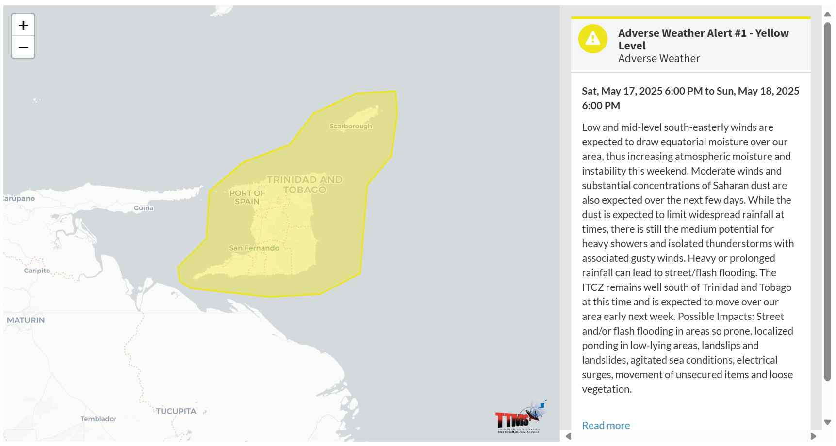

According to the TTMS, this period of inclement weather is due to several factors: “Low and mid-level south-easterly winds are expected to draw equatorial moisture over our area, thus increasing atmospheric moisture and instability this weekend.”
This “alert” status considers the possibility of the event occurring. This adverse weather event is likely, and the following impacts are likely, according to the TTMS:
- Street and/or flash flooding in areas so prone.
- Localized ponding in low-lying areas.
- Landslips and landslides
- Agitated sea conditions
- Electrical surges [Lightning]
- Movement of unsecured items and loose vegetation.

The alert’s color indicates the severity of the event and the probability of its occurrence. Currently, the alert level is Yellow. This means that the hazards are likely, and the severity of the impacts is moderate for this particular alert. You should be aware of the hazards in your area, which are associated mainly with street/flash flooding, gusty winds near and above 40 KM/H, possibly falling trees, landslides, and agitated seas.
A moderate Adverse Weather Alert can result in possible injuries and behavioral changes, which are required to ensure safety. Minor damage to property may also occur, temporarily disrupting income-earning activities and affecting a couple of communities.
The Met Office advises the public to continue to remain vigilant and monitor weather conditions, assess their surroundings before venturing out, avoid driving or wading through flood waters, take necessary precautions to mitigate potential impacts, follow the instructions of government officials, and monitor weather updates.


