As mentioned earlier this week, a significant swell event propagating across the Atlantic Ocean is forecast to affect T&T from Thursday into the weekend. Peak swells, with periods up to 17 seconds, are forecast from Thursday night through Saturday, with less severe long-period swells through next week.
With severe impacts likely, this is the second-ever Orange-Level Hazardous Seas Alert issued by the Trinidad and Tobago Meteorological Service since the color-coded Multi-Hazard Early Warning System debuted in 2018. The first was issued in December 2022.
What you need to know
— What is happening: Beginning Thursday evening, swells with periods of up to 17 seconds will begin to affect Trinidad and Tobago’s northern coastlines. A buoy located just east of Barbados recorded peak open water wave heights of 3.9 meters with swell periods of 19 seconds just after midday on Thursday. Through Saturday, high-energy swells are forecast to continue, eventually affecting sheltered, north-facing coastlines of Trinidad in the Gulf of Paria by Friday.
— What can we expect: Large, battering waves are likely along T&T’s northern coastlines with wave heights up to 3.5 meters (11.5 feet), with choppy conditions in sheltered areas. Moderate to significant coastal erosion is likely. There is a very high risk of dangerous rip currents along the country’s northern coastlines. Spring Tides end on Wednesday, December 3rd, 2024, with the overall sea state in open waters moderate through the alert period, becoming moderate to rough early next week.
Latest Alerts
TTMS Issues Adverse Weather Alert For T&T
Trinidad and Tobago is NOT under any tropical storm or hurricane threat, watch, or warning at this time.
The Hazardous Seas Alert
The Trinidad and Tobago Meteorological Service issued a Hazardous Seas Alert (Orange Level) at 11:56 AM on Thursday, November 28th, 2024, for northern and north-eastern exposed coastal areas of Trinidad and Tobago, including north-facing coastal areas of the Gulf of Paria to a lesser extent. According to the TTMS, this alert will remain in effect for affected areas from 5:00 PM November 28th through 8:00 AM Saturday, November 30th, 2024.


This “alert” status considers the possibility of the event occurring. This hazardous seas event is likely, and the following impacts are likely, according to the TTMS:
- High-energy, long period north/north-easterly swells are expected to produce large breakers along near-shore coastal areas.
- Although the onset may be infrequent, this event can cause large, battering waves exacerbated at high tides, along these shorelines.
- Near-shore activities including fishing, swimming and boat moorings can be disrupted. Impacts may also include intrusion of salt water and displacement of sand, further than the average reach point.

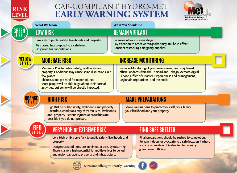
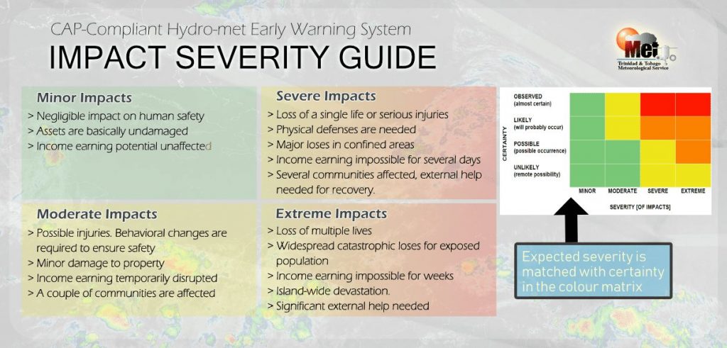
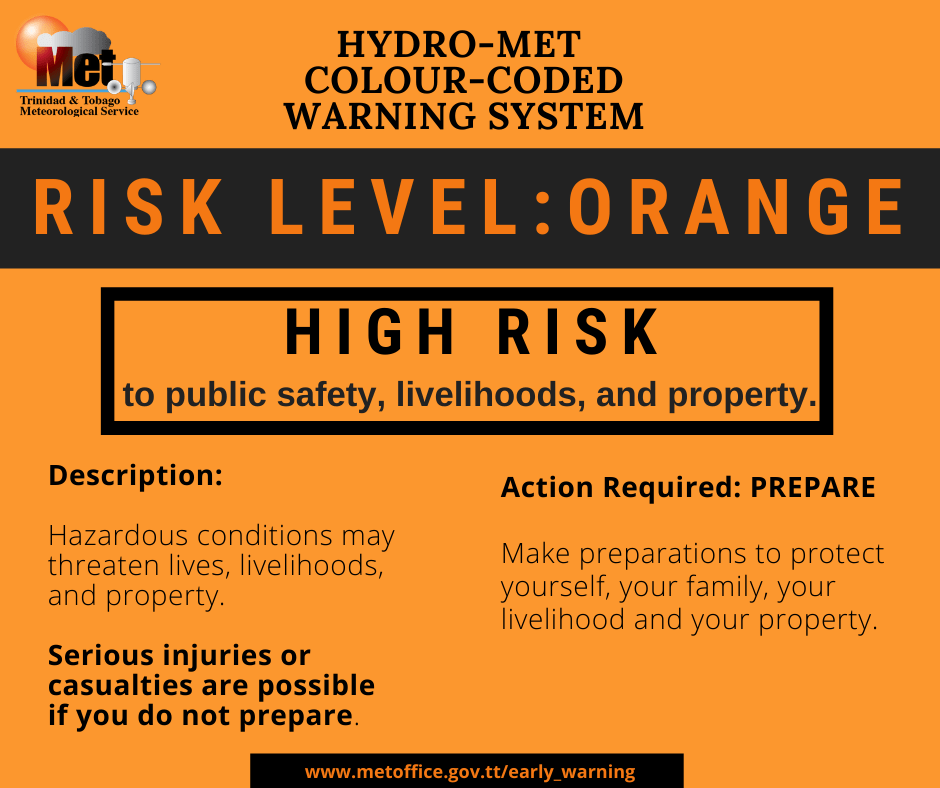
The alert’s color indicates the event’s severity and probability of the event occurring. Currently, the alert level is Orange. This means that the hazards are likely, and the severity of impacts is severe for this particular alert. Large battering waves in nearshore areas are forecast, producing dangerous conditions for all nearshore marine interests with a high risk of rip currents and beach erosion.
For a severe Hazardous Seas Alert, there is the potential for a loss of a single life or serious injuries; physical defenses are needed, major losses are possible in confined areas, income earning is impossible for several days, and several communities are affected where external help is needed for recovery.
Coastal communities, sea bathers, fishermen, and small craft operators should finalize preparations to protect lives, livelihoods, and property, activate their safety plan, and protect important assets and documents.
The Met Office is advising all marine interests to carefully monitor nearshore/coastal sea conditions and exercise extreme caution along identified areas. Restrict nearshore marine activities. Secure coastal property. Continue to monitor updates from official sites.


