


The Trinidad and Tobago Meteorological Service has issued an Adverse Weather Alert for Trinidad due to very moist and unstable conditions across the region ahead of an approaching low-level trough.
However, due to high moisture, light wind shear, and favorable low—and upper-level conditions, showers and thunderstorms could become locally intense, particularly on Wednesday, affecting both Trinidad (where the alert is currently in effect) and Tobago.
What you need to know
— Rainfall: Most of Trinidad and Tobago forecast to record up to 15 millimeters but across the northern and eastern halves of Trinidad, Tobago and localized areas of western coastal Trinidad can see isolated rainfall totals between 25 and 62.5 millimeters.
— Hazards: The main hazards will be street/flash flooding and landslides across particularly northern Trinidad and Tobago, as well as gusty winds exceeding 45 KM/H accompanying shower and thunderstorm activity. Due to relatively saturated conditions from this weekend’s rainfall, the threat of landslides is high in northern/northwestern Trinidad.
Latest Alerts

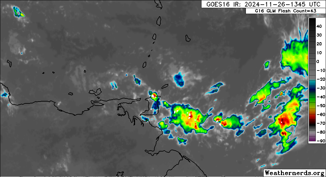
TTMS Issues Adverse Weather Alert For T&T
Trinidad and Tobago is NOT under any tropical storm or hurricane threat, watch, or warning at this time.
The Adverse Weather Alert
The Trinidad and Tobago Meteorological Service issued an Adverse Weather Alert (Yellow Level) on Tuesday at 10:37 AM. The alert went into effect for Trinidad and Tobago at 10:45 AM today, Tuesday, November 26th, 2024, through tomorrow, Wednesday, 4:00 PM, November 17th, 2024.


As mentioned earlier, the inclement weather forecast is due to a very moist and unstable atmosphere ahead of a low-level through across Trinidad and Tobago.
This “alert” status considers the possibility of the event occurring. This adverse weather event is likely, and the following impacts are likely, according to the TTMS:
- An approaching trough is expected to bring periods of light to moderate showers with a 70% chance of heavier showers or thunderstorms intermittently today into tomorrow.
- This weather pattern increases the risk of landslides and landslips, especially in hilly areas such as the Northern Range.
- Additional impacts include street/flash flooding and gusty winds in the vicinity of heavy downpours.

The alert’s color indicates the severity of the event and the probability of its occurrence. Currently, the alert level is Yellow. This means that the hazards are likely, and the severity of the impacts is moderate for this particular alert. You should be aware of the hazards in your area, which are associated mainly with landslides, street/flash flooding, gusty winds, possibly falling trees, and agitated seas.
A moderate Adverse Weather Alert can result in possible injuries, and behavioral changes are required to ensure safety. Minor damage to property may also occur, temporarily disrupting income-earning activities and affecting a couple of communities.
The Met Office advises the public to monitor weather conditions and assess your surroundings before venturing out, avoid driving or wading through flood waters, follow the instructions of government officials, and monitor weather updates.


