


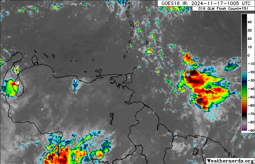
The Trinidad and Tobago Meteorological Service has issued an Adverse Weather Alert for the country due to very moist and unstable conditions across the region. While satellite imagery shows a broad area of showers and thunderstorms east of the country, most intense weather is expected to remain east of T&T, at least on Sunday.
However, due to high moisture, light wind shear, and favorable low—and upper-level conditions, pop-up showers and thunderstorms could become locally intense, leading to isolated high precipitation and gusty winds. Forecast models show more rainfall is forecast on Monday and Tuesday, particularly across southern and eastern areas that remain waterlogged from this past week’s floods.
What you need to know
— Rainfall: Through the alert period, at least through 6:00 PM, most areas are forecast to see up to 10 millimeters, and areas that experience heavy showers/thunderstorms totals can range between 25 and 50 millimeters of rainfall.
— Hazards: The main hazards will be localized street/flash flooding and gusty winds exceeding 55 KM/H accompanying shower and thunderstorm activity. Due to relatively saturated conditions from this week’s rainfall, landslides are also possible in elevated southern and eastern areas. Seas may become locally rough or agitated in heavy shower/thunderstorm activity.
Latest Alerts

Adverse Weather Alert Discontinued For Western Trinidad
Trinidad and Tobago is NOT under any tropical storm or hurricane threat, watch, or warning at this time.
The Adverse Weather Alert
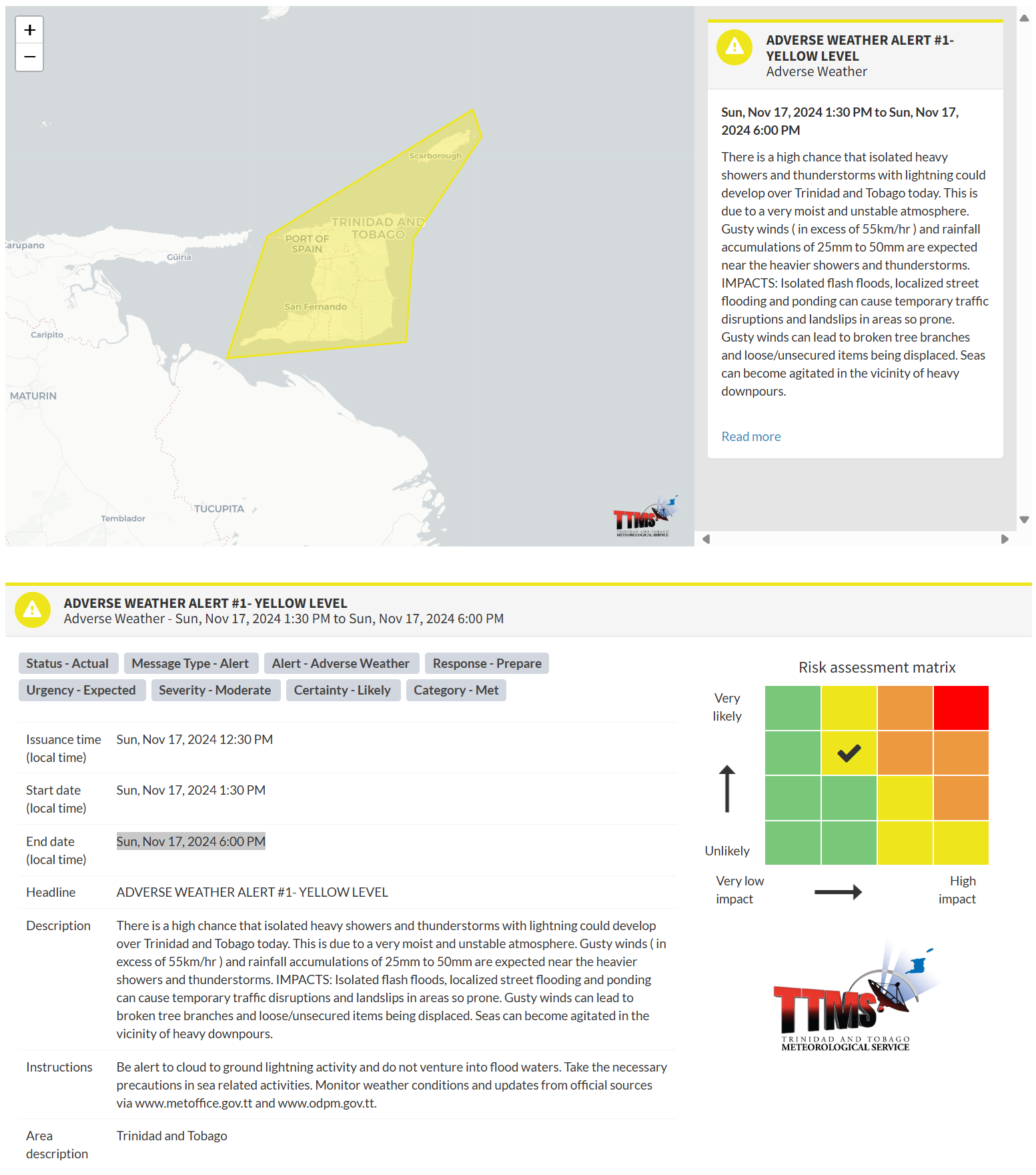
The Trinidad and Tobago Meteorological Service issued an Adverse Weather Alert (Yellow Level) on Sunday at 12:30 PM. The alert went into effect for Trinidad and Tobago at 1:30 PM today, Sunday, November 17th, 2024, through 6:00 PM, November 17th, 2024.
As mentioned earlier, the inclement weather forecast is due to a very moist and unstable atmosphere across Trinidad and Tobago.
This “alert” status considers the possibility of the event occurring. This adverse weather event is likely, and the following impacts are likely, according to the TTMS:
- Gusty winds (in excess of 55 KM/H) can cause broken tree branches and the displacement of loose/unsecured items.
- Rainfall accumulations of 25mm to 50mm are expected near the heavier showers and thunderstorms.
- Isolated flash floods, localized street flooding and ponding can cause temporary traffic disruptions and landslips in areas so prone.
- Seas can become agitated in the vicinity of heavy downpours.

The alert’s color indicates the severity of the event and the probability of its occurrence. Currently, the alert level is Yellow. This means that the hazards are likely, and the severity of the impacts is moderate for this particular alert. You should be aware of the hazards in your area, which are associated mainly with street/flash flooding, gusty winds near and above 55 KM/H, possibly falling trees, and agitated seas.
A moderate Adverse Weather Alert can result in possible injuries, and behavioral changes are required to ensure safety. Minor damage to property may also occur, temporarily disrupting income-earning activities and affecting a couple of communities.
The Met Office advises the public to be alert to cloud-to-ground lightning activity and not venture into flood waters. Take the necessary precautions when engaging in sea-related activities. Monitor weather conditions and updates


