


The Trinidad and Tobago Meteorological Service (TTMS) has discontinued the Adverse Weather Alert for Trinidad and Tobago.
What you need to know
— What has happened: Scattered moderate to heavy showers and isolated thunderstorms mainly affected Trinidad over the last 24 hours due to the Intertropical Convergence Zone (ITCZ) and strong daytime heating yesterday.
— What to expect: Additional ITCZ activity is likely overnight through Tuesday, with daytime heating with anomalously light to southerly winds forecast to trigger and slowly move showers and thunderstorms.
— Hazards: Street/flash flooding remains possible due to localized heavy/violent rainfall. Gusty winds up to 55 KM/H are possible in heavy downpours, and thunderstorms may produce frequent cloud-to-ground lightning. Seas may become locally agitated during heavy showers or thunderstorms. Funnel clouds and waterspouts also remain possible.
Latest Alerts

TTMS Issues Adverse Weather Alert For T&T
Trinidad and Tobago is NOT under any tropical storm or hurricane threat, watch, or warning at this time.
The Adverse Weather Alert Discontinuation
The Trinidad and Tobago Meteorological Service discontinued the Adverse Weather Alert (Yellow Level) on Saturday at 3:34 PM.
Trinidad and Tobago is not under any tropical storm watch or warning at this time.
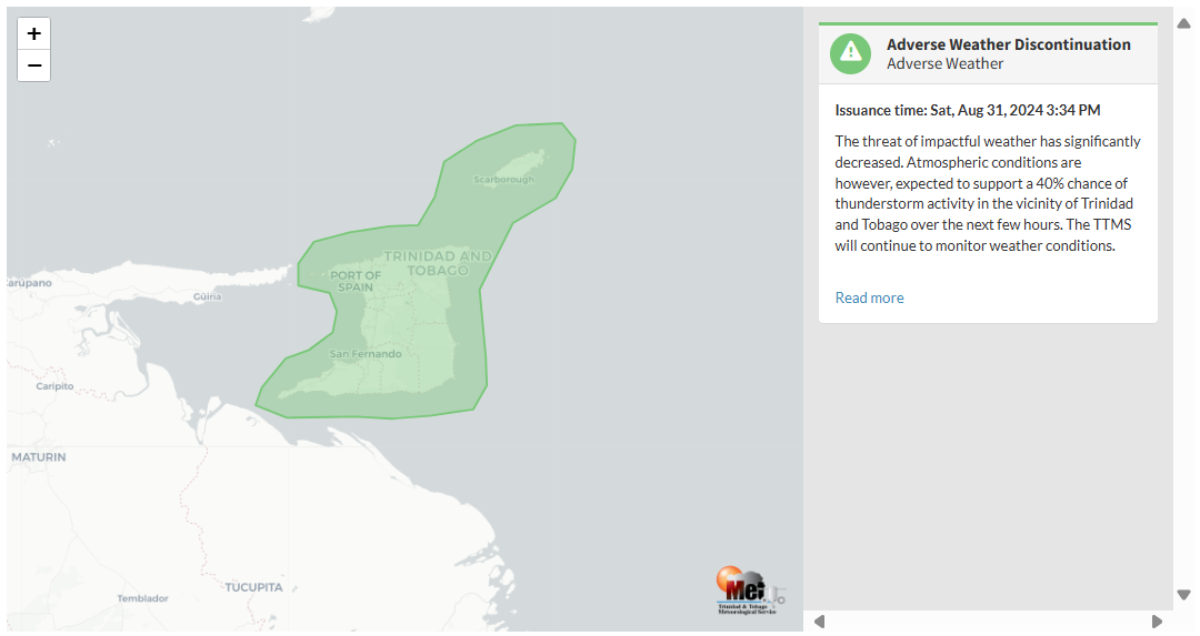
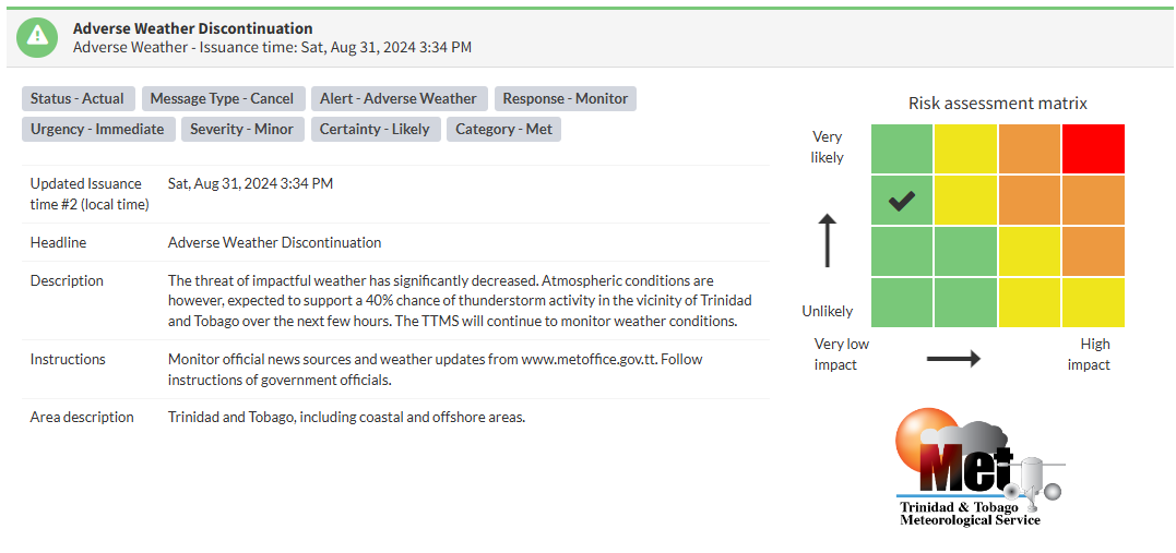
The TTMS states, “The threat of impactful weather has significantly decreased. Atmospheric conditions are, however, expected to support a 40% chance of thunderstorm activity in the vicinity of Trinidad and Tobago over the next few hours. The TTMS will continue to monitor weather conditions.”
This “alert” status considers the possibility of the event ending, with the certainty at its second-highest, at likely.

The alert’s color indicates the event’s severity and probability of occurring. Currently, the alert level is Green, as the discontinuation was issued, with certainty at likely. According to the TTMS, possible impacts are minor.
At this level, there is a negligible impact on human safety. The Met Office advises the public to continue monitoring weather conditions and follow instructions from government officials.


