


The Trinidad and Tobago Meteorological Service has expanded the Adverse Weather Alert to include Tobago and has extended it from 9:00 AM to 11:00 AM today.
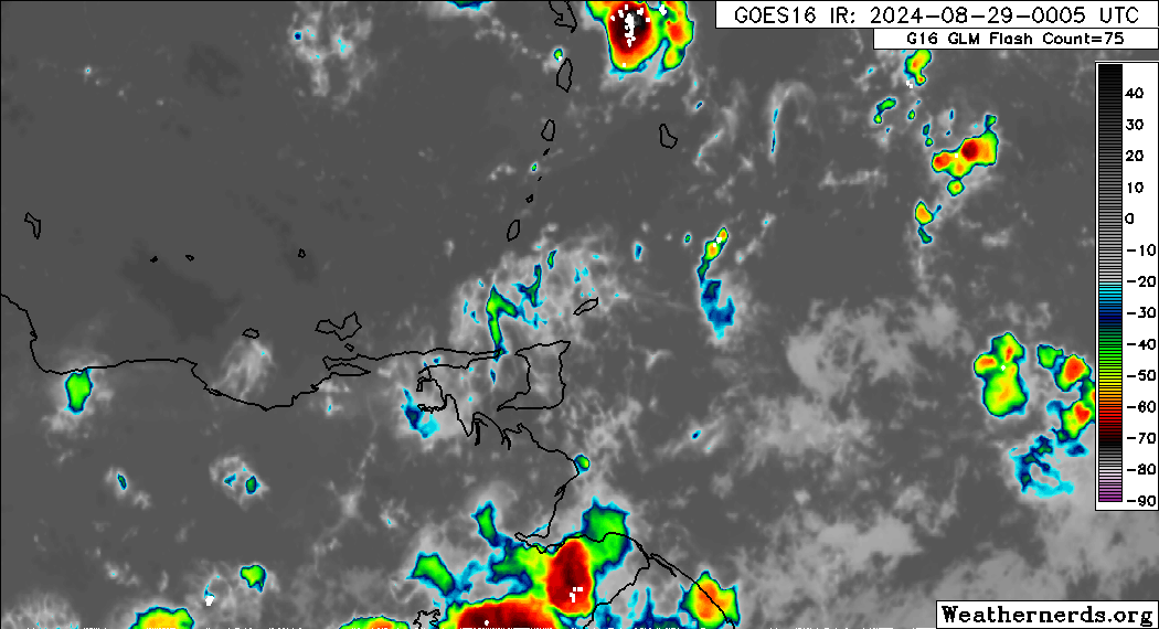
This period of adverse weather is due to the approaching Intertropical Convergence Zone from the south of T&T, which is expected to move across the country during the early morning hours of today.
Forecast models also show strong daytime heating and anomalously light winds, to at times southerly, as forecast, to affect T&T, leading to isolated strong thunderstorms during the late morning through the afternoon today beyond the end of this new, and former, Adverse Weather Alert.
What you need to know
— Rainfall: Over the next 18 hours, forecast models show rainfall accumulations across Trinidad and Tobago generally remaining under 25 millimeters (1 inch), but isolated areas can see up to 50 millimeters favoring, but not limited to, Trinidad.
— Hazards: As a result of periods of heavy/violent rainfall, street/flash flooding is highly likely, particularly across Trinidad. Wind gusts up to 55 KM/H are possible in heavy showers and thunderstorms, with frequent cloud-to-ground lightning possibly in thunderstorm activity. With the potential for intense rainfall in elevated areas of Trinidad, landslides are possible. Seas are forecast to become locally agitated during heavy showers or thunderstorms. Funnel cloud development is also possible, favoring Trinidad.
Latest Alerts

TTMS Maintains Adverse Weather Alert For T&T
Trinidad and Tobago is NOT under any tropical storm or hurricane threat, watch, or warning at this time.
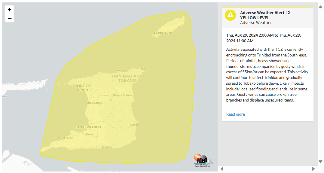
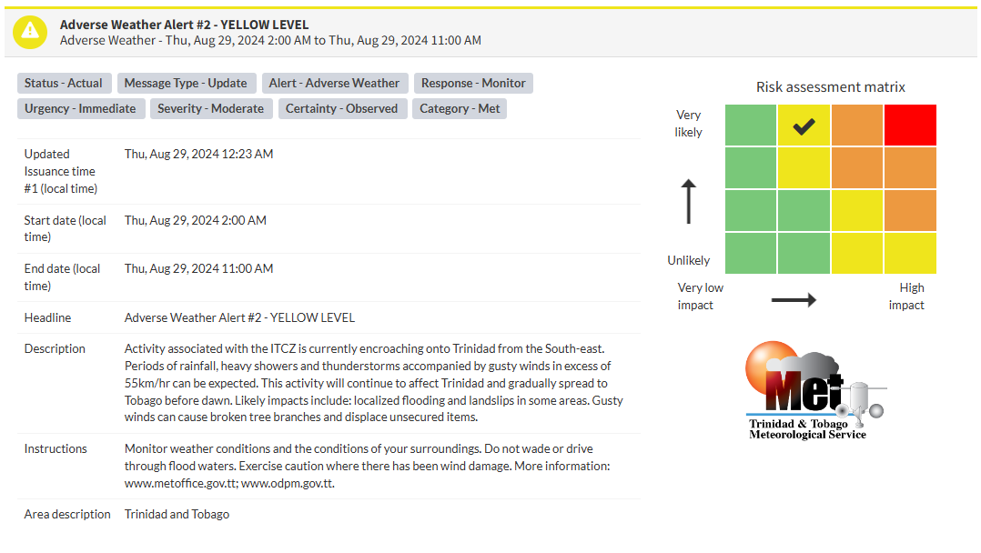
The Adverse Weather Alert
The Trinidad and Tobago Meteorological Service updated the Adverse Weather Alert (Yellow Level) on Thursday at 12:23 AM. The new alert goes into effect for Trinidad, and now Tobago, at 2:00 AM Thursday, August 29th, 2024, now until 11:00 AM Thursday, August 29th, 2024.
As mentioned earlier, the forecast of inclement weather is due to several weather features affecting Trinidad – the ITCZ, the trailing instability and moisture from a tropical wave, a low-level trough, anomalously light to southerly winds and later today, strong daytime heating.
This “alert” status considers the possibility of the event occurring. This adverse weather event is very likely/observed, and the following impacts are very likely, according to the TTMS:
- Activity associated with the ITCZ is currently encroaching on Trinidad from the southeast.
- Periods of rainfall, heavy showers, and thunderstorms accompanied by gusty winds in excess of 55 KM/H can be expected. Gusty winds can cause broken tree branches and displace unsecured items.
- This activity will continue to affect Trinidad and gradually spread to Tobago before dawn.
- Likely impacts include localized flooding and landslips in some areas.

The alert’s color indicates the severity of the event and the probability of its occurrence. Currently, the alert level is Yellow. This means that the hazards are very likely, and the severity of the impacts is moderate for this particular alert. You should be aware of the hazards in your area, which are associated mainly with street/flash flooding, landslides, gusty winds near 55 KM/H, possibly falling trees, and agitated seas.
A moderate Adverse Weather Alert can result in possible injuries, and behavioral changes are required to ensure safety. Minor damage to property may also occur, temporarily disrupting income-earning activities and affecting a couple of communities.
The Met Office advises the public to monitor weather conditions and the conditions of their surroundings, not wade or drive through flood waters, and exercise caution where there has been wind damage.


