


The Trinidad and Tobago Meteorological Service (TTMS) has discontinued the Adverse Weather Alert for Trinidad and Tobago.
Heavy rainfall earlier today lead to localized street flooding in southern areas of Trinidad.
What you need to know
— What has happened: Scattered moderate to heavy showers, and isolated thunderstorms affected mainly Trinidad over the last 24 hours due to a low-level trough and a tropical wave interacting with the Intertropical Convergence Zone (ITCZ), coupled with strong daytime heating yesterday.
— What to expect: Additional strong daytime heating with anomalously light to southerly winds are forecast to trigger and slowly move showers and thunderstorms along western Trinidad northward, with locally intense rainfall possible.
— Hazards: Street/flash flooding remains possible due to localized heavy/violent rainfall. In heavy downpours, gusty winds up to 55 KM/H are possible, and thunderstorms may produce frequent cloud-to-ground lightning. Seas may become locally agitated during heavy showers or thunderstorms. Funnel clouds also remain possible along western coastal areas.
Latest Alerts

TTMS Issues Adverse Weather Alert For T&T
Trinidad and Tobago is NOT under any tropical storm or hurricane threat, watch, or warning at this time.
The Adverse Weather Alert Discontinuation
The Trinidad and Tobago Meteorological Service discontinued the Adverse Weather Alert (Yellow Level) on Thursday at 10:10 AM.
Trinidad and Tobago is not under any tropical storm watch or warning at this time.
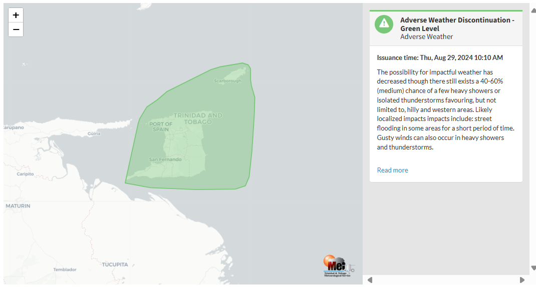
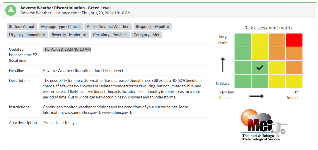
According to the TTMS, “The possibility for impactful weather has decreased though there still exists a 40-60% (medium) chance of a few heavy showers or isolated thunderstorms favoring, but not limited to, hilly and western areas. Localized impacts likely include street flooding in some areas for a short period of time. Gusty winds can also occur in heavy showers and thunderstorms.” This “alert” status takes into account the possibility of the event ending, with the certainty at its second-lowest, at possible.

The alert’s color indicates the event’s severity and probability of occurring. Currently, the alert level is Green, as the discontinuation was issued with certainty as possible. According to the TTMS, possible impacts are moderate.
A moderate Adverse Weather Alert can result in possible injuries, and behavioral changes are required to ensure safety. Minor damage to property may also occur, temporarily disrupting income-earning activities and affecting a couple of communities.
The Met Office advises the public to continue monitoring weather conditions and the conditions of your surroundings.


