


Strong daytime heating, coupled with the passage of a tropical wave, the presence of a low-level trough, and the Intertropical Convergence Zone, have led to unstable conditions across Trinidad and, to a lesser extent, Tobago. As a result of the potential for impactful weather, the Trinidad and Tobago Meteorological Service has issued an Adverse Weather Alert for Trinidad.
What you need to know
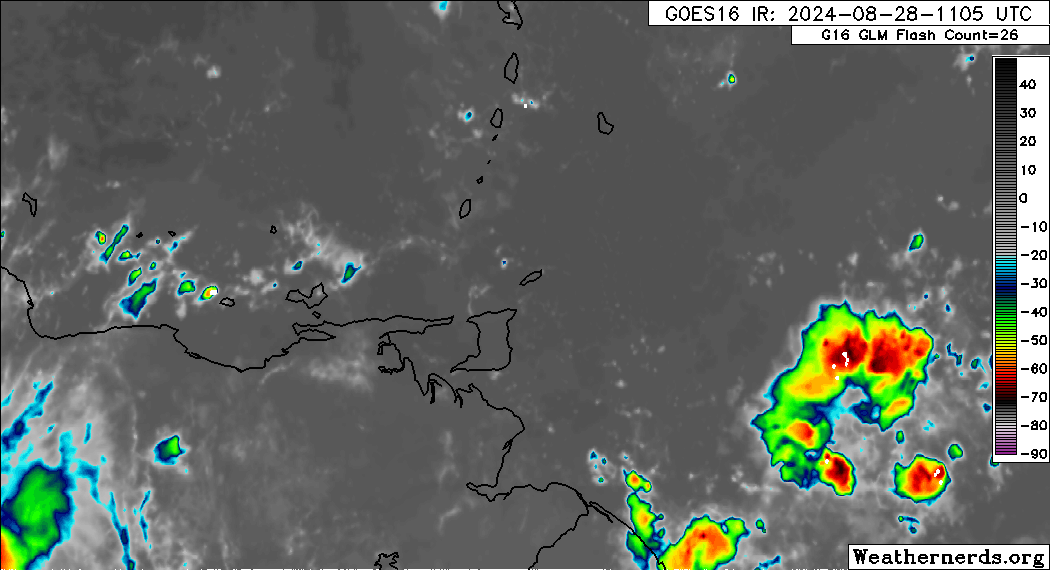
— Rainfall: Over the next 24 hours, forecast models show rainfall accumulations across Trinidad and Tobago generally remaining less than 37.5 millimeters (1.5 inches), but isolated areas can see between 50 and 100 millimeters favoring, but not limited to, southern and western areas of Trinidad.
— Hazards: As a result of periods of heavy/violent rainfall, street/flash flooding is highly likely, particularly across the western and southern halves of Trinidad. Wind gusts up to 55 KM/H are possible in heavy showers and thunderstorms, with frequent cloud-to-ground lightning possibly in thunderstorm activity. With the potential for intense rainfall in elevated areas of Trinidad, landslides are possible. Seas are forecast to become locally agitated during heavy showers or thunderstorms. Funnel cloud development is also possible, favoring southern and western areas.
Latest Alerts

TTMS Issues Adverse Weather Alert For T&T
Trinidad and Tobago is NOT under any tropical storm or hurricane threat, watch, or warning at this time.
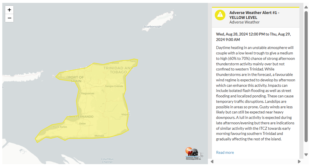
The Adverse Weather Alert
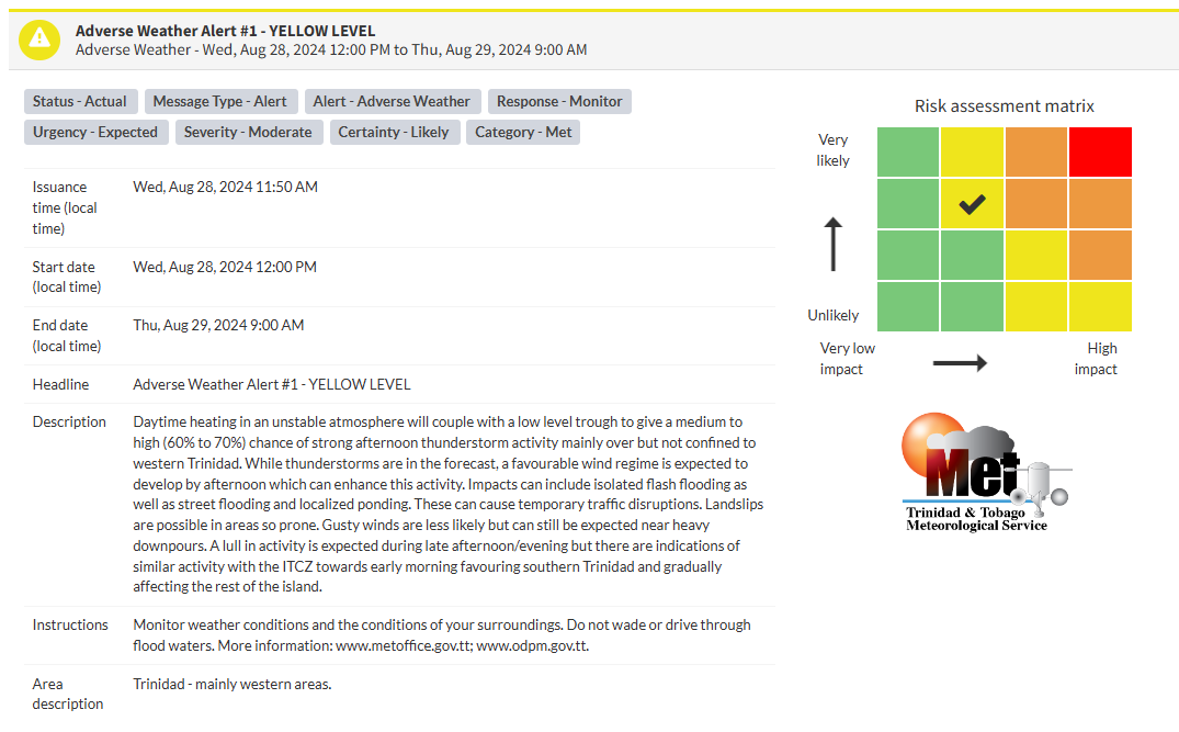
The Trinidad and Tobago Meteorological Service issued an Adverse Weather Alert (Yellow Level) on Wednesday at 11:50 AM. The alert went into effect for Trinidad at 12:00 PM (noon) Wednesday, August 28th, 2024, until 9:00 AM Thursday, August 29th, 2024.
As mentioned earlier, the forecast of inclement weather is due to several weather features affecting Trinidad.
This “alert” status considers the possibility of the event occurring. This adverse weather event is likely, and the following impacts are likely, according to the TTMS:
- Daytime heating in an unstable atmosphere will be coupled with a low-level trough to give a medium to high (60% to 70%) chance of strong afternoon thunderstorm activity, mainly over but not confined to western Trinidad. While thunderstorms are in the forecast, a favorable wind regime is expected to develop by the afternoon, which can enhance this activity.
- Impacts can include isolated flash flooding, street flooding, and localized ponding, which can cause temporary traffic disruptions.
- Heavy rainfall may accompany damaging gusty winds over 55 KM/H.
- Landslips are possible in areas so prone.
- Gusty winds are less likely but can still be expected near heavy downpours.
- A lull in activity is expected during late afternoon/evening, but there are indications of similar activity with the ITCZ towards early morning, favoring southern Trinidad and gradually affecting the rest of the island.

The alert’s color indicates the severity of the event and the probability of its occurrence. Currently, the alert level is Yellow. This means that the hazards are likely, and the severity of the impacts is moderate for this particular alert. You should be aware of the hazards in your area, which are associated mainly with street/flash flooding, landslides, gusty winds near 55 KM/H, possibly falling trees, and agitated seas.
A moderate Adverse Weather Alert can result in possible injuries, and behavioral changes are required to ensure safety. Minor damage to property may also occur, temporarily disrupting income-earning activities and affecting a couple of communities.
The Met Office advises the public to monitor weather conditions and the conditions of their surroundings and not wade or drive through flood waters.


