


The Trinidad and Tobago Meteorological Service (TTMS) has discontinued the Adverse Weather Alert for Trinidad and Tobago. However, additional showers and thunderstorms are forecast across the country, mainly Trinidad, through the late morning and afternoon.
What you need to know
— What has happened: A low-level trough interacted with the Intertropical Convergence Zone, bringing showers and thunderstorms across the country, mainly Trinidad. Locally heavy rainfall produced street/flash flooding in southern areas.
— What to expect: Daytime heating and sea breeze convergence, in addition to the influence of the Intertropical Convergence Zone, will lead to shower and thunderstorms developing across mainly Trinidad. Locally intense thunderstorms are possible.
— Hazards: As a result of periods of heavy/violent rainfall, street/flash flooding is highly likely, particularly across Trinidad. While the threat of gusty winds remains lower, wind gusts up to 55 KM/H are possible in heavy showers and thunderstorms, with frequent cloud-to-ground lightning possible in thunderstorm activity.
Latest Alerts

TTMS Issues Adverse Weather Alert For T&T
Trinidad and Tobago is NOT under any tropical storm or hurricane threat, watch, or warning at this time.
The Adverse Weather Alert Discontinuation
The Trinidad and Tobago Meteorological Service discontinued the Adverse Weather Alert (Yellow Level) at 10:03 AM.
Trinidad and Tobago is not under any tropical storm watch or warning at this time.
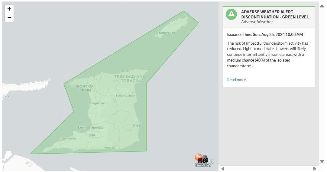
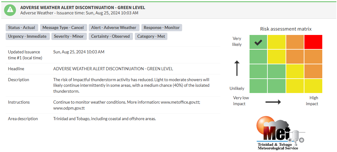
According to the TTMS, “The risk of Impactful thunderstorm activity has reduced. Light to moderate showers will likely continue intermittently in some areas, with a medium chance (40%) of the isolated thunderstorm..”

The alert’s color indicates the event’s severity and probability of occurring. Currently, the alert level is Green, as the discontinuation was issued, with certainty at very likely or observed. According to the TTMS, possible impacts are minor.
At this level, there is a negligible impact on human safety. The Met Office advises the public to continue monitoring weather conditions.


