


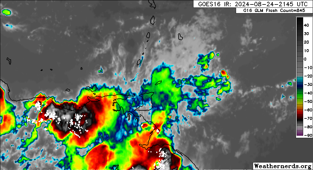
As moist and unstable conditions affect Trinidad and Tobago, which are associated with a low-level trough interacting with the Intertropical Convergence Zone, forecast models indicate a resurgence of severe weather overnight tonight. Activity with the ITCZ tends to peak during the early morning hours, as shown by the American GFS model, while the European ECMWF model shows less severe activity.
What you need to know
— Rainfall: Over the next 18 hours, forecast models show rainfall accumulations across Trinidad and Tobago between 25 and 75 millimeters, with locally higher totals up to 100 millimeters favoring southern and eastern Trinidad.
— Hazards: As a result of periods of heavy/violent rainfall, street/flash flooding is highly likely, particularly across eastern and southern Trinidad. Wind gusts up to 55 KM/H are possible in heavy showers and thunderstorms, with frequent cloud-to-ground lightning possibly in thunderstorm activity. With the potential for intense rainfall in elevated areas of Trinidad and Tobago for another day, landslides are possible. Seas are forecast to become locally agitated during heavy showers or thunderstorms.
Latest Alerts

TTMS Maintains Adverse Weather Alert For T&T
Trinidad and Tobago is NOT under any tropical storm or hurricane threat, watch, or warning at this time.
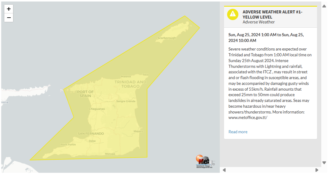
The Adverse Weather Alert
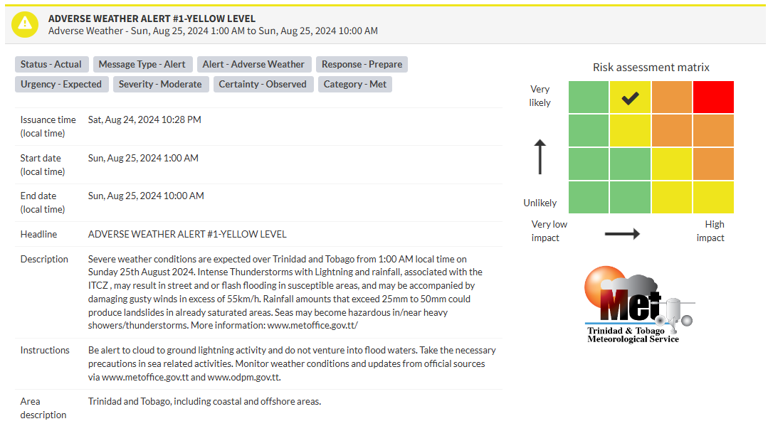
The Trinidad and Tobago Meteorological Service issued an Adverse Weather Alert (Yellow Level) on Saturday at 10:28 PM. The alert goes into effect for Trinidad and Tobago at 1:00 AM Sunday, August 25th, 2024, and remains in effect until 10:00 AM Sunday, August 25th, 2024.
As mentioned earlier, the forecast of inclement weather is due to the ITCZ interacting with a low-level trough, bringing unstable conditions across the region.
This “alert” status considers the possibility of the event occurring. This adverse weather event is very likely/observed, and the following impacts are very likely, according to the TTMS:
- Severe weather conditions are expected over Trinidad and Tobago from 1:00 AM local time on Sunday, August 25th, 2024.
- Intense Thunderstorms with lightning and rainfall associated with the ITCZ may result in street or flash flooding in susceptible areas.
- Heavy rainfall may be accompanied by damaging gusty winds in excess of 55 KM/H.
- Rainfall amounts exceeding 25mm to 50mm could produce landslides in saturated areas.
- Seas may become hazardous in/near heavy showers/thunderstorms.

The alert’s color indicates the severity of the event and the probability of its occurrence. Currently, the alert level is Yellow. This means that the hazards are very likely, and the severity of the impacts is moderate for this particular alert. You should be aware of the hazards in your area, which are associated mainly with street/flash flooding, landslides, gusty winds near 55 KM/H, possibly falling trees, and agitated seas.
A moderate Adverse Weather Alert can result in possible injuries, and behavioral changes are required to ensure safety. Minor damage to property may also occur, temporarily disrupting income-earning activities and affecting a couple of communities.
The Met Office advises the public to be alert to cloud-to-ground lightning activity and not enter flood waters. Take the necessary precautions when engaging in sea-related activities. Monitor weather conditions and updates from official sources


