


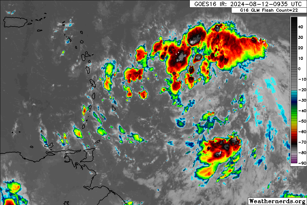
As Potential Tropical Cyclone Five moves north of T&T, bringing heavy showers, thunderstorms and gusty winds to the northern Windwards and Leewards, a very moist and unstable atmosphere exists across T&T, with near calm to westerly winds through Monday afternoon. As a result of strong daytime heating, sea breeze convergence and orographic effects, locally heavy showers and strong thunderstorms are possible.
What you need to know
— Rainfall: Over the next 12 hours, forecast models show rainfall accumulations across Trinidad and Tobago between 25 and 75 millimeters, with locally higher totals up to 100 millimeters favoring Trinidad.
— Hazards: As a result of periods of heavy/violent rainfall, street/flash flooding is highly likely, particularly across Trinidad. While the threat of gusty winds remains lower, wind gusts up to 55 KM/H are possible in heavy showers and thunderstorms, with frequent cloud-to-ground lightning possible in thunderstorm activity. With the potential for very heavy rainfall in elevated areas of Trinidad, landslides are possible. Seas are forecast to become locally agitated during heavy showers or thunderstorms. Due to anomalously light winds, to westerly winds at times, funnel cloud development is also possible, which can touch down as waterspouts if over water, or tornadoes if on land.
Latest Alerts

TTMS Issues Adverse Weather Alert For T&T
Trinidad and Tobago is NOT under any tropical storm or hurricane threat, watch, or warning at this time.
The Adverse Weather Alert
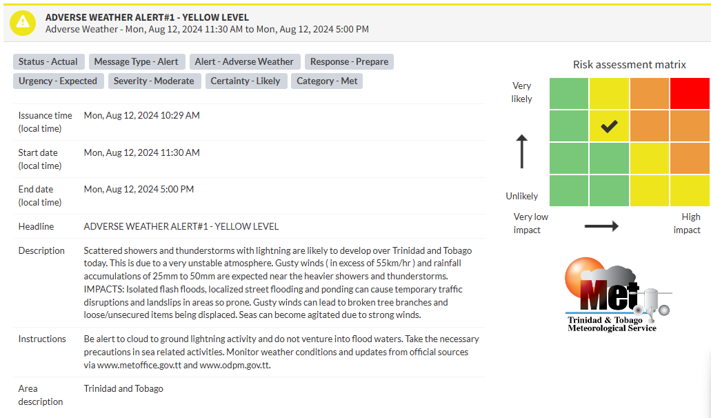
The Trinidad and Tobago Meteorological Service issued an Adverse Weather Alert (Yellow Level) on Monday at 10:29 AM. The alert goes into effect for Trinidad and Tobago at 11:30 AM Monday, August 12th, 2024, and remains in effect until 5:00 PM Monday, August 12th, 2024.
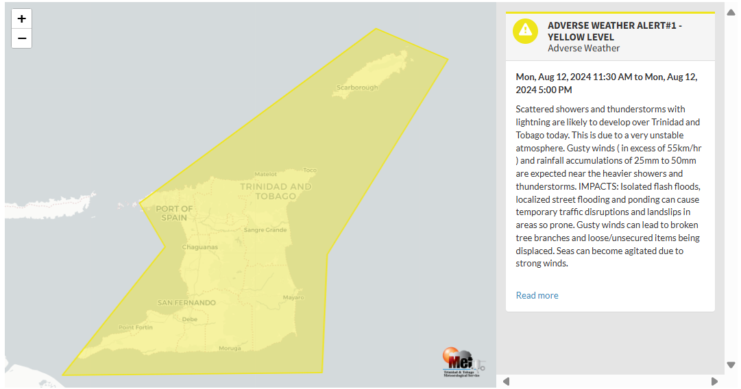
As mentioned earlier, the forecast of inclement weather is due to a potential tropical cyclone bringing unstable conditions across the region.
This “alert” status considers the possibility of the event occurring. This adverse weather event is likely, and the following impacts are likely, according to the TTMS:
- Due to a very unstable atmosphere, scattered showers and thunderstorms with lightning are likely to develop over Trinidad and Tobago today.
- Gusty winds (in excess of 55 KM/H) and rainfall accumulations of 25mm to 50mm are expected near the heavier showers and thunderstorms.
- Isolated flash floods, localized street flooding and ponding can cause temporary traffic disruptions and landslips in areas so prone.
- Gusty winds can lead to broken tree branches and loose/unsecured items being displaced. Seas can become agitated due to strong winds.

The alert’s color indicates the severity of the event and the probability of its occurrence. Currently, the alert level is Yellow. This means that the hazards are likely, and the severity of the impacts is moderate for this particular alert. You should be aware of the hazards in your area associated mainly with street/flash flooding, landslides, gusty winds near 55 KM/H possible falling trees, and agitated seas.
A moderate Adverse Weather Alert can result in possible injuries, and behavioral changes are required to ensure safety. Minor damage to property may also occur, temporarily disrupting income-earning activities and affecting a couple of communities.
The Met Office is advising the public to be alert to cloud-to-ground lightning activity and not venture into flood waters, take the necessary precautions in sea-related activities, and monitor weather conditions and updates from official sources


