


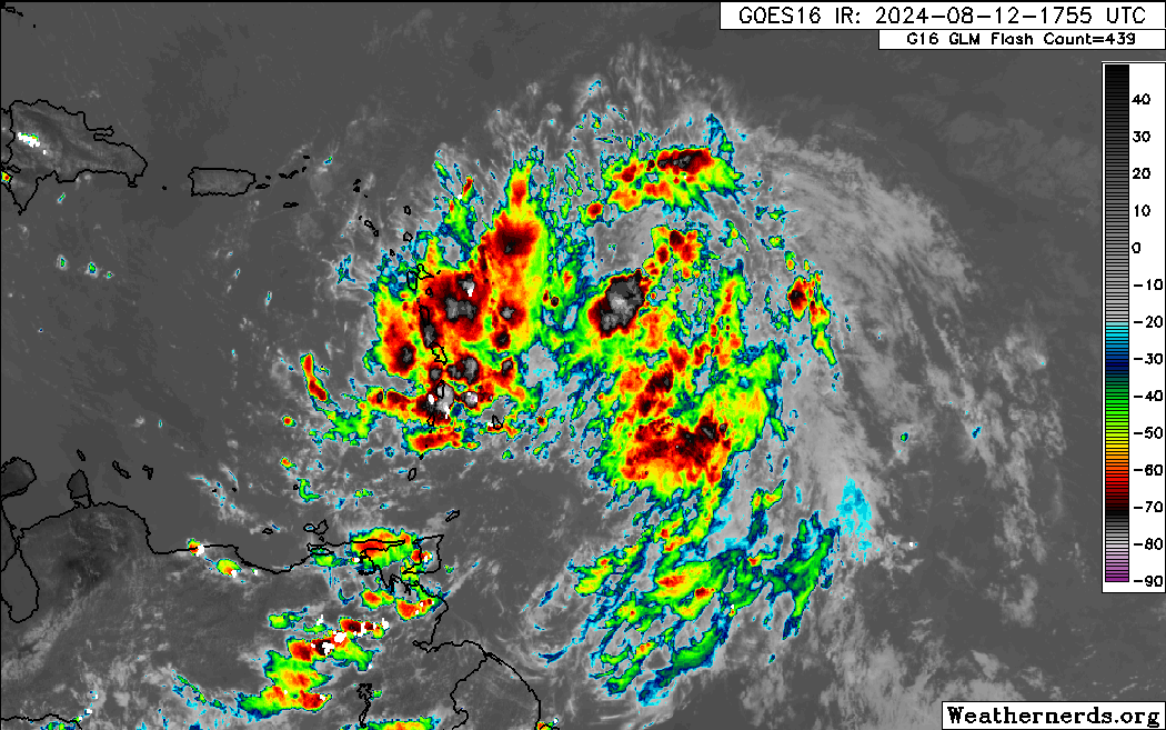
As Tropical Storm Ernesto moves north of T&T, bringing heavy showers, thunderstorms, and gusty winds to the northern Windwards and Leewards, a very moist and unstable atmosphere exists across T&T. As Ernesto remains north, the wind flow across T&T, coupled with a moist and unstable atmosphere will lead to showers and thunderstorms from overnight tonight through tomorrow, particularly during the early morning and late morning through afternoon hours.
What you need to know
— Rainfall: Over the next 36 hours, forecast models show rainfall accumulations across Trinidad and Tobago between 25 and 75 millimeters, with locally higher totals up to 100 millimeters favoring Trinidad and eastern Tobago.
— Hazards: As a result of periods of heavy/violent rainfall, street/flash flooding is highly likely, particularly across Trinidad, along the East-West Corridor, southern Trinidad, and western coastal areas. While the threat of gusty winds remains lower across Trinidad, wind gusts up to 55 KM/H are possible in heavy showers and thunderstorms, particularly across Tobago, with frequent cloud-to-ground lightning possibly in thunderstorm activity. With the potential for very heavy rainfall in elevated areas of Trinidad and Tobago, landslides are possible. Seas are forecast to become locally agitated during heavy showers or thunderstorms. Due to anomalous light winds and southerly/westerly winds at times, funnel cloud development is also possible, which can touch down as waterspouts if over water or tornadoes if on land, mainly during the afternoon hours.
Latest Alerts

Adverse Weather Alert Discontinued. Showers, Thunderstorms Still In The Forecast
Trinidad and Tobago is NOT under any tropical storm or hurricane threat, watch, or warning at this time.
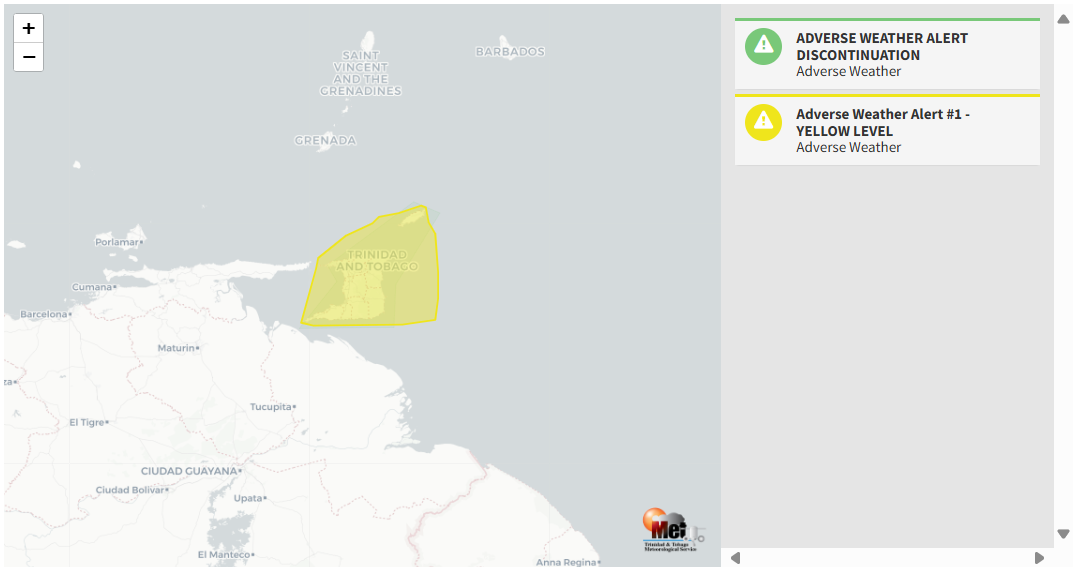
The Adverse Weather Alert
The Trinidad and Tobago Meteorological Service issued an Adverse Weather Alert (Yellow Level) on Monday at 6:51 PM. The alert goes into effect for Trinidad and Tobago at 1:00 AM Tuesday, August 13th, 2024, and remains in effect until 5:00 PM Tuesday, August 13th, 2024.
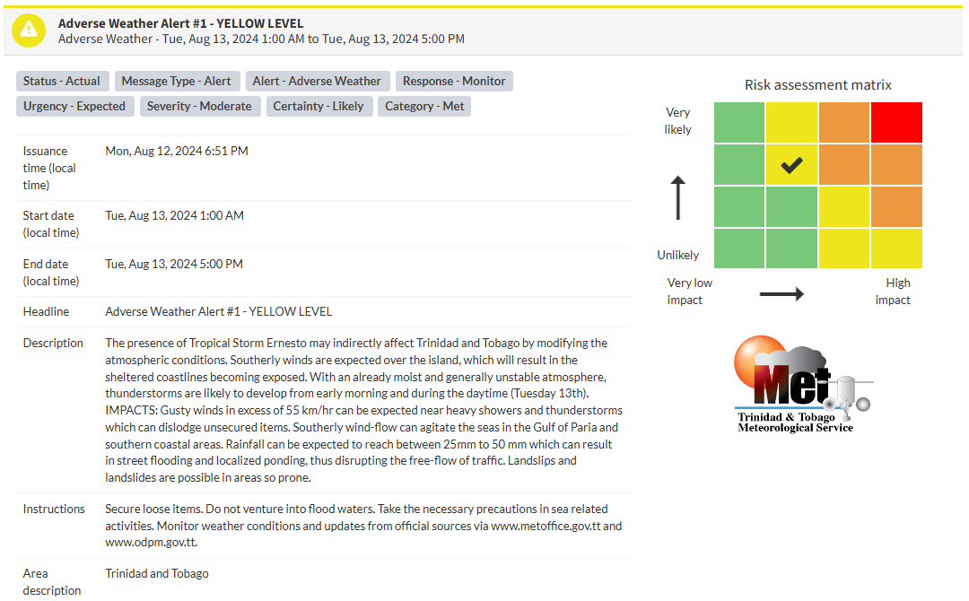
As mentioned earlier, the forecast of inclement weather is due to Tropical Storm Ernesto’s influence across T&T, bringing unstable conditions across the region.
This “alert” status considers the possibility of the event occurring. This adverse weather event is likely, and the following impacts are likely, according to the TTMS:
- Southerly winds are expected over the island, which will result in the sheltered coastlines becoming exposed.
- With an already moist and generally unstable atmosphere, thunderstorms are likely to develop from early morning and during the daytime.
- Gusty winds in excess of 55 km/hr can be expected near heavy showers and thunderstorms, which can dislodge unsecured items.
- Southerly wind flow can agitate the seas in the Gulf of Paria and southern coastal areas.
- Rainfall can be expected to reach between 25mm to 50 mm, which can result in street flooding and localized ponding, thus disrupting the free-flow of traffic.
- Landslips and landslides are possible in areas that are so prone.

The alert’s color indicates the severity of the event and the probability of its occurrence. Currently, the alert level is Yellow. This means that the hazards are likely, and the severity of the impacts is moderate for this particular alert. You should be aware of the hazards in your area, which are associated mainly with street/flash flooding, landslides, gusty winds near 55 KM/H, possibly falling trees, and agitated seas.
A moderate Adverse Weather Alert can result in possible injuries, and behavioral changes are required to ensure safety. Minor damage to property may also occur, temporarily disrupting income-earning activities and affecting a couple of communities.
The Met Office is advising the public to secure loose items, do not venture into flood waters, take the necessary precautions in sea-related activities, monitor weather conditions and updates from official sources


