


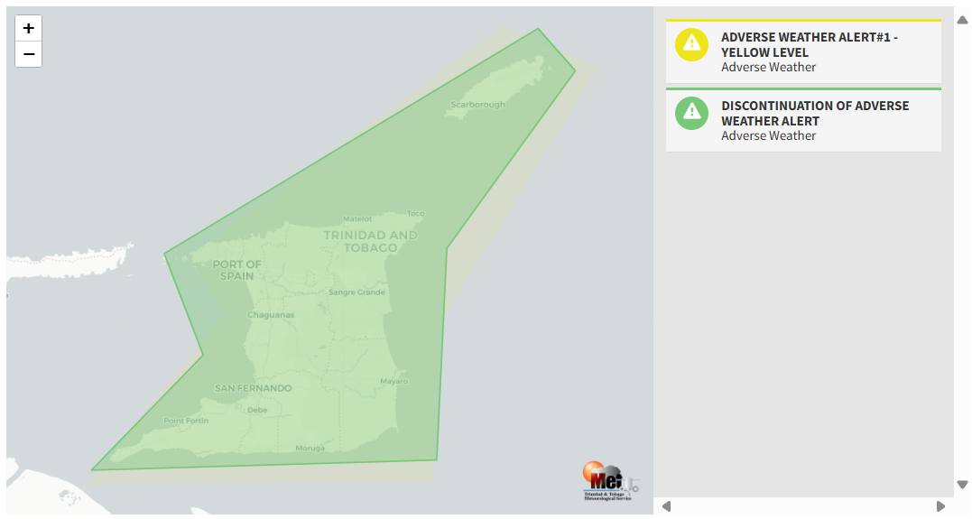
The Trinidad and Tobago Meteorological Service (TTMS) has discontinued the Adverse Weather Alert for Trinidad and Tobago as conditions gradually settled this afternoon.
Heavy rainfall over the last 6 hours triggered impactful flooding across north-central and northwestern Trinidad. An intense thunderstorm moved northward across west-central Trinidad, causing flooding in Claxton Bay and Couva, and further intensified as it interacted with the Northern Range. Between 11:00 AM and 12:00 PM (noon) on Monday, peak rainfall accumulations ranged between 25 and 75 millimeters (1-3 inches) across north-central Trinidad, leading to floods from Tunapuna to Port of Spain.
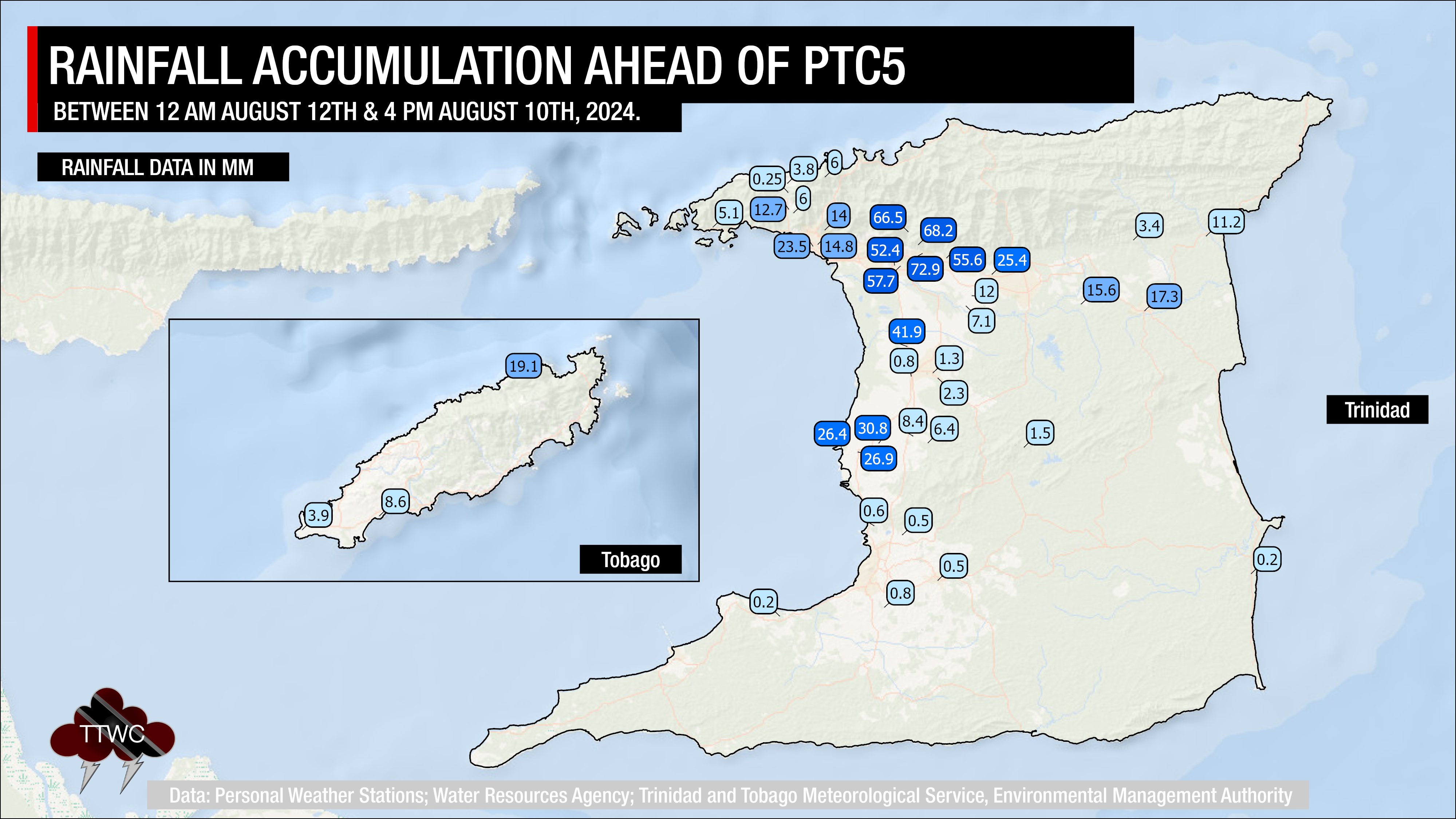
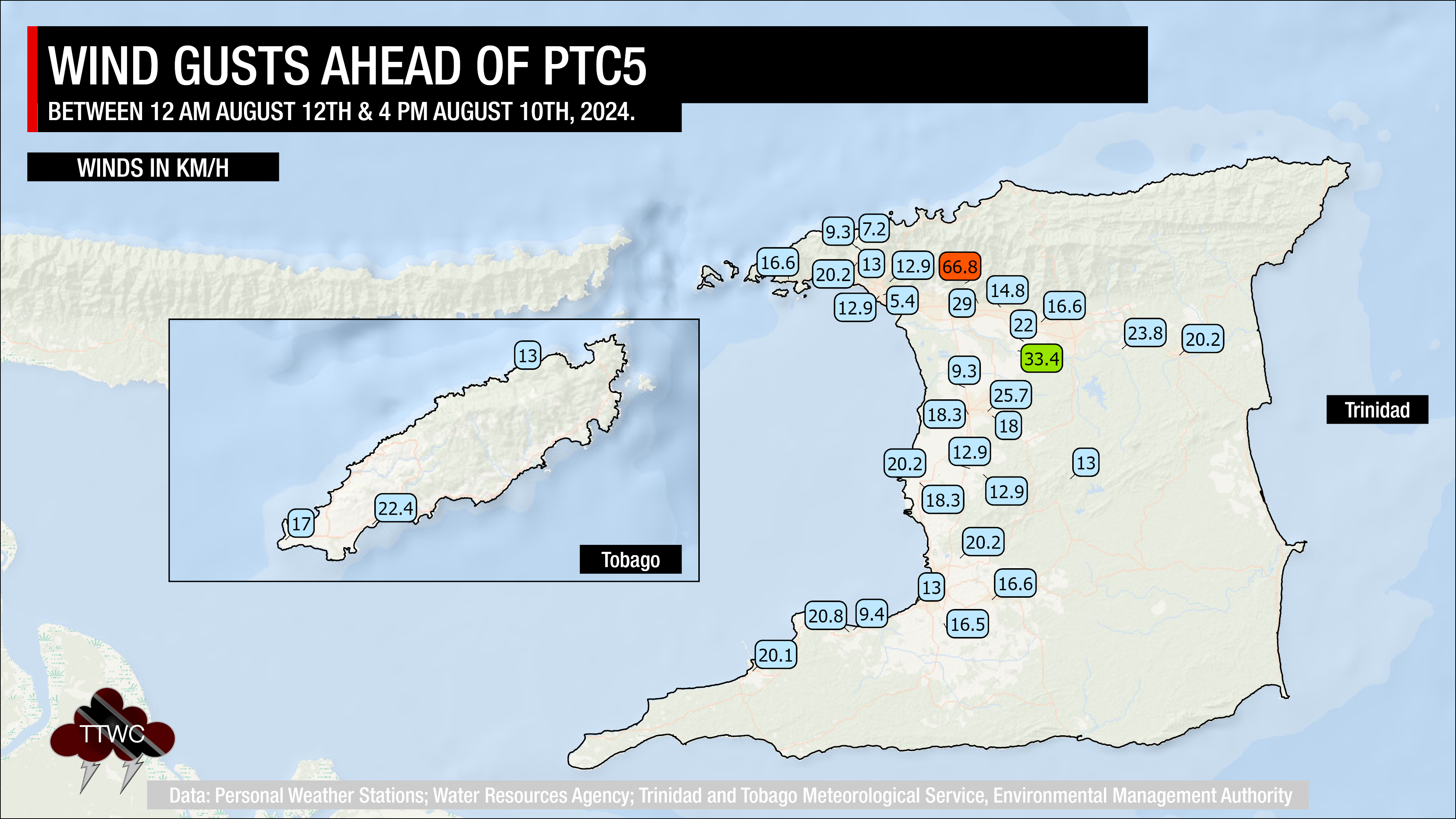
Peak wind gusts remained below 30 KM/H across the country, with a sole station in St. Joseph, which saw street and flash flooding, recorded a wind gust of 66.8 KM/H between 11:00 AM and noon on Monday.
What you need to know
— What has happened: Due to an unstable atmosphere, locally heavy rainfall affected parts of Trinidad and, to a lesser extent, Tobago on Monday. This led to impactful street and flash flooding across northern parts of Trinidad. The activity was due to Potential Tropical Cyclone 5, now called Tropical Storm Ernesto, as of 5:00 PM Monday, bringing high moisture, light winds and increased instability across the region.
— What to expect: As Tropical Storm Ernesto moves across the Leewards, T&T will experience near-calm to westerly winds tonight, then near-calm to southerly winds through Tuesday, then southeasterly winds on Wednesday, leading to a high chance of showers and thunderstorms, particularly as activity moves north from Venezuela toward T&T.
— Hazards: As a result of periods of heavy/violent rainfall, street/flash flooding is highly likely, particularly across Trinidad. While the threat of gusty winds remains lower, wind gusts up to 55 KM/H are possible in heavy showers and thunderstorms, with frequent cloud-to-ground lightning possible in thunderstorm activity. With the potential for very heavy rainfall in elevated areas of Trinidad, landslides are possible. Seas are forecast to become locally agitated during heavy showers or thunderstorms. Due to anomalously light winds to westerly winds during the late morning through afternoons, funnel cloud development is also possible, which can touch down as waterspouts if over water, or tornadoes if on land.
Latest Alerts

High Wind Alert Remains In Effect For T&T
Trinidad and Tobago is NOT under any tropical storm or hurricane threat, watch, or warning at this time.
The Adverse Weather Alert Discontinuation
The Trinidad and Tobago Meteorological Service discontinued the Adverse Weather Alert (Yellow Level) on Monday at 3:48 PM.
Trinidad and Tobago is not under any tropical storm watch or warning at this time.
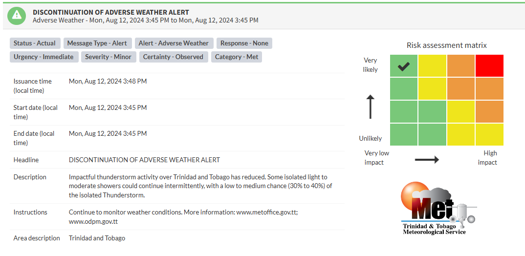
According to the TTMS, “Impactful thunderstorm activity over Trinidad and Tobago has reduced. Some isolated light to moderate showers could continue intermittently, with a low to medium chance (30% to 40%) of the isolated thunderstorm.”

The alert’s color indicates the event’s severity and probability of occurring. Currently, the alert level is Green, as the discontinuation was issued, with certainty at very likely or observed. According to the TTMS, possible impacts are minor.
At this level, there is a negligible impact on human safety. The Met Office advises the public to continue monitoring weather conditions.


