


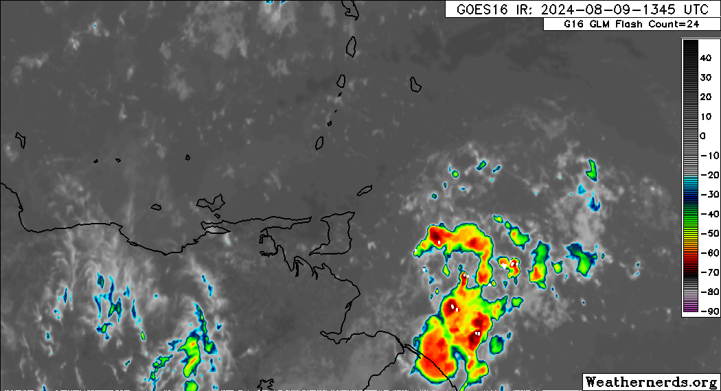
Heavy showers and thunderstorms are approaching, associated with a tropical wave interacting with the Intertropical Convergence Zone. They are forecast to affect T&T from this evening through tomorrow (Saturday afternoon). As a result, the Trinidad and Tobago Meteorological Service has issued an Adverse Weather Alert for the country.
What you need to know
— Rainfall: Over the next 24 hours, forecast models show rainfall accumulations across Trinidad and Tobago between 25 and 75 millimeters, with locally higher totals favoring Trinidad.
— Hazards: As a result of periods of heavy/violent rainfall, street/flash flooding is likely, particularly across Trinidad. While the threat of gusty winds remains lower, wind gusts up to 55 KM/H are possible in heavy showers and thunderstorms, which will produce cloud-to-ground lightning. With the potential for very heavy rainfall in elevated areas of Trinidad, landslides are possible in elevated areas. Seas are forecast to become locally agitated during heavy showers or thunderstorms.
Latest Alerts

TTMS Issues Adverse Weather Alert For T&T
Trinidad and Tobago is NOT under any tropical storm or hurricane threat, watch, or warning at this time.
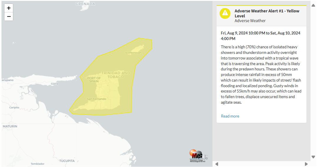
The Adverse Weather Alert
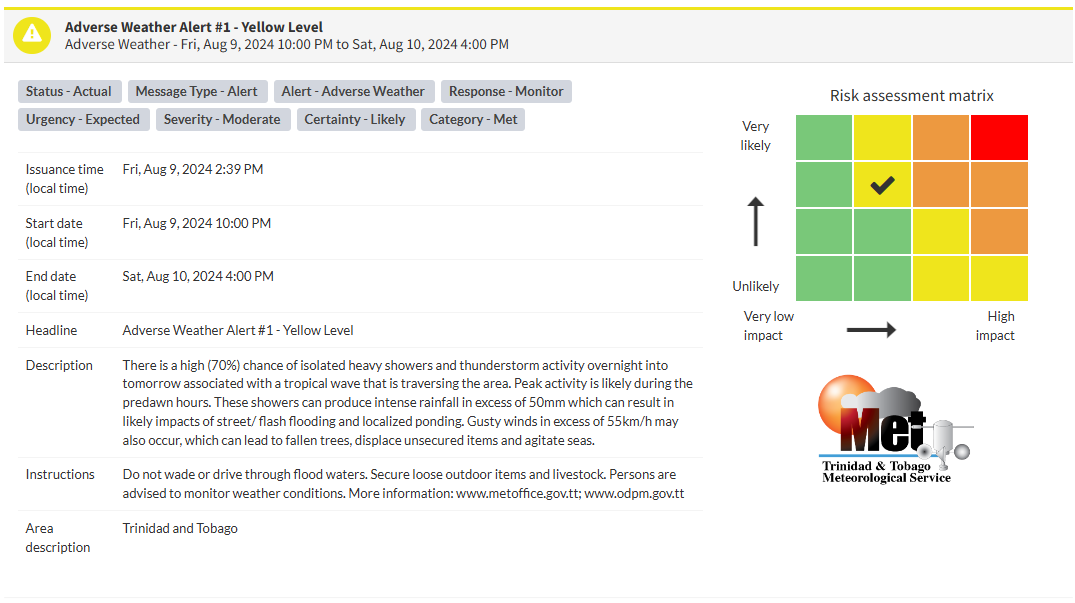
The Trinidad and Tobago Meteorological Service issued an Adverse Weather Alert (Yellow Level) on Friday at 2:39 PM. The alert goes into effect for Trinidad and Tobago at 10:00 PM Friday, August 9th, 2024, and remains in effect until 4:00 PM Saturday, August 10th, 2024.
As mentioned earlier, the forecast of inclement weather is due to a tropical wave interacting with the Intertropical Convergence Zone across T&T.
This “alert” status considers the possibility of the event occurring. This adverse weather event is likely, and the following impacts are likely, according to the TTMS:
- There is a high (70%) chance of isolated heavy showers and thunderstorm activity overnight into tomorrow associated with a tropical wave that is traversing the area. Peak activity is likely during the predawn hours.
- These showers can produce intense rainfall in excess of 50mm, which can result in likely impacts of street/ flash flooding and localized ponding.
- Gusty winds in excess of 55 KM/H may also occur, which can lead to fallen trees, displace unsecured items, and agitate seas.

The alert’s color indicates the severity of the event and the probability of its occurrence. Currently, the alert level is Yellow. This means that the hazards have been observed, and the severity of the impacts is moderate for this particular alert. You should be aware of the hazards in your area associated mainly with street/flash flooding, landslides, gusty winds near 55 KM/H possible falling trees, and agitated seas.
A moderate Adverse Weather Alert can result in possible injuries and behavioral changes are required to ensure safety. Minor damage to property may also occur, temporarily disrupting income-earning activities and affecting a couple of communities.
The Met Office is advising the public to monitor weather conditions before venturing out, secure loose outdoor objects and livestock, not drive through flood waters, monitor official news sources and weather updates, and follow instructions of government officials.


