


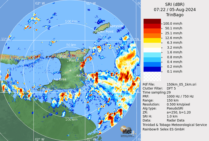
Early morning showers and thunderstorms continue as activity associated with Tropical Wave 27 interacting with the Intertropical Convergence Zone affects the country. Compared to the initial forecast of northern and eastern areas, heavier rainfall is now set to favor southern and eastern areas.
What you need to know
— Rainfall: Over the next 18 hours, forecast models show rainfall accumulations across Trinidad and Tobago between 15 and 25 millimeters, with areas across northern Trinidad and Tobago, as well as localized areas of eastern and western coastal Trinidad, receiving as high as 75 millimeters of rainfall.
— Hazards: As a result of periods of heavy/violent rainfall, street/flash flooding is likely. While the threat of gusty winds remains lower than in Tobago, wind gusts up to 55 KM/H are possible, favoring Tobago in heavy showers and thunderstorms, which will produce cloud-to-ground lightning. With the potential for very heavy rainfall in elevated areas of Tobago and northern Trinidad, landslides are likely in elevated areas. Seas are forecast to become locally agitated during heavy showers or thunderstorms.
Latest Alerts

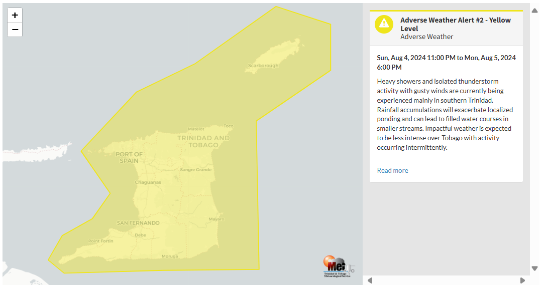
TTMS Issues Adverse Weather Alert For T&T
Trinidad and Tobago is NOT under any tropical storm or hurricane threat, watch, or warning at this time.
The Adverse Weather Alert
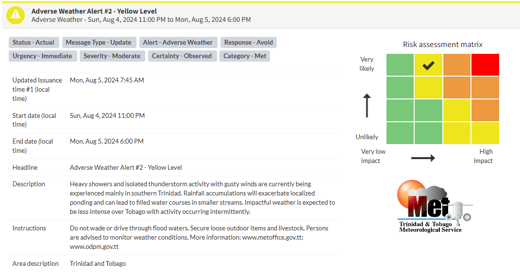
The Trinidad and Tobago Meteorological Service issued the Adverse Weather Alert (Yellow Level) on Monday at 7:45 AM. The alert went into effect for Trinidad and Tobago at 11:00 PM Sunday, August 4th, 2024, and remains in effect for the country until 6:00 PM Monday, August 5th, 2024.
As mentioned earlier, the forecast of inclement weather is due to a tropical wave interacting with the Intertropical Convergence Zone across T&T.
This “alert” status considers the possibility of the event occurring. This adverse weather event is has been observed, and the following is very likely/observed, according to the TTMS:
- Heavy showers and isolated thunderstorm activity with gusty winds are currently being experienced, mainly in southern Trinidad.
- Rainfall accumulations will exacerbate localized ponding and can lead to filled water courses in smaller streams.
- Impactful weather is expected to be less intense over Tobago, with activity occurring intermittently.

The alert’s color indicates the severity of the event and the probability of its occurrence. Currently, the alert level is Yellow. This means that the hazards have been observed, and the severity of the impacts is moderate for this particular alert. You should be aware of the hazards in your area associated mainly with street/flash flooding, landslides, gusty winds near 55 KM/H possible falling trees, and agitated seas.
A moderate Adverse Weather Alert can result in possible injuries and behavioral changes are required to ensure safety. Minor damage to property may also occur, temporarily disrupting income-earning activities and affecting a couple of communities.
The Met Office is advising the public to monitor weather conditions before venturing out, secure loose outdoor objects and livestock, not drive through flood waters, monitor official news sources and weather updates, and follow instructions of government officials.


