


The Trinidad and Tobago Meteorological Service (TTMS) has discontinued the Adverse Weather Alert for Trinidad and Tobago as conditions gradually settled this evening.
What you need to know
— What has happened: Isolated heavy showers and thunderstorms moved across Trinidad and Tobago overnight, producing rainfall mainly across eastern and northern Trinidad, as well as Tobago. This was due to a surge in trade winds accompanying Tropical Wave 24, interacting with the Intertropical Convergence Zone (ITCZ)
— What to expect: Following the passage of Tropical Wave 24, elevated winds remain across the area, as well as the ITCZ. Through tonight (Thursday night), forecast models show rainfall accumulations across Trinidad and Tobago between 12.5 and 37.5 millimeters, but high-resolution modeling shows localized totals across parts of Trinidad receiving as high as 50 millimeters of rainfall. Conditions are forecast to settle by the mid to late afternoon across T&T.
— Hazards: The main hazards still remain gusty winds between 45 KM/H and 65 KM/H, accompanying heavy showers and thunderstorms, which will produce cloud-to-ground lightning. As a result of localized of heavy/violent rainfall, street/flash flooding remain possible. Due to relatively saturated soils, landslides are likely in elevated areas, particularly along the Northern Range and windward slopes of Tobago. Seas are forecast to become locally agitated during heavy showers or thunderstorms.
Latest Alerts

TTMS Issues Adverse Weather Alert For T&T
Trinidad and Tobago is NOT under any tropical storm or hurricane threat, watch, or warning at this time.
The Adverse Weather Alert Discontinuation
The Trinidad and Tobago Meteorological Service discontinued the Adverse Weather Alert (Yellow Level) on Thursday at 9:24 AM.
Trinidad and Tobago is not under any tropical storm watch or warning at this time.
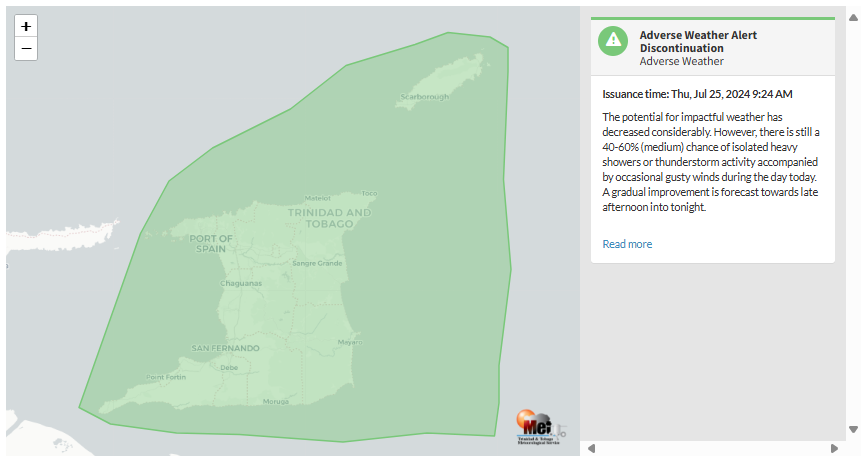
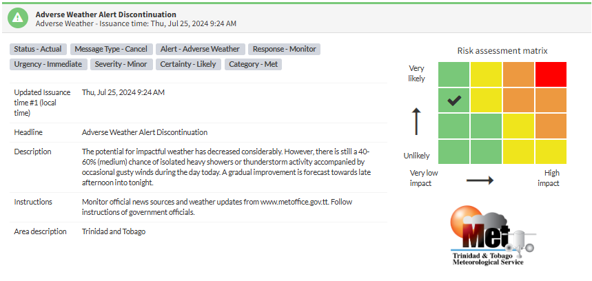
According to the TTMS, “The potential for impactful weather has decreased considerably. However, there is still a 40-60% (medium) chance of isolated heavy showers or thunderstorm activity accompanied by occasional gusty winds during the day today. A gradual improvement is forecast towards late afternoon into tonight.” This “alert” status takes into account the possibility of the event ending, with the certainty at its near-highest, at likely.

The alert’s color indicates the event’s severity and probability of occurring. Currently, the alert level is Green, as the discontinuation was issued, with certainty at likely. According to the TTMS, possible impacts are minor.
The Met Office is still advising the public to monitor official news sources and weather updates and follow government officials’ instructions.


