What you need to know
No areas are being monitored for tropical development in the Atlantic Basin at this time. However, we’re monitoring a tropical wave east of the Lesser Antilles that is set to move across T&T this week.
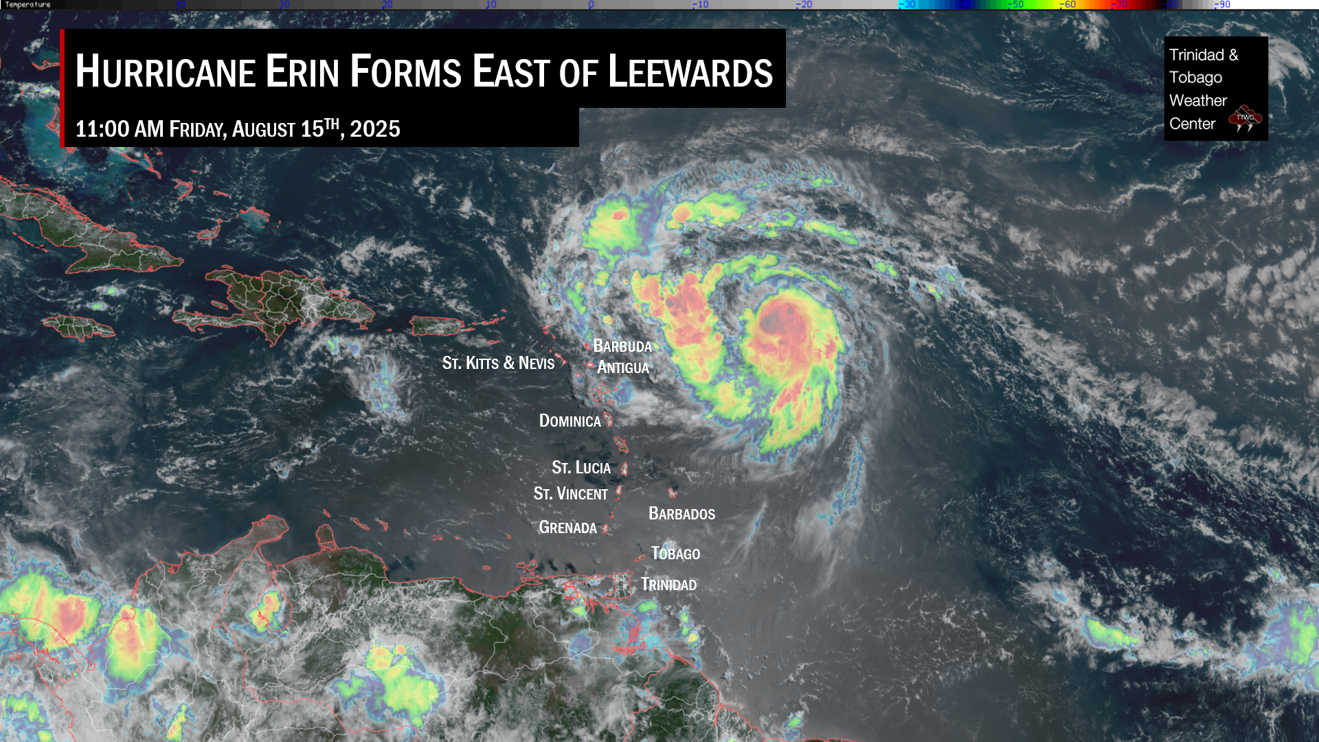
— Tropical Wave 24: This tropical wave is located approximately 2,350 kilometers east of T&T, along 40W, moving west at 15-20 knots. There is no significant shower or thunderstorm activity associated with this wave at this time due to significant Saharan Dust across the northern portion of the wave axis, but it is forecast to increase convergence across T&T on Wednesday and bring the ITCZ across the country Wednesday into Thursday.
— Hazards for T&T: From early Tuesday morning through Friday morning, cloudiness, isolated to scattered showers and thunderstorms, are forecast to affect Trinidad and Tobago as first a low-level trough, then Tropical Wave 24 interact with the Intertropical Convergence Zone.
Low-Level Trough & Tropical Wave 24
A weak low-level trough embedded within the Intertropical Convergence Zone (ITCZ) is forecast to move across T&T and the Windward Islands tonight (Monday night) through Tuesday, bringing sufficient instability for scattered showers and isolated thunderstorms through Tuesday.
Then, on Wednesday, low-level winds are forecast to increase, with enhanced convergence trailing the low-level trough, as well as the ITCZ remaining across T&T. All of these features will lead to scattered showers and thunderstorms across both islands but favoring Trinidad.
Conditions are set to briefly settle into Wednesday evening as a dry pocket of air ahead of Tropical Wave 24 moves across the region. By early Thursday morning, the weak tropical wave moves across the Lesser Antilles but interacts with the ITCZ still across Trinidad and Tobago, leading to scattered showers and thunderstorms once more.
Dust models also show a moderate to high concentration surge of Saharan Dust moving in by Wednesday evening, which may limit rainfall activity on Thursday. However, it may also not fully capture the ITCZ across T&T.
By Friday, the ITCZ is forecast to shift southward as a ridge rebuilds by the afternoon. A s a result, rainfall is expected during the first half of the day through the early afternoon.
With the ITCZ around, it is important to remember that peak activity associated with this area of convergence typically happens during the early morning and early afternoon hours. Heavy overnight rainfall is possible, and those living in flood-prone areas should be ready to act in the event persistent heavy rainfall materializes, leading to street, flash, and even riverine flooding.
Elsewhere across the Atlantic
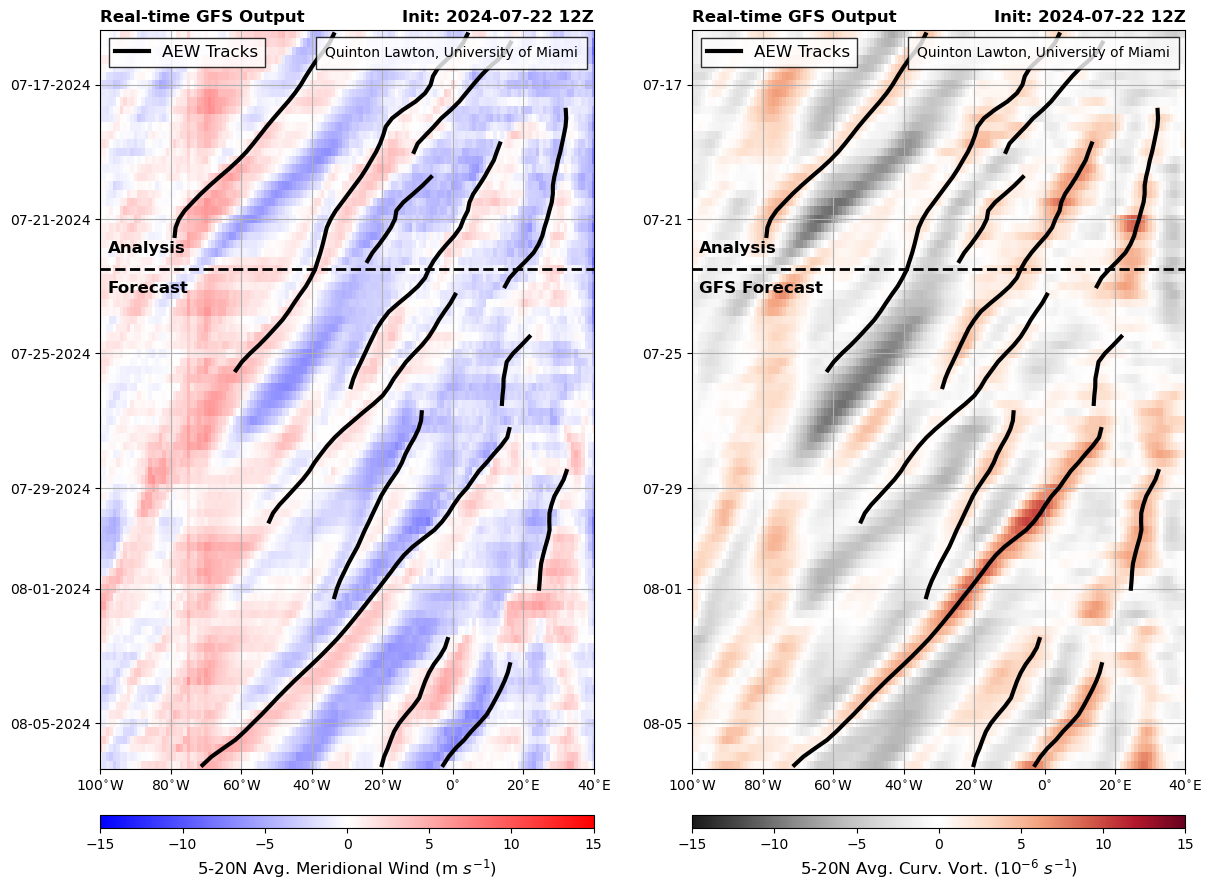
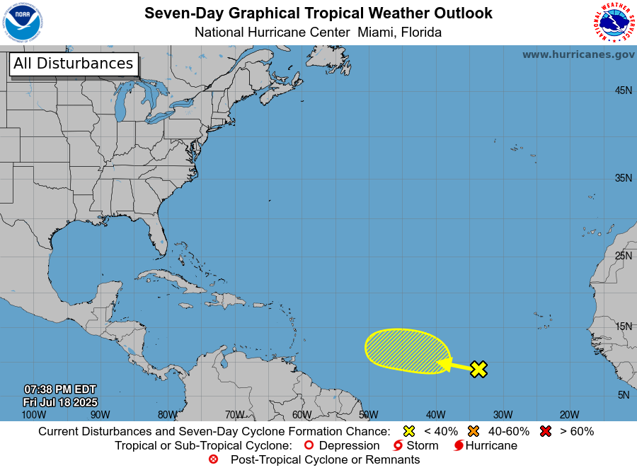
Forecast models show the next tropical wave will move across T&T by July 25th and then a quiet period until August 5th. Top models and the National Hurricane Center show no tropical cyclone development is expected across the Atlantic Basin over the next seven days. Longer-range modelling shows no development is likely through the end of July but shows that stronger tropical waves are likely to begin moving off the African coast from the end of the month.
Meanwhile, the tropical Atlantic is experiencing its most significant outbreak of Saharan dust in over two years.

Current high to significant levels of Saharan Dust have led to generally unfavorable conditions in the Atlantic Basin for tropical development and even some cooling of ocean temperatures near Africa.
The dry, dust-laden air from the deserts of North Africa usually peaks in late June and July and is an anticipated part of the seasonal cycle. In 2023 Saharan dust was largely a no-show, with the lowest coverage of dust over the tropical Atlantic in at least 20 years (since satellites began measuring dust).
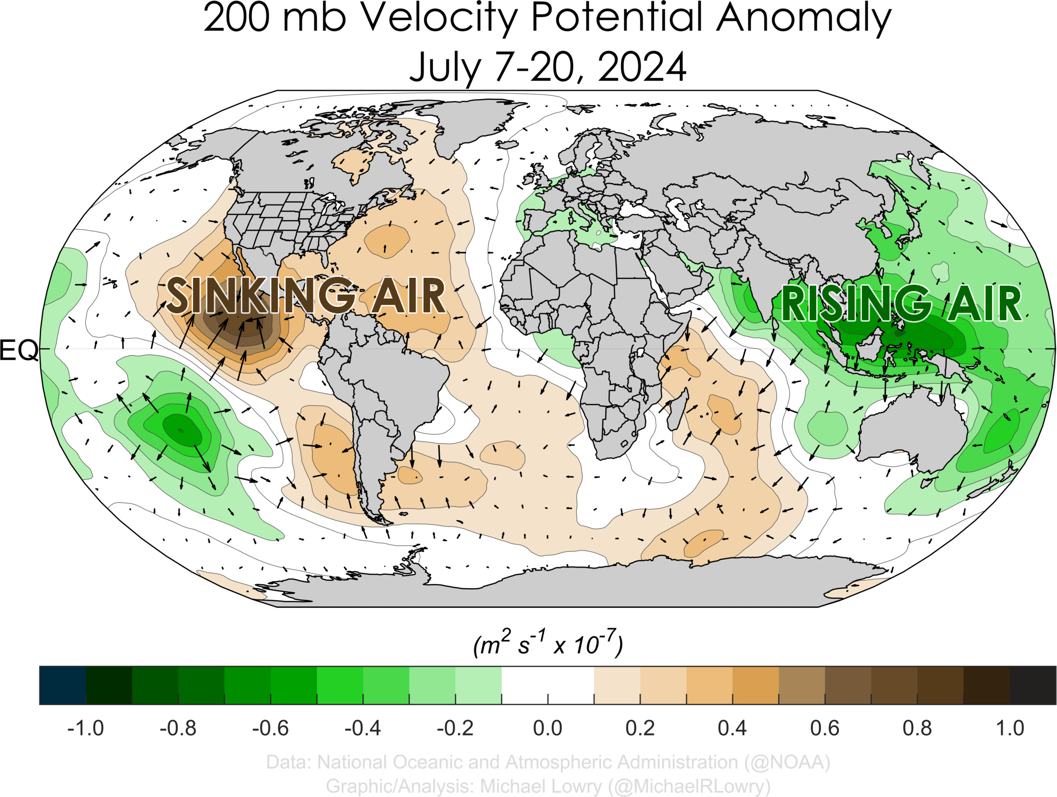
Another reason is likely the Madden-Julian Oscillation, or MJO, which circles the globe roughly every month or two. The MJO generally leads to rising or sinking air across large portions of the globe. The rising branch promotes hurricane activity by encouraging stormier conditions in the tropics and reducing storm-busting wind shear—which we saw in June, which produced Tropical Storms Arlene and Chris and Hurricane Beryl. The sinking branch of the MJO generally leads to mostly quiet tropical conditions, though development does happen from time to time. This larger area of sinking air has settled across the Atlantic and Eastern Pacific in recent weeks, leading to our general quietness.
While conditions remain quiet for now, the background conditions are becoming increasingly favorable as we move into the peak of the Atlantic Hurricane Season from late August with warmer ocean temperatures, lower overall wind shear, and stronger tropical waves that roll off the African coast.
Longer-range models show that wind shear is forecast to begin reducing during the first week of August across the Lesser Antilles and Main Development Region closer to the Lesser Antilles. Additionally, weaker-than-average trade winds are forecast to return next week, which will allow for the Main Development Region and seas near T&T to warm up once more.
Not Every Tropical Wave Brings Severe Weather
Tropical waves vary in intensity as they travel westward across the Atlantic. This variability can be in the order of days or as short term as hours. Sometimes, you may see satellite imagery that shows heavy thunderstorms and deep convective activity east of Trinidad and Tobago during the late night and early morning, but by daybreak – nothing.
This is due to diurnal (daily) variations in convective showers whereby convection peaks overnight and wanes during the day for already occurring convective systems (i.e., not triggered by daytime heating).
Activity can be enhanced by its proximity to upper-level troughs and the ITCZ but can also be degraded by hostile upper-level conditions and Saharan Dust.