Hurricane Beryl has moved across the Windward Islands as a powerful Category 4 Hurricane with maximum sustained winds of 240 KM/H. As this hurricane moves into the eastern Caribbean Sea, the Trinidad and Tobago Meteorological Service (TTMS) has downgraded the Orange-Level Tropical Storm Warning to an Orange-Level Adverse Weather Alert.
What you need to know
— Rainfall: Through Thursday morning, across Trinidad, rainfall accumulations between 25 and 50 millimeters are likely, while across Tobago, accumulations between 25 and 75 millimeters are likely, with isolated totals favoring the northern half of Trinidad and Tobago exceeding 150 millimeters, particularly where feeder band activity develops.
— Hazards For Trinidad: While the threat of tropical storm conditions, including sustained winds of 63-118 KM/H, has diminished as Hurricane Beryl moves westward away from Trinidad, there remains a high chance (70%) of periods of rainfall of varying intensities with isolated thunderstorms according to the TTMS. Gusty winds near 55 KM/H may accompany heavier downpours and these downpours will likely produce street/flash flooding. Landslides are possible in elevated areas of northern Trinidad and Tobago.
— Marine: According to the TTMS, large battering waves have been observed, and hazardous seas are expected to persist, posing a danger to small craft and coastal and offshore activities. Mariners should continue to expect significant wave heights, posing a danger to small craft and coastal and offshore activities. Wave heights will begin to decline overnight tonight through Tuesday morning.
Latest Alerts

High Wind Alert Remains In Effect For T&T
Trinidad and Tobago is NOT under any tropical storm or hurricane threat, watch, or warning at this time.
The Adverse Weather Alert
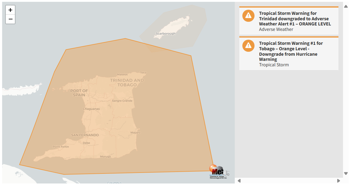
The Trinidad and Tobago Meteorological Service has downgraded the Tropical Storm Warning for Trinidad and surrounding coastal waters to an Adverse Weather Alert at 11:31 AM Monday. According to the TTMS, it will remain in effect until 6:00 PM on Monday, July 1st, 2024.
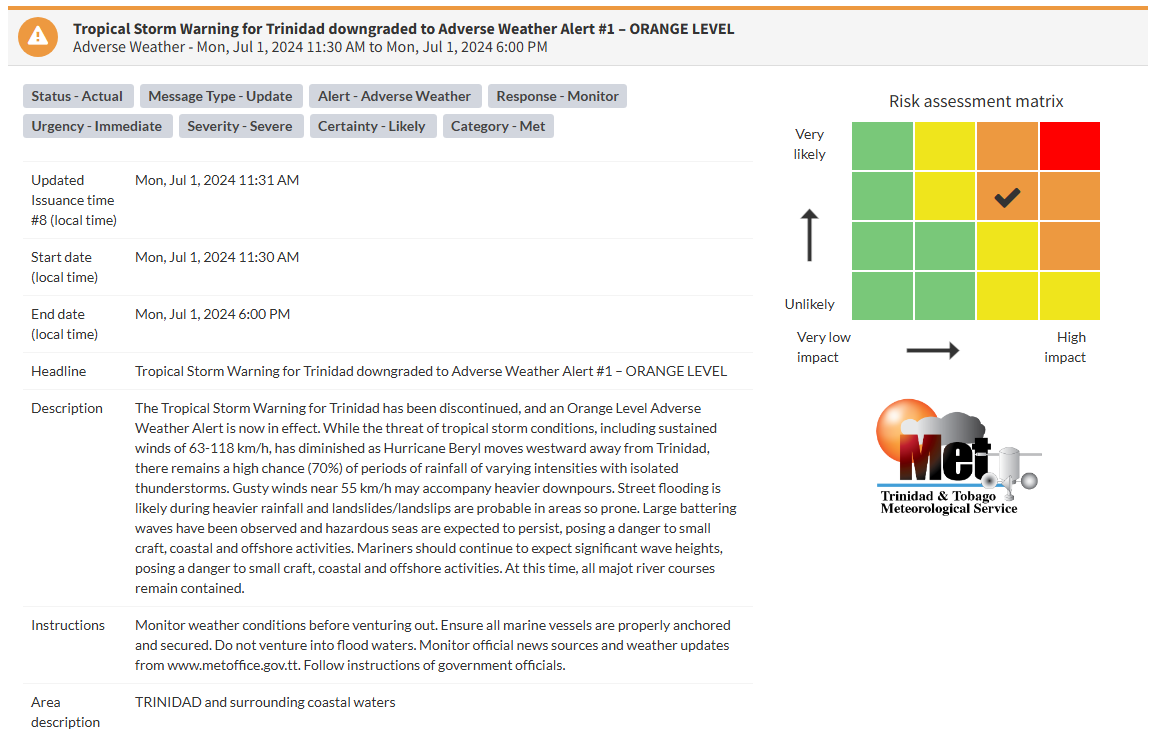
“The Tropical Storm Warning for Trinidad has been discontinued, and an Orange Level Adverse Weather Alert is now in effect. While the threat of tropical storm conditions, including sustained winds of 63-118 KMH, has diminished as Hurricane Beryl moves westward away from Trinidad, there remains a high chance (70%) of periods of rainfall of varying intensities with isolated thunderstorms. Gusty winds near 55 KM/H may accompany heavier downpours. Street flooding is likely during heavier rainfall and landslides/landslips are probable in areas so prone. Large battering waves have been observed, and hazardous seas are expected to persist, posing a danger to small craft and coastal and offshore activities. Mariners should continue to expect significant wave heights, posing a danger to small craft and coastal and offshore activities. At this time, all major river courses remain contained.” according to the Trinidad and Tobago Meteorological Service.
Why am I not under a tropical storm watch or warning?
A tropical storm warning is an announcement that sustained winds of 34 to 63 knots (39 to 73 mph or 63 to 118 km/hr) are expected somewhere within the specified area within 36 hours in association with a tropical, subtropical, or post-tropical cyclone.
A tropical storm watch is an announcement that sustained winds of 34 to 63 knots (39 to 73 mph or 63 to 118 km/hr) are possible within the specified area within 48 hours in association with a tropical, subtropical, or post-tropical cyclone.
This specific watch or warning is based on the potential for experiencing tropical-storm-force winds alone, not the other hazards associated with a tropical storm (hazardous seas, torrential rainfall, etc.). This means if the system tracks close to your country, but the strongest winds remain offshore or north/east of your location, you may not be placed under a tropical storm watch or warning, but you may have other advisories in effect.

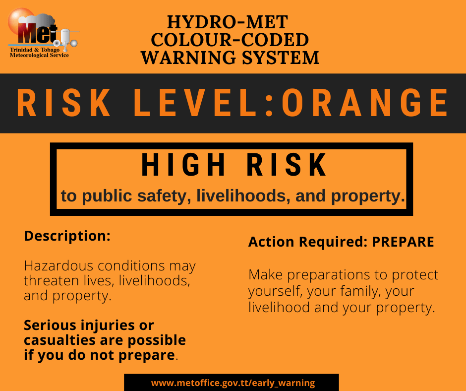
The alert’s color indicates the severity of the event and the probability of it occurring. Currently, the alert level is orange. This means that the hazards are likely, and the severity of impacts is severe for this particular alert. You should be aware of the hazards in your area associated mainly with gusty winds, street and flash flooding, and frequent lightning. Seas will also become hazardous, and mariners should prepare for large waves in nearshore areas, particularly Atlantic-facing coastlines.
For an orange-level Adverse Weather Alert, there is a high risk to public safety, livelihoods, and property. Hazardous conditions may threaten lives, livelihoods, and property. Serious injuries or casualties are possible if you do not prepare.
A severe Adverse Weather Alert means that the event may result in the loss of a single life or serious injuries; physical defenses are needed, major losses in confined areas, income earning impossible for several days, and several communities may be affected. External help is needed for recovery.
The public, according to the TTMS, should monitor weather conditions before venturing out and ensure all marine vessels are properly anchored and secured. do not venture into flood waters, and monitor official news sources and weather updates.