


The Adverse Weather Alert has been extended for Trinidad and Tobago due to medium to high chances for thunderstorms overnight, according to the Trinidad and Tobago Meteorological Service.
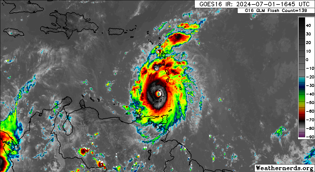
With Hurricane Beryl’s influence across T&T’s atmosphere as it moves away from the Windwards, southeast to northwest winds will lead to northward-moving showers and thunderstorms across both islands, with mountain ranges enhancing shower/thunderstorm activity.
What you need to know
— Rainfall: Over the next 24 hours, forecast models show additional rainfall accumulations up to 25 millimeters, favoring the eastern half of Trinidad, and southern coastal areas. In isolated thunderstorms, locally higher totals are possible. At this time, all major rivers are contained.
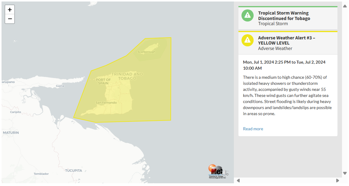
— Hazards: According to the Trinidad and Tobago Meteorological Service, “There is a medium to high chance (60-70%) of isolated heavy showers or thunderstorm activity, accompanied by gusty winds near 55 KM/H. These wind gusts can further agitate sea conditions. Street flooding is likely during heavy downpours and landslides/landslips are possible in areas so prone.”
Latest Alerts

TTMS Issues Adverse Weather Alert For T&T
Trinidad and Tobago is NOT under any tropical storm or hurricane threat, watch, or warning at this time.
The Adverse Weather Alert
The Trinidad and Tobago Meteorological Service updated the Adverse Weather Alert (Yellow Level), which includes Trinidad and Tobago and surrounding coastal waters, on Monday at 5:34 PM. The alert went into effect from 2:25 PM on Monday, July 1st, 2024, and remains in effect through 10:00 AM on Tuesday, July 2nd, 2024.
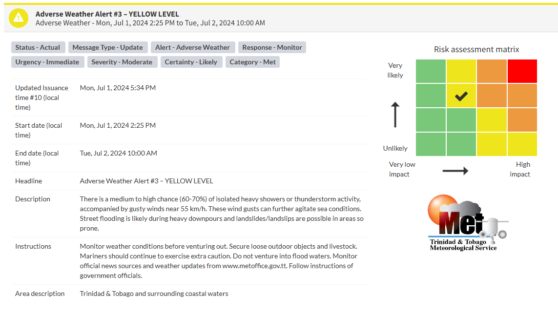
This “alert” status considers the possibility of the event occurring. This adverse weather event is likely to have the following impacts, according to the TTMS:
- There is a medium to high chance (60-70%) of periods of rainfall of varying intensities with isolated thunderstorms.
- Gusty winds near 55 KM/H may accompany heavier downpours.
- These wind gusts can further agitate sea conditions.
- Street flooding is likely during heavier rainfall.
- Landslides/landslips are probable in elevated areas.

The alert’s color indicates the severity of the event and the probability of its occurrence. Currently, the alert level is Yellow. This means that the hazards are likely, and the severity of the impacts is moderate for this particular alert. You should be aware of the hazards in your area associated mainly with gusty winds in excess of 55 KM/H, locally heavy rainfall producing street flooding, landslides and frequent lightning.
A moderate Adverse Weather Alert can result in possible injuries and behavioral changes are required to ensure safety. Minor damage to property may also occur, temporarily disrupting income-earning activities and affecting a couple of communities.
The Met Office is advising the public to monitor weather conditions before venturing out, secure loose outdoor objects, ensure all marine vessels are properly anchored and secured, do not venture into flood waters, monitor official news sources and weather updates, and follow instructions of government officials.


