


As Invest 95L continues its general westward path, meteorological offices across the Windward Islands, including Trinidad and Tobago, are paying close attention.
Barbados
Barbados, the first island across the Lesser Antilles to be affected by this disturbance and eventual system, has been proactive in alerting the island’s population of approaching hazards. As of 7:00 PM, Thursday, June 27th, 2024, there is a:
- Excess Rainfall: Yellow alert for the entire island of Barbados on Monday, July 1st, 2024, with total rainfall accumulations up to 100 millimeters.
- Wind: Yellow alert for the entire island from the night of Sunday, June 30th, 2024, through Monday, July 1st, 2024, with winds up to 75 KM/H.
- Marine: Yellow alert for eastern offshore zones from the night of Sunday, June 30th, 2024, and all offshore zones, mainly from Monday, July 1st, through Tuesday, July 2nd, 2024, with waves in open waters peaking on Monday, reaching as high as 6 meters (20 feet).
- Severe Thunderstorms: Yellow alert for the entire island on Monday, July 1st, 2024.
In an information statement issued by the Barbados Meteorological Service at 5:00 PM Thursday, June 27th, 2024, they state, “By Saturday, a tropical storm watch as well as marine advisories may be issued.”
They continued, for Barbados, “The tropical wave is likely to develop into a tropical storm over the next few days and is expected to affect Barbados late Sunday night into Monday, July 1st, 2024. As a result, there is a possibility of flash flooding and storm-force winds impacting the island during that time. Additionally, sea conditions may become hazardous from as early as Sunday and a Small Craft Warning and High Surf warning may be issued for Barbados during the weekend.”
Trinidad and Tobago
While the Trinidad and Tobago Meteorological Service has been monitoring the system, on Wednesday, June 26th, 2024, they issued the following statement as part of their Five-Day Weather Forecast:
“The Trinidad and Tobago Meteorological Service (TTMS) is at this time monitoring a strong tropical wave, the axis of which is presently located near 30W, to the east of Trinidad and Tobago and the Windward Islands, and moving westward. This wave is exhibiting moderate to strong vorticity in the low to medium levels, and analysis, together with numerical models projections, is showing that over the next few days the possibility for some intensification exists. Trinidad and Tobago, the Windward Islands, and the southern Leeward Islands, are likely to begin to experience the weather conditions associated with this wave by early Monday (01st July 2024). Current analysis is showing the likelihood of cloudy periods with moderate showers over varying areas and the high chance for the development of thunderstorm activity. The more intense weather is likely to be, but not confined to, from north Trinidad to just north of Barbados. This system could produce gusty winds, choppy seas, and street or flash flooding as it moves across the area.”
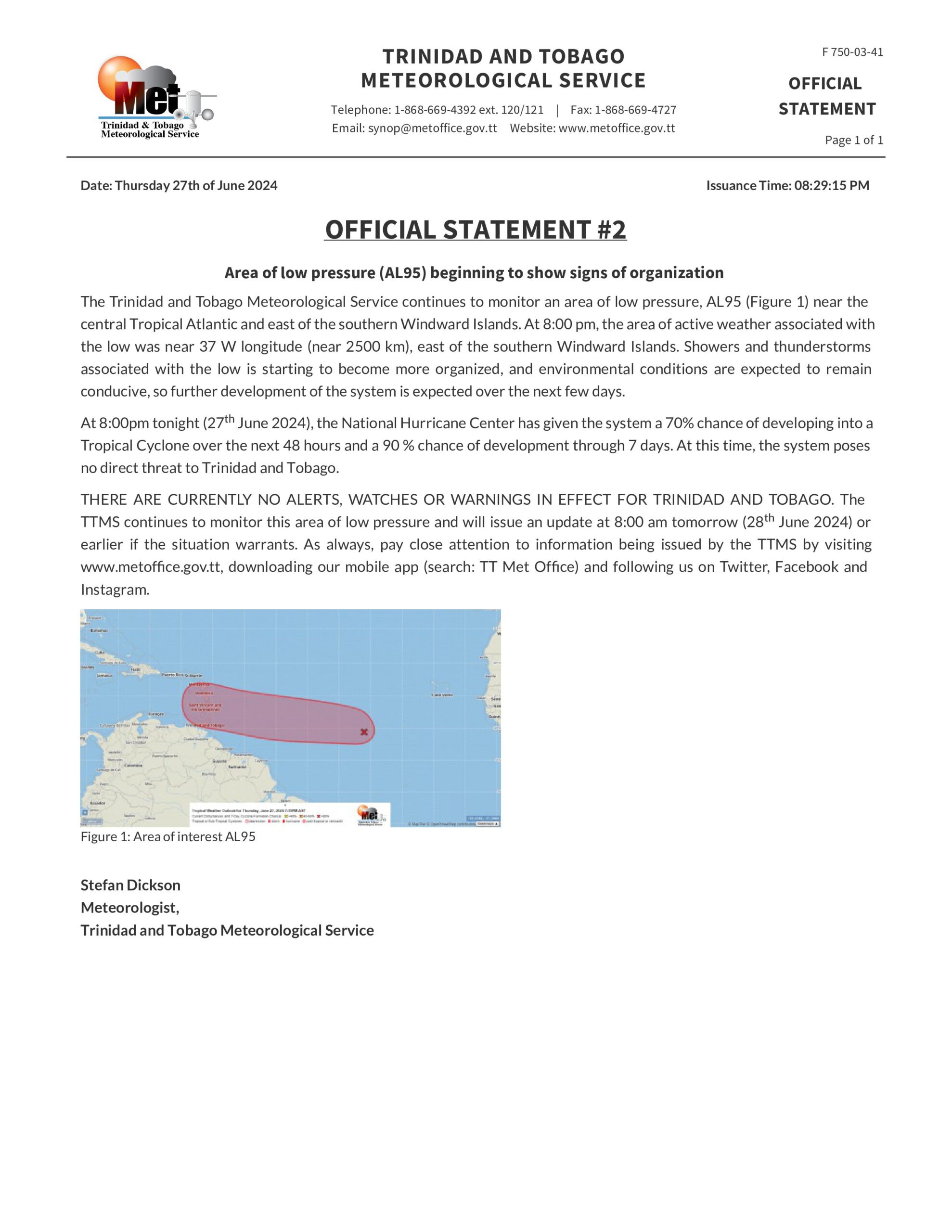
At 8:29 PM, Thursday, June 27th, 2024, the Trinidad and Tobago Meteorological Service issued their second official statement on the system, recapping the state of what we know, and including the following:
“At this time, the system poses no direct threat to Trinidad and Tobago. THERE ARE CURRENTLY NO ALERTS, WATCHES OR WARNINGS IN EFFECT FOR TRINIDAD AND TOBAGO. The TTMS continues to monitor this area of low pressure and will issue an update at 8:00 am tomorrow (28 June 2024) or earlier if the situation warrants.”
Grenada
There are no alerts, watches, or warnings in effect for Grenada. However, in a release from the Grenada Meteorological Service, “the system poses no threat to the state of Grenada at the moment.” They urge the Grenadian public to pay attention to the local meteorological office.
St. Vincent and the Grenadines
The St. Vincent and the Grenadines, in their third information statement, stated that “a level on uncertainty still exist concerning the track of the center of the system and the magnitude of the associated hazards. However, model guidance suggests that the presence of the system in the vicinity increases the chance of some rain, gusty winds and deteriorating seas, particularly around Monday.”


