A tropical wave is set to move across Trinidad and Tobago over the next 24 hours, while the National Hurricane Center is monitoring two areas in the Gulf of Mexico and the southwestern Atlantic for tropical cyclone formation.
What you need to know
— Tropical Wave 10: With no discernable or trackable features, we’ve dropped Tropical Wave 09 from the analysis, but the axis of Tropical Wave 10 is located along 55/56W on Sunday afternoon, moving west at 5-15 knots (9-28 KM/H). This tropical wave is forecast to move across T&T on Sunday night into Monday, with the Intertropical Convergence Zone (ITCZ) lingering across the area into Tuesday.
— Tropical Wave 11: This tropical wave has just moved off the African coast, located along 24W on Sunday afternoon, moving west at 10-15 knots (18-28 KM/H). Based on current model guidance, this wave is forecast to move across the region next Saturday. Prior to this wave, a low-level trough induced by the ITCZ is forecast to move across T&T Thursday into Friday.
— Hazards: Mainly Sunday through Tuesday morning, and again Thursday through Saturday morning, periods of rain, moderate to heavy showers, and isolated to scattered thunderstorms are forecast to affect Trinidad and Tobago as a result of these tropical waves interacting with the Intertropical Convergence Zone. Due to strong westerly wind shear, flooding concerns remain low.
Tropical Wave 10
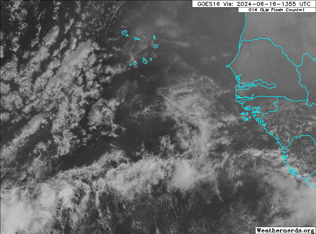
The 10th tropical wave analyzed by the National Hurricane Center is located approximately 312 nautical miles or 600 kilometers east of Trinidad and Tobago, along 55/56W, and moving west at 5-15 knots (9-28 KM/H). The tropical wave is producing scattered showers and thunderstorms, mainly associated with the confluence of trade winds occurring along the northern portion of the wave axis and then where the wave interacts with the Intertropical Convergence Zone.
Across the wave axis, total precipitable water (TPW) values, which measure atmospheric moisture, are high, between 2 and 3 inches. An upper-level trough axis is positioned across the Lesser Antilles, with favourable upper-level divergence across T&T and east of the Windwards. As a result, strong westerly to southwesterly wind shear is across Trinidad and Tobago, but any shower/thunderstorm activity across the country will see some local enhancement.
Forecast models show little to no accumulating rainfall across most areas of Trinidad and Tobago, with isolated totals up to 25 millimeters, favoring northern and eastern areas, as well as southwestern Trinidad through Tuesday morning.
By Tuesday morning, a high-concentration surge of Saharan Dust is forecast to move in across Trinidad and Tobago, significantly reducing rainfall chances and decreasing air quality.
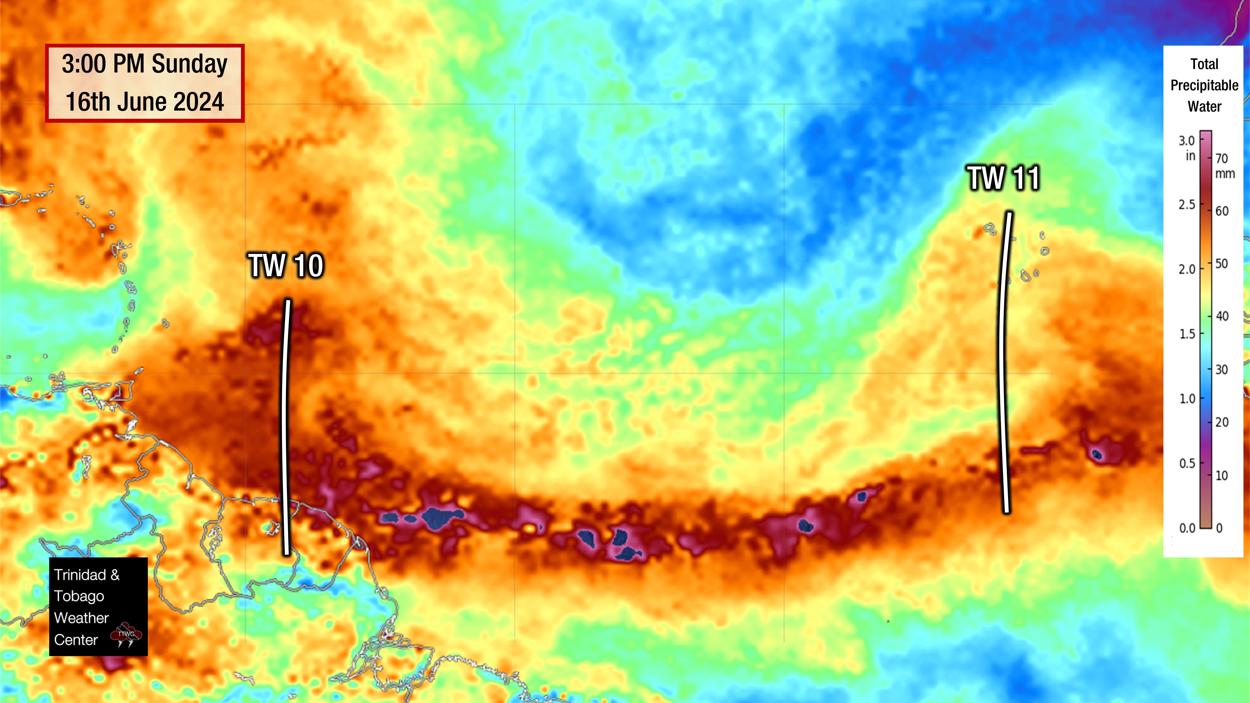
Tropical Wave 11
The 11th tropical wave analyzed by the National Hurricane Center is located well east of Trinidad and Tobago, along 24W, moving west at 10-15 knots (18-28 KM/H). Based on current model guidance, this wave is forecast to move across the region next Saturday. Prior to this wave, a low-level trough induced by the ITCZ is forecast to move across T&T Thursday into Friday.
A major surge of Saharan Dust is moving off the African Coast in tandem with this tropical wave, limiting any convection associated with the wave axis.
Development In The Gulf of Mexico
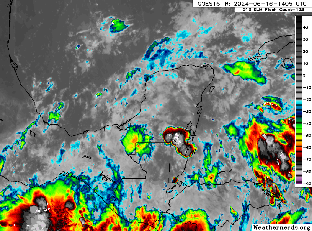
The National Hurricane Center is monitoring an emerging low-pressure system in the Bay of Campeche in the southwestern Gulf of Mexico, with high chances of tropical cyclone formation over the next seven days. The NHC gives this system a low chance, 30%, of tropical cyclone formation over the next 48 hours and a high chance, 70%, of development over the next seven days.
According to the NHC, “A large area of disturbed weather is located over Central America, the Yucatan Peninsula of Mexico, and the adjacent waters of the northwestern Caribbean Sea. A broad area of low pressure is forecast to form from this system over the southwestern Gulf of Mexico on Monday or Tuesday. Environmental conditions appear conducive for the subsequent gradual development of the low, and a tropical depression or tropical storm could form by midweek while it moves slowly westward or west-northwestward.”
The NHC warms, “Regardless of development, several days of heavy rainfall are expected across portions of southern Mexico and Central America, and these rains are likely to cause life-threatening flooding and flash flooding. Locally heavy rainfall is also expected to spread over portions of the northwestern coast of the Gulf of Mexico by the middle of the week. In addition, gale warnings have been issued for portions of the Gulf of Mexico, and more information on these is available in High Seas Forecasts issued by the National Weather Service.”
Southwestern Atlantic
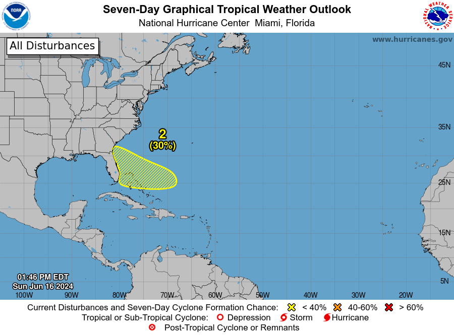
The National Hurricane Center is also monitoring an area in the southwestern Atlantic for the eventual development of a low-pressure system, the tail end of a cold front.
According to the NHC, “A trough or an area of low pressure is forecast to form by midweek
a few hundred miles northeast of the central Bahamas. Environmental conditions could be conducive for some development of this system thereafter while it moves westward or west-northwestward.”
The NHC gives this system a near-zero chance of development over the next 48 hours and a low chance, 30%, over the next seven days.
Not Every Tropical Wave Brings Severe Weather
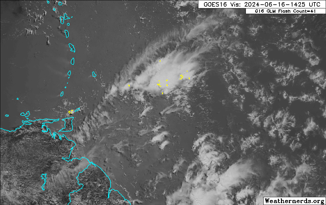
Tropical waves vary in intensity as they travel westward across the Atlantic. This variability can be in the order of days or as short term as hours. Sometimes, you may see satellite imagery that shows heavy thunderstorms and deep convective activity east of Trinidad and Tobago during the late night and early morning, but by daybreak – nothing.
This is due to diurnal (daily) variations in convective showers whereby convection peaks overnight and wanes during the day for already occurring convective systems (i.e., not triggered by daytime heating).
Activity can be enhanced by its proximity to upper-level troughs and the ITCZ but can also be degraded by hostile upper-level conditions and Saharan Dust.